-
Category Navigation
-
Size 4.5 MB
MapPath is an easy-to-use app allowing you to record your trips. It displays your track, your position and live information such as your speed, altitude or average speed. Note that continued use of GPS running in the background can dramatically decrease battery life.
MapPath : GPS Tracking, Measure alternatives
voYaa - GPS Tracks & Trails
Want a way to track your outdoor activities? voYaa is perfect for recording every minute of your adventure. FeaturesTrack- Tracks your location in real-time, anywhere in the world- Pause a track and resume it later- Add waypoints to the current track or manually relocate them- Add pictures to the current track- Add custom waypoints and pictures with titles & descriptions- World-wide tracking capabilityShare & Save- Share your track via email or social media channelsTrack History- View all your past tracks including speed, elevation, distance & time- View all the track elements step by step or in list view- Resume an old track or edit its detailsIf you like our work, please write a review and if you have a feature request or any other questions regarding the app - dont hesitate to email us at [email protected] use of GPS running in the background can dramatically decrease battery life.
-
size 12.5 MB
Geo Measure Area Calculator GPS Field Measurement
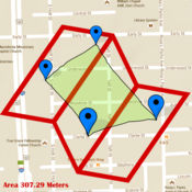
Geo Measure is best free tool for you, when you want to purchase some property, and want to calculate area of that property. Geo Measure will help you like your best friends and will give you exact calculated area. No hidden charges All suggestions are welcome
-
size 22.0 MB
Trail Maker
Ever want to make a trail? Not a trail that constantly tracks you and creates a complicated map full of information you dont want, but a simple trail of points that you are in complete control over? Make a tour route and share it with your guests Keep track of which maple trees you tap Whether you want to quickly jot down a series of points, or create a beautiful trail complete with pictures, Trail Maker is the app for you.
-
size 11.7 MB
JAS Location Tracker
JAS Location Tracker records your location into journeys as you move. You can then view it on Google Maps, see its data in graphs, or dig into its detailed statistics such as speed, altitude, distance, time, and etc. Always keep your eyes on the traffic while on the move.
-
size 24.5 MB
Measure distance on map. Land
Measure length of anything on map, even if there is no routes or ground. If you want to measure your route without roads - this is that you need Measure roads, buildings or lands from the birds eye view. Disclaimer: any data, calculated by this program is relative, for accurate data considering local laws address the local geodesic services.
-
rating 5.0
-
size 22.6 MB


