-
Category Navigation
-
Rating 5
-
Size 22.6 MB
Measure length of anything on map, even if there is no routes or ground. If you want to measure your route without roads - this is that you need Measure roads, buildings or lands from the birds eye view. Disclaimer: any data, calculated by this program is relative, for accurate data considering local laws address the local geodesic services.
Measure distance on map. Land alternatives
Minimalist GPS Tracker
A universal GPS Tracker. Records tracks, keeps the history, and exports in GPX format. Please note that continued use of GPS running in the background can dramatically decrease battery life.
-
size 16.0 MB
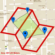
Geo Measure Area Calculator GPS Field Measurement
Geo Measure is best free tool for you, when you want to purchase some property, and want to calculate area of that property. Geo Measure will help you like your best friends and will give you exact calculated area. No hidden charges All suggestions are welcome
-
size 22.0 MB
Compass 55. Land nav tool kit.
All-in-one assistant with a map, compass, GPS coordinates to view and share in 6 formats, altitude, distance, sunset/sunrise, speedometer with top and average speed, navigator to your target or along the route and a whole lot more + Advanced target/waypoint editor. Can be also used as a coordinates converter. Please note that as with all GPS apps, continued use of GPS running in the background can dramatically decrease battery life.
-
rating 4.5
-
size 38.4 MB
Draw on Map - Create Your Own Map And add Waypoint
Draw your own Map now with 600+ objects by making iCONic Path Its Free Have you ever try to described your current position to your fiends/family members on phone or gmail and get even more annoyed. Check these app. Follow us on Facebook: #Draw-On-MapFollow us on Twitter: @DrawOnMap
-
rating 3.13333
-
size 28.1 MB


