-
Category Navigation
-
Size 24.5 MB
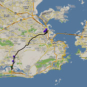
JAS Location Tracker records your location into journeys as you move. You can then view it on Google Maps, see its data in graphs, or dig into its detailed statistics such as speed, altitude, distance, time, and etc. Always keep your eyes on the traffic while on the move.
JAS Location Tracker alternatives
We Camera 03
We Camera 03 is an app that anyone can use Street View easily. Main Features: Current location navigation (Street view and map are synchronized) Point designation by hold Create route Street view and map on the same screen Multiple pins Four types of map share Search Traffic Full screenSupports: iPhone / iPad and Latest devices, Latest iOS Device Rotate (Portrait / Landscape)The map uses Google Maps SDK for iOS.
-
rating 4.58333
-
size 35.4 MB
Fine Maps
You can choose more convenient map application Fine Maps supports 4 map vendors with consistent user interface as well as having many convenient features. The UI is intuitive, interactive and rapid. And its FREE You can download and experience right now [ New Features in Version 4.5 ] Supporting All Embedded Interactive/Rapid UI with 4 Map Vendors Gesture Rotation Easy Tilting[ Fine Maps Features ] Street View Mode Expandable KML Layers - Layer Downloader - Layer Manager - Folder Available Easy Route - Driving / Bus / Walking - Mile / Km Easy Ruler - Dragging Point - Removing Point - Mile / Km Bookmark Manager - Folder Available - Rename - Move to Folder - Email / Twitter / Facebook Sharing Favorite Keyword Manager - Folder Available - Rename - Move to Folder Drawing on the Map and Sharing - Pen Size / Pen Color - Eraser - Undo / Redo - Email / Twitter / Facebook Sharing My Location Compass Detail Information of a Place Full Screen Mode Landscape Mode Map / Satellite / Hybrid / Terrain Modes iPad / iPhone Supported iOS 6 Supported
-
size 29.5 MB

Map-o-meter
Map-o-meter is an easy to use app that allows you to mark an arbitrary path/route on the map and measure its distance. With closed paths the area is displayed. Features:- Imperial and metric units are supported- Map can be zoomed to your current location- Paths can be loaded/saved to a file- Undo- Search a location (by address or name)- Compute route given a start and finish points and optional waypoints- Portrait and landscape support
-
size 0.9 MB


