-
Category Navigation
-
Rating 4.59999
-
Size 18.5 MB
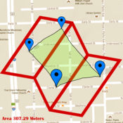
Area Map is a quick and easy tool to measure area anywhere in the world Great for measuring acreage of your property or determining how many square feet of materials you will need. Area Map will also allow you to draw with your finger to measure any area no matter what the shape Simply search for a location on the map and start measuring * Use it as a contractor to provide quick and easy estimates * Use it for calculating a landscaping job* Use it to measure roof sizes* Use it to measure land * Use it for anything that requires area measurements
Area Map alternatives
GPS Kit - Offline GPS Tracker
- TIME Magazines 15 Fantastic GadgetsPerfect for hiking or mountain biking.- TUAW.comThe GPS Kit app has a number of excellent outdoor uses, especially [for] hiking, biking or geocaching.- NBCs The Browser Radio ShowMost beneficial for adventure-type guys.Top-of-the-line GPS system for adventurers and professionals in the great outdoors. Designed for outdoor activities such as:hiking, hunting, camping, skiing, cycling, geocaching, mountain biking, motorcycling, off-roading, fishing, and other romping in or out of the backcountryANYWHERE IN THE WORLD.GPS Kit is a full-featured GPS system for the iPhone that combines all the functionality of expensive handheld units with the power of wireless technology. Pace- Moving Time, Stopped Time, Direction- 3-Axis Inclinometer and Glide Ratio- Customizable cell on mapLoaded with Related Utilities- Elevation and speed graphs - On-map tracking controls and timer- On-map ruler - Multi-touch area measurements* Use of Squawk requires an Internet connection and extended use may adversely impact battery life Continued use of GPS running in the background can dramatically decrease battery life
-
rating 3.5
-
size 19.5 MB
Elevation Chart - Draw Profile View by Touchs
Elevation Chart is a tool used to get the elevation of any place on the surface of the Earth. Youre able to place a pin anywhere on the map to view its elevation in feet or meters along with its longitude, latitude, and address. #1 in Mexico and other 5 countries, #2 in United States, and top 10 in 12 countries (iPad Navigation) Features Show the elevations between two points in profile view, more visualization One tap to show the elevation of your current location Get elevation of any place on earth by: 1) touching the location on the map; 2) search by address/name Show Walking Distance between two points if available Show Ellipsoidal Distance (according to Vincentys formula) as label of x-axis Show elevation in feet or meters Work on iPad, iPhone, and iPod Touch Known Issues - In some situations, the Walking Distance which get from maps.googleapis.com is obviously wrong, compare to the Ellipsoidal Distance.- Limitations of elevation query: 2,500 requests per day; 50 requests per second. Requirements Internet connection. Video Tutorial Pick one of the following: https://appbead.com/app-elevation-chart.html http://youtu.be/o1T9-prX9Dg
-
size 2.4 MB
Wolf-GIS APEX
Wolf-GIS APEX provides easy-to-use mobile GIS, drawing, and mapping tools for the collection, management, and display of your location-based data, providing you with the visual context to make better, more informed decisions. With powerful GIS functionality, enhanced performance, useful map-based tools, and data-sharing capabilities, APEX Pro offers dynamic features for the GIS professional or groups of users that wish to collaborate in the timber, agricultural, mining, real estate, geology, or civil engineering industries. - Personal Monthly- 1 Month- $6.99 (US App Store)- Personal Annual- 1 year- $74.99 (US App Store)- Payment will be charged to iTunes Account at confirmation of purchase- Subscription automatically renews unless auto-renew is turned off at least 24-hours before the end of the current period- Account will be charged for renewal within 24-hours prior to the end of the current period, and identify the cost of the renewal- Subscriptions may be managed by the user and auto-renewal may be turned off by going to the users Account Settings after purchase- No cancellation of the current subscription is allowed during active subscription period- http://www.wolfgisapex.com/privacy-policy.pdf- Any unused portion of a free trial period, if offered, will be forfeited when the user purchases a subscription.
-
size 56.8 MB
Geo Measure Area Calculator GPS Field Measurement
Geo Measure is best free tool for you, when you want to purchase some property, and want to calculate area of that property. Geo Measure will help you like your best friends and will give you exact calculated area. No hidden charges All suggestions are welcome
-
size 22.0 MB
Measure distance on map. Land
Measure length of anything on map, even if there is no routes or ground. If you want to measure your route without roads - this is that you need Measure roads, buildings or lands from the birds eye view. Disclaimer: any data, calculated by this program is relative, for accurate data considering local laws address the local geodesic services.
-
rating 5.0
-
size 22.6 MB
