Elevation Chart - Draw Profile View by Touchs!
-
Category Navigation
-
Size 2.4 MB
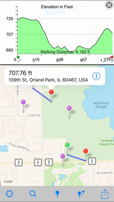
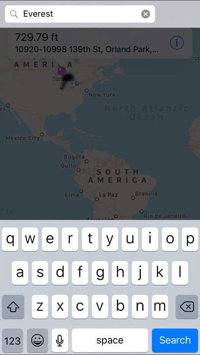
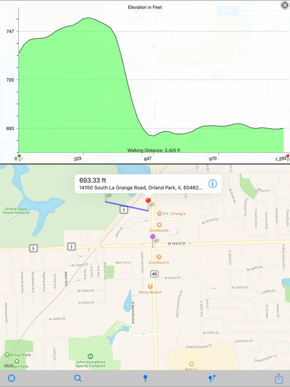
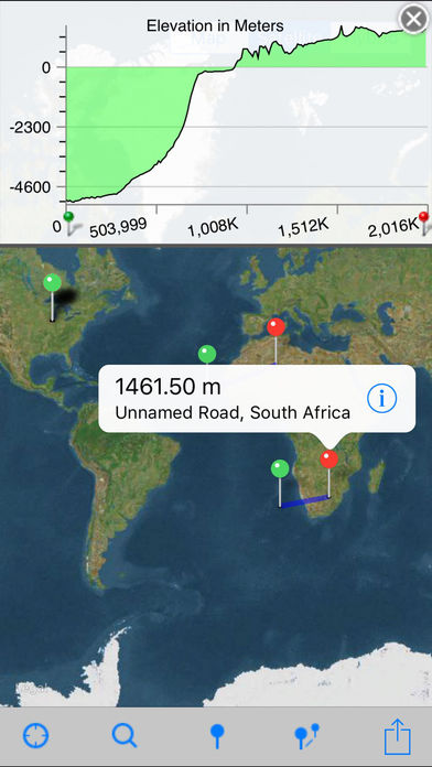
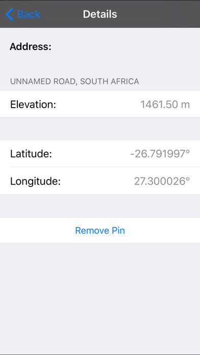
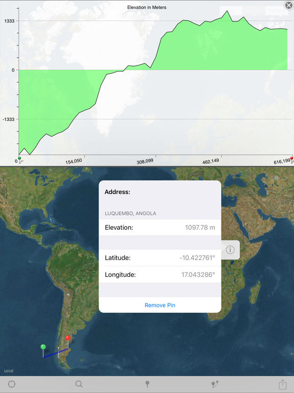
Elevation Chart is a tool used to get the elevation of any place on the surface of the Earth. Youre able to place a pin anywhere on the map to view its elevation in feet or meters along with its longitude, latitude, and address. #1 in Mexico and other 5 countries, #2 in United States, and top 10 in 12 countries (iPad Navigation) Features Show the elevations between two points in profile view, more visualization One tap to show the elevation of your current location Get elevation of any place on earth by: 1) touching the location on the map; 2) search by address/name Show Walking Distance between two points if available Show Ellipsoidal Distance (according to Vincentys formula) as label of x-axis Show elevation in feet or meters Work on iPad, iPhone, and iPod Touch Known Issues - In some situations, the Walking Distance which get from maps.googleapis.com is obviously wrong, compare to the Ellipsoidal Distance.- Limitations of elevation query: 2,500 requests per day; 50 requests per second. Requirements Internet connection. Video Tutorial Pick one of the following: https://appbead.com/app-elevation-chart.html http://youtu.be/o1T9-prX9Dg