-
Category Utilities
-
Size 1.4 MB
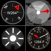
The SkyPro app is a simple utility application for use with the SkyPro GPS Receiver from Dual Electronics, model XGPS160. (This app is NOT for use with the XGPS150/A/E - please download the Bluetooth GPS Status Tool app instead.) - Requires iOS 8.0 or later - For use ONLY with the SkyPro GPS from Dual Electronics, model XGPS160.
SkyPro GPS Status Tool for iPhone alternatives
LTE Cell Info: Network Status
LTE Cell Info is a great multifunctional tool, which helps you to gather all the information you need to know about your cellular connection. It is a clever way how to get all the details about your current carrier, the connection mode or even detect max. Pull down with your finger to refresh the information
-
rating 3.43902
-
size 34.3 MB
GPS Plan
GPS Plan is a software supporting any form of analysis to determine visibility for GNSS satellites. By you set the date and place,you will be able to show sky plots, the number of available satellites and DOP (Dilution of Precision).Almanac to calculate satellites position is downloaded from QZ-vision automatically.
-
size 37.7 MB
Survival GPS(Flashlight ,Compass, Speedometer, Altimeter, Course and Map)
Optimized for iPhone 5,5S , iPhone 6, iPhone 6 Plus. iPhone 6S .6S Plus iPhone SE iPhone 7. THERE IS NO BUILT-IN MAGNETOMETER IN IPOD TOUCH, IPHONE 3G.
-
size 7.7 MB
Bad Elf GPS
This utility app allows owners of any Bad Elf GPS accessory to check the health of the Bad Elf hardware, view the GPS data being received, transfer and view trip logs, and install firmware updates. Visit www.bad-elf.com to learn more about the Bad Elf GPS, GPS Pro/Pro+, and the GNSS Surveyor accessories, which add a high performance GPS receiver to the iPod touch, iPhone, and iPad via the 30-pin dock connector, Lighting connector, or Bluetooth. Note: Continued use of the GPS running in the background can dramatically decrease battery life.
-
size 88.0 MB
Pix4Dcapture
Pix4Dcapture turns your consumer drone into a professional mapping tool. A free companion of Pix4D software, Pix4Dcapture is the perfect tool to automatically capture image data for optimal 3D models and 2D maps. Discover our cloud and desktop 3D mapping and modeling solutions on our website.
-
size 137 MB


