-
Category Utilities
-
Size 41.2 MB
Map Pilot Business is the same app as Map Pilot for DJI except it includes all of the In-App Purchase options at a discounted price. Map Pilot Business is offered with volume discounts for large institutional purchases through the Apple Volume Purchase Program. Features:Terrain Awareness Multi-Pass Linear Mission PlanningMulti-Flight CoordinationMulti-Battery ManagementAutomatic, Shutter Priority and Manual Exposure ModesBasemap Caching for Offline OperationsConnectionless Camera TriggeringExternal Map Data and Markers via MapBoxTerrain Aware Image Footprint DisplaySave/Edit MissionsRefly Saved MissionsView 3D logs on-device with Google EarthImport KML via Email or AirDropExport KML, log files, and Flights file via Email or AirDropFlight Log reviewBuilt-in Simulator for testingHealthyDrones upload from Log File ManagerRAW imaging available via In App PurchaseFullest Possible Use of Each BatteryAppropriate Camera TriggeringOverlap ManagementSpeed ManagementAutomatic Takeoff and LandingLive Video Preview (large and small)Signal Quality WarningLine of Sight IndicatorAutomatically Captures Elevation Reference Image (Ground Image)Natural Landing AssistanceLive Map ViewCompatible with iOS 8, iOS 9, and iOS 10.Supported Aircraft:Inspire 2Phantom 4 ProPhantom 4 AdvancedPhantom 4Mavic ProPhantom 3 ProfessionalPhantom 3 AdvancedPhantom 3 StandardInspire 1Inspire 1 ProMatrice M100Matrice M200Matrice M600
Map Pilot for DJI - Business alternatives
AirMap for Drones
AirMap is the leading provider of aeronautical data & services to unmanned aircraft, or drones. AirMap offers these features and more:- View only the airspace rules you need based on the context of your mission with localized rulesets for Germany, Japan, the U.K., the U.S., and the Canada.- Super Fast Vector Maps- Pilot Profile View- Manage UAV Aircraft- Create & Manage Flights (incl. Future Flights)- Submit Digital Flight Notifications to Participating Airports- View Public Flights- Get Real-time Traffic Alerts- Toggle between Four Different Map Styles- Search Map by Place or Location- Confirm that your flight is cleared for takeoff with AirMaps recommended preflight checklist.
-
rating 3.30709
-
size 116 MB
Flight Plan for DJI Drones
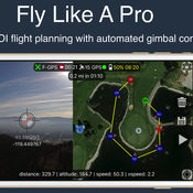
Fly like a pro - Create flight plans quickly that keep the camera focused on your subject with smooth transitions and perfect framing. With autonomous flight plans you can accomplish shots far to difficult to fly manually. Crosshairs display lat/lng targetFollow-me with auto gimbal controlFull ground stationVariable width FPV/map viewGesture camera controlInstructions:http://flightplan.beyondthecube.ca/Demo Videos:https://www.youtube.com/watch?v=FbO_dfTj-PY&list=PLa6UXqRipoPoss6G69VPzQtf89GVg3jnM
-
size 113 MB
Autopilot for DJI Drones
Fly like a professional - capturing smooth, perfectly framed, and visually stunning imagery. With autonomous and semi-autonomous flight modes, Autopilot enables you to execute flight and camera control sequences that were previously too difficult or impossible to perform manually. The aircraft will intersect the imaginary laser created by your device.
-
rating 4.4
-
size 166 MB
Pix4Dcapture
Pix4Dcapture turns your consumer drone into a professional mapping tool. A free companion of Pix4D software, Pix4Dcapture is the perfect tool to automatically capture image data for optimal 3D models and 2D maps. Discover our cloud and desktop 3D mapping and modeling solutions on our website.
-
size 137 MB
HD Sync
Is your drone healthy? Or is it about to surprise you on your next flight? In order to view your flight details - please visit the site directly.
-
size 10.9 MB


