-
Category Navigation
-
Size 2.0 MB
KML KMZ Viewer-Converter is an application provides you to load the kml or kmz files, convert and create kml or kmz files over the map. This app works for offline and online. If the file contains markers, then tap on the marker to see the detail description of marker like Description,email id, url links,phone numbers,Images,Web site page.2)Connect to Internet to open the url links,web pages,Images from Description page.Continued use of GPS running in the background can dramatically decrease battery life.
KML KMZ Viewer-Converter alternatives
Citymapper Transit Navigation
Real-time departures. Transport maps. Background GPS is only used when in GO navigation mode.
-
size 189 MB
Theodolite
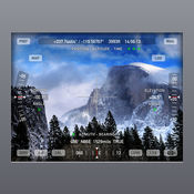
40%-OFF SALE Theodolite is on sale for 40%-off to celebrate its seven year anniversary As seen in Apples Special Event Keynote, Theodolite is a multi-function viewfinder for iPhone and iPod touch that combines a compass, two-axis inclinometer, rangefinder, GPS, map, nav calculator, tracker, and geo-tag photo/movie camera into one indispensable app. Uses are endless, and the app is great for hiking, boating, hunting, golf, outdoor sports, sightseeing, navigation, and finding your way around. iPod touch devices do not have GPS or compass hardware.
-
rating 4.58993
-
size 6.6 MB
Avenza Maps
Get the App. Get the Map. Privacy Policy: https://www.avenzamaps.com/legal/privacy-policy.htmlTerms Of Use: https://www.avenzamaps.com/legal/terms.html
-
size 56.5 MB
Map Plus (GIS Editor + Offline Map + GPS Recorder)
The most powerful and versatile tool for viewing and editing custom maps and managing mass of your geography or travel data. You can use Map Plus as a professional GIS tool for geographic data gathering, editing, measuring, cartography, surveying, planning, online/offline viewing and many other management. User Manual: http://duweis.com/en/mapplus_guide.htmlUser Forum: http://duweis.com/forums/viewforum.php?f=13Contact Us:[email protected]
-
size 60.7 MB
GPS & Maps: Track Coordinates, Compass + Waypoints
GPS & Maps is a simple, yet powerful GPS app for supporting navigation and outdoor activities like geocaching, sailing, skating, trekking, biking or traveling by airplane. It measures your position, height and acceleration with accuracy information and in different units like feet, meter, miles and kilometers. Compass and heading information are only available on devices with magnetometer (iPhone3 GS or newer and iPad).
-
size 23.9 MB


