-
Category Navigation
-
Rating 2.9
-
Size 49.7 MB
iGeoTrans is a perfect solution to replacing dedicated handheld GPS navigation devices for iPhone, iPad and iPod touch users. It supports surveying, mapping, fieldwork and related fields for any area in the world.KEY FEATURES:- Locates users location with high accuracy.- Allows users to manage and load waypoints, displaying straight route from users location to the selected waypoint on the map in real time.- Allows users to compute the area or distance directly on the map- Displays direction, digital compass, route and the straight-line distance between users location and the selected waypoint on the map in real time.- Users can manage the reference coordinate systems by adding, removing, and updating them. SUPPORT: [email protected] GPS in iGeoTrans IS ONLY AS ACCURATE AS YOUR devices built-in GPS.Facebook: http://www.facebook.com/iGeoTrans/Better performance on iOS 6 with iPhones (3GS, 4, 4S, 5, 5S, 5C) and iPad (2, 3, 4, mini).
iGeoTrans Lite alternatives
GPS Locator for Trekking, Hiking, Running and Sailing...
Great GPS AppGPS Locator allows you to find where you are and where you heading to. Just install this free app, no internet connection is required. Features- Locate where you are- See where you are heading to- Monitor your speed- Track your movement- Share with friends and family- Free on iPhone* It requires internet connection only to display maps and ads, any other location sensing feature does not require connection to any type of network cellular or wifi.
-
size 10.2 MB
GPS Map
With GPS Map you can search and bookmark your favorite locations. Search locations via address or GPS coordinates and save them. Have fun
-
rating 3.33333
-
size 2.0 MB
GPS me!
Using this iPhone application, you can send your exact location to your friends via e-mail. Your friends can receive your location not only on their iPhones but also any other phones, tablets or computers through Google Maps. Over 600,000 downloads
-
size 0.7 MB
Map Plus
The most powerful and versatile tool for viewing and editing custom maps and managing mass of your geography or travel data. You can use Map Plus as a professional GIS tool for geographic data gathering, editing, measuring, cartography, surveying, planning, online/offline viewing and many other management. User Manual: http://duweis.com/en/mapplus_guide.htmlUser Forum: http://duweis.com/forums/viewforum.php?f=13Contact Us:[email protected]
-
size 60.7 MB
More Information About alternatives
iGeoTrans
iGeoTrans is a perfect solution to replacing dedicated handheld GPS navigation devices for iPhone, iPad and iPod touch users. It supports surveying, mapping, fieldwork and related fields for any area in the world.KEY FEATURES:- Locates users location with high accuracy.- Allows users to manage and load waypoints, displaying straight route from users location to the selected waypoint on the map in real time.- Allows users to compute the area or distance directly on the map- Displays direction, digital compass, route and the straight-line distance between users location and the selected waypoint on the map in real time.- Users can manage the reference coordinate systems by adding, removing, and updating them. SUPPORT: [email protected] GPS in iGeoTrans IS ONLY AS ACCURATE AS YOUR devices built-in GPS.Facebook: http://www.facebook.com/iGeoTrans/Better performance on iOS 6 with iPhones (3GS, 4, 4S, 5, 5S, 5C) and iPad (2, 3, 4, mini).
-
size 49.7 MB
-
version 1.6.16
Map-o-meter
Map-o-meter is an easy to use app that allows you to mark an arbitrary path/route on the map and measure its distance. With closed paths the area is displayed. Features:- Imperial and metric units are supported- Map can be zoomed to your current location- Paths can be loaded/saved to a file- Undo- Search a location (by address or name)- Compute route given a start and finish points and optional waypoints- Portrait and landscape support
-
size 0.9 MB
-
version 2.1.1
OkMap Mobile, an off road GPS navigator for your sport activities
OkMap Mobile is easy to use and its capabilities are similar to those of the best known handhelds GPS.Draw your path on the map OkMap will calculate for you the altitude differences and travel times producing also statistics and graphs. A compass will show you the direction to follow along the path. FEATURES Maps- Offline custom map in KMZ format- Online map from various TMS and WMS web servers (Apple, OpenStreetMap, Nokia, ESRI, ecc)- Adding new web services- Tiles caching- From 0 to 4 customizable navigation and status indicators (among about 60)- Coordinates in different datum and in UTM, GeoRef, USNG, BNG, IG format- Mode: 3D map, follow user, distance computing- Find: waypoint, track, route, address, coordinates, geocaches- Zoom on: GPX data, copied coordinates- Reverse geocoding- Create tracks with autorouting- Create and modify waypoints, tracks and routes on the map- Download and manage altrimetric data (DEM) from SRTM project Navigation- Start, pause and stop recording of current track- Save waypoint in current position (with photo also) - Go to a waypoint and navigation along a track or route- Trip computer with about 60 navigation and status indicators- Reset and send values via email- Proximity waypoint feature- Anchor alarm- Send position to OkMap remote server Compass- 4 customizable navigation and status indicators (among about 60)- Graphic compass with north and target direction- True or magnetic compass- Vocal syntethizer when you are pointing your deviceAugmented reality- Augmented reality to show your waypoints - Manual aligment of waypoints dragging on the screen - Set the view ray (minimum and maximum)- Take high resolution pictures with superimposed information - Waypoints search featureWaypoints- List of waypoints- Modify and delete functions- Sort and filters features- Waypoint detailsTracks- List of tracks and track points - Modify and delete functions- Sort and filters features- Track details- Track graphs- Track statistics- Invert track- Estimate travel time featureRoutes- List of routes and route waypoints- Modify and delete functions- Sort and filters features- Route details- Invert routeUtilities- List GPX files- Send GPX files by email- List custom maps files (KMZ)- Download and upload your GPX and KMZ file from/to iCloud drive- Archive current GPX file- Send my position via email- Customizable preferences- Delete cache and restore factory settings- Information and links
-
size 96.4 MB
-
version 2.5
Roadbook
Roadbook is a simple and efficient app to navigate and move precisely to pre-set GPS points (waypoints). Follow the guide and enjoy the ride Designed for fans of outdoor activities such as:Walking, road and mountain biking, geocaching, motorcycling, all-road, friends trips and more, this all around the world Roadbook is a complete navigation system for iPhone, iPod-Touch* and iPad* which combines the features of a roadbook paper to the power of mobile technology devices from Apple. Roadbook management Compatible with any GPX and KML files Open KML and GPX files from Safari and Mail Displays the details such as the number of waypoints and the path distance Sends roadbooks by email Transfer of roadbooks via iTunes (import / export)Roadbook creation Create from your device new GPX roadbooks Simple and intuitive interface Manual mode with positioning waypoints on the map Automatic mode using the current GPS position (recognition) Add a name, a description and comments for each point of interestNavigation 3 intuitive modules to follow your path Navigation module Arrow to reach the next waypoint Compass to keep a view of the north Display of course following the true North Orientation Module Arrow orientation to turn to the next waypoint Display information about current waypoint Display information on the current GPS position Measures module Displays the distance between the user and the waypoint Display partial (distance between two waypoints / distance done) Display partial of the entire path Display of the instantaneous velocity Route displayed on a map (requires internet connection, or with downloaded maps) Display the summary of your current ride Ability to easily switch from one landmark to another Intelligent GPS moduleConfiguration Display units (metric, imperial, nautical) GPS accuracy required Distance to switch automatically points of interest Energy saver modeThe app now handles navigation in background mode (you can close the app in navigation mode, the navigation continues to follow your position).Continued use of GPS running in the background can dramatically decrease battery life.
-
size 2.3 MB
-
version 2.0
MultiRoad
Find easily the shortest route between multiple points MultiRoad allows you to create sessions where you specify the different waypoints, start and arrival. Then MultiRoad compute the best itinerary for you Functionalities :- Store your session and come back to it whenever you want- Add pictures to the annotations- Edit your session afterward to add, remove or reorganize waypoints- add your phone contacts on the map*- transport mode : driving or walking- choose between standard map, satellite or both- Distance are estimated. (*Note that only contacts with postal address can be imported)If you like MultiRoad, please dont forget to leave a comment on iTunes
-
size 3.3 MB
-
version 1.3
SearchPatterns Pro Sea
Do you conduct Search and Rescue operations on a boat/ship? Then this is REALLY the app for you Easily calculate various values to help you manage your search patterns. PLUS have a map displaying the search area and your search pattern, and with GPS equipped iOS devices, you can see your current position as well Universal App Featured search patterns: - Expanding Square - Creeping Line Ahead (CLA) - Sector Search - Track Crawl - Oil FieldFor each search pattern, you can: - calculate total distance of your search - calculate how long it will take to conduct it - calculate total square area searched - calculate tracks - view/calculate left or right patterns - display the pattern on a map - view a Full Screen map in Portrait or Landscape - view current position with reference to the pattern - view calculated waypoint Lat/Longs to enter into a search GPS - mark your current position for where you left track or for a call-around/sighting/on-top - enter a variation so you can enter all tracks in Magnetic but the pattern is still oriented True North on the map - enter distances/speeds in: nm / sm / km / yards- view bearing & distance to CSP from current position - draw a line direct to the CSP from current position - EXPORT the pattern as a .GPX file for use in other apps/Computer programs- EXPORT your breadcrumbs as a .GPX filein addition to: Expanding Square: - calculate number of waypoints needed to enter the pattern in a GPS - tap on the graphic to highlight which legs you have completed (iPad only) Creeping Line Ahead: - calculate number of legs to fly based on a given the distance you need to creep (defined search area) OR - calculate the maximum distance you can cover based on a fixed amount of legs Sector: - use 60 degree or 30 degree cuts - calculate subsequent tracks Track Crawl: - use bearing/distance or Lat/Long inputs to calculate subsequent waypoints Oil Field:- Calculate the pattern based on various anglesEmail the developer for questions/comments/requests
-
size 1.6 MB
-
version 1.1
GPS HSI
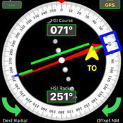
- GPS-HSI is a training program only for GROUNG TRAINING NOT FOR NAVIGATION purposes.- GPS position type selectable between decimal or degrees.- uses GPS position to calculate distance, time and estimate fuel consumption. - HSI (Horizontal Situation Indicator) function shows your desired radial from selected waypoint,- CDI (Course Deviation Indicator) shows selected corse shift up to + -10- TO / FROM indicator shows your selected HSI course approaching or away from selected Poi.- Red Arrow shows Homing direction of selected waypoint- MAP function use online map, you can create your planned route bye touching to map or with MyPoi button you can enter coordinates directly.- Builded route recording and loading automatically.-From Setting page,You can ON or OFF HSI Touch Turn function to control HSI with touch and turn. column: Latitude (example: 40.97 for North, -40.97 for South)2. column: Longitude (example: 28.81 for East, -28.81 for West)3. column: Fix Name
-
size 0.9 MB
-
version 1.3
UTM For Flight
Designed as a companion app to ForeFlight. This utility converts UTM GPS coordinates to Lat/Lon (Latitude/Longitude) and then permits exporting the converted coordinate directly into ForeFlight user waypoints. Converted waypoint can also be verified on the map within the app using either street map or satellite imagery.
-
size 28.2 MB
-
version 1.04
SF MUNI Tracker
After a few days on the App Store Bay Area riders have already put SF MUNI Tracker into the Top 50 Navigation apps And climbing Apple has placed us on New and Noteworthy. Thanks for choosing us. -Google map showing users location as well as the location and travel direction of buses corresponding to the current selected route.
-
rating 2
-
size 2.0 MB
-
version 1.1
Planimeter Pro - Measure the Distance & Area
Just draw on the map to measure the distance between two places or circle out the area that need to be measured on the map , Planimeter will then calculate the distance or area immediately. Features:1. (Open your gps location, and hold your phone ,walk around and circle out your room by your feet ,it will calculate the the result) 2.Support minor adjustments when you circled out an area on the map.3.Accurate data calculator .4.Support ios 10Suitable Groups : engineering,architect, sports enthusiast or a geography hobbyist,and etc.
-
size 3.7 MB
-
version 1.0


