GPS HSI!
-
Category Education
-
Size 0.9 MB
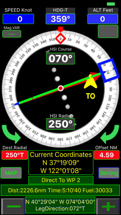
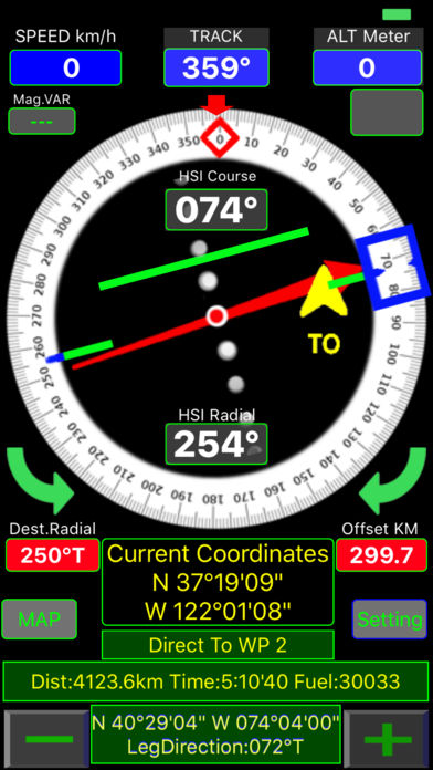
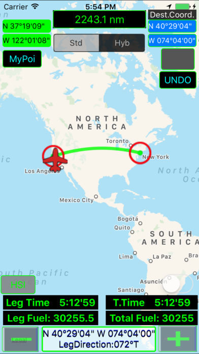
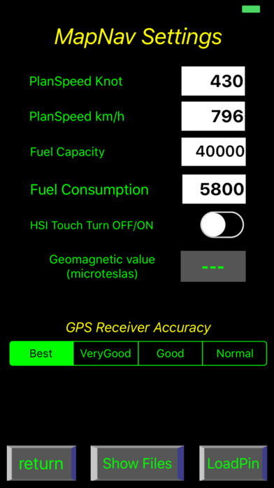
- GPS-HSI is a training program only for GROUNG TRAINING NOT FOR NAVIGATION purposes.- GPS position type selectable between decimal or degrees.- uses GPS position to calculate distance, time and estimate fuel consumption. - HSI (Horizontal Situation Indicator) function shows your desired radial from selected waypoint,- CDI (Course Deviation Indicator) shows selected corse shift up to + -10- TO / FROM indicator shows your selected HSI course approaching or away from selected Poi.- Red Arrow shows Homing direction of selected waypoint- MAP function use online map, you can create your planned route bye touching to map or with MyPoi button you can enter coordinates directly.- Builded route recording and loading automatically.-From Setting page,You can ON or OFF HSI Touch Turn function to control HSI with touch and turn. column: Latitude (example: 40.97 for North, -40.97 for South)2. column: Longitude (example: 28.81 for East, -28.81 for West)3. column: Fix Name