-
Category Education
-
Size 32.7 MB
Mancos brings the geology of the United States and beyond to your iPhone. Tap the map, search by name, or use GPS to instantly locate yourself, show state-level geological maps, the geological formation and the regional stratigraphic column, all supplied by the servers at earth-base.org. Also view any fossil collections from your region, supplied by paleodb.org.
Mancos alternatives
iGeology
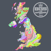
iGeology - Interactive geological mapping of the UK.iGeology is for anyone who wants to explore their local geology, at street-level scale, virtually anywhere in the UK.Amateur geologists, walkers and gardeners can look at whats in their local area, to find out about the rocks at the surface (superficial deposits) or the bedrock beneath. Search on place names or the postcode where you live, then click on the map and reveal the rocks beneath your feet. Only 1:625 000 scale data is available for Northern Ireland.
-
rating 5.0
-
size 68.5 MB
Rockd
Explore, learn about, and document your geologic surroundings Whether you are a professional geoscientist or curious about the rocks around you and the stories they tell, Rockd allows you to explore and learn about the geologic record, contribute your own observations, and log your journey through the geologic record. Features: - Instant access to geologic and geographic summaries of your current location via a Dashboard - Interactive global access to more than 140 geologic maps, with more being added weekly - See your past location and explore paleogeographic maps from C.R. Send an email to [email protected] and we will do our best to help you resolve it.
-
size 121 MB
pangaea
The pangaea app dynamically shows the breakup of the supercontinent Pangaea and the positions of the continents over the last 200 million years on a 3D globe. Significant events are indicated on the globe at the time of the event (millions of years ago). Correlates with the Next Generation Science Standards for Earth Science:ESS1.C: The History of Planet EarthESS2.B: Plate Tectonics and Large-Scale System Interactions
-
size 83.1 MB
geotimescale enhanced
This app displays the Geologic Time Scale that represents the timeline for Earths history. The Geologic Time Scale shows the names of the eons, eras, periods, epochs, and ages along with their corresponding dates. Correlates with the Next Generation Science Standards for Earth Science:ESS1.C: The History of Planet EarthESS2.E: Biogeology
-
size 200 MB
geotimescale 2
Now a Universal app for iOS 9.Need a quick reference to the geologic time scale of Earths history? Find out, for example, when dinosaurs ruled the world or when reptiles first appeared. Touching each of these icons reveals additional information about which phenomenon occurred at that time such as the extinction of the dinosaurs at 66 Ma.
-
size 8.8 MB


