-
Category Education
-
Size 51.2 MB
FieldDataCollector is a universal , iOS data collection application to collect data in i-phone and i-pad running iOS 8.0 and above. It uses geolocation and offers the ability to build robust and flexible forms for collecting data with or without internet connection. There is also a inbuilt map cache which stores the tiles, that gets downloaded while navigating the map, and are available in offline mode.
FieldDataCollector alternatives
Udemy Online Courses
1,700 50,000 2,000 - iOS11 ARKit 1,000 Udemy 10 - 200 25,000 80 Udemy - Venture Beat Udemy - Tech Crunch JavaSwiftPythonRuby on Rails JavaScript HTMLCSS IT Microsoft Excel [email protected]
-
rating 3.3

iNaturalist
One of the worlds most popular nature apps, iNaturalist helps you identify the plants and animals around you. Get connected with a community of over 400,000 scientists and naturalists who can help you learn more about nature Whats more, by recording and sharing your observations, youll create research quality data for scientists working to better understand and protect nature. KEY FEATURES Discover species new to you both near and far Record your own observations and share them with the community Receive suggestions and crowdsourced identifications of what youve seen Discuss and help others identify what theyve seen Follow projects comprised of smaller communities and fellow citizen scientists passionate about a particular place and/or species
-
rating 4.59701
-
size 32.6 MB
geotimescale 2
Now a Universal app for iOS 9.Need a quick reference to the geologic time scale of Earths history? Find out, for example, when dinosaurs ruled the world or when reptiles first appeared. Touching each of these icons reveals additional information about which phenomenon occurred at that time such as the extinction of the dinosaurs at 66 Ma.
-
size 8.8 MB
iGeology
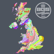
iGeology - Interactive geological mapping of the UK.iGeology is for anyone who wants to explore their local geology, at street-level scale, virtually anywhere in the UK.Amateur geologists, walkers and gardeners can look at whats in their local area, to find out about the rocks at the surface (superficial deposits) or the bedrock beneath. Search on place names or the postcode where you live, then click on the map and reveal the rocks beneath your feet. Only 1:625 000 scale data is available for Northern Ireland.
-
rating 5.0
-
size 68.5 MB


