-
Category Utilities
-
Size 59.2 MB
With this app you can pilot your Parrot bebop or bebop2 like never beforeMain Feature:-TapFly Mode (read more down below)-Map TapFly Mode (read more down below)-AR Localizers (read more down below)-Watch Me Mode (read more down below)-Watch IT Mode (POI) (read more down below)-Follow Me Mode (position,speed, and altitude tracking)-Track Me Mode (follow me from any angle)-Dynamic Track (the bebop orbit around you while follow you)-Orbit-Exclusive Headless Mode-VR Mode (read more down below)-Fullscreen Mode-Altitude Limit Override-Configurable 4 positions rate selector on piloting screen Tripod Mode Filming 1 Mode Filming 2 Mode Sport Mode-Piloting mode 1, 2, 3, 4 -work with: Skycontroller Skycontroller2 MFI bluetooth controller FLYPAD controller WIFI extender-Return home-Banked Turn-Flight Limits-Media Management-On screen information: -speed -altitude -altitude over sea level -distance -wifi signal strength -bebop battery level -device battery level -skycontroller battery level -bebop gps fix (with satellite number) -device gps fix (color coded on the precision level) -skycontroller gps fix -dinamic viewfinder -flight timer -radar-Exponential analog stick for precise manual piloting with the phone-Videofeed from the bebop -Map view-Flat Trim-Calibration-Save last know Bebop Position-Super handy shortcut to system wi-fi options-Siri voice feedback-Metric/Imperial unit-exposure correction-color saturation-white balance-video recoding Mb/s-video recording frame rateLocalization: - english - italian - spanish TapFly Mode With this modality you can pilot your bebop just by tapping your destination on the videoFeed, its work like Magic Map TapFly Mode In this modality you can tap on the Map your destination and the Bebop will automatically reach it AR Localizers Floatting target on the videofeed that indicate you your position and the position of your POI Watch Me Mode In this modality the camera of the bebop always point at you You can still the control of the bebop move it around and take unmatched selfie video, no limit to your imagination Or you can move around, the bebop will stay stationary hovering but always looking what you doing self rotating on the z axis and tilting the camera for keep you in frame Follow Me ModeAs you expect in this mode the bebop will follow you Just choose the distance and the elevation from which you what to be followed and enjoy the best follow algorithm out there The movement of the bebop are precisely calculated considering speed,acceleration,direction,distance both of you and the bebop it self. Track / Dynamic Track Me Mode Not only follow you from behind, with the mode the bebop follow you from any angle, you can change angle altitude and distance on the fly and more the angle can change dynamically so the bebop orbit around you Watch IT Mode (POI) Choose a point on the map and the bebop will always look at your Point Of Interest You can move the bebop around while it look at the place you choose The best solution for shot your favorite monument, castle,lakeyour target will be always in frame, with automatic yaw angular speed calculated base on the tangential speed of the bebop with you POI-VR mode (Split view for VR headset - goggles)include options forheadtracking for move the camera (optional)pan headtracking looked on speed (optional)on-screen arrow that indicate your position AR localizeradjustable FOVworks with skycontroller,skycontroller 2 and bluetooth MFI controllerThis app is built with Parrot SDK 3.12-This app works with both Bebop1 and Bebop2 but the update GPS module of the Bebop2 will guarantee better performance and precision in all position related operation-Many of special function of the app require a GPS equipped device-Altitude Tracking require a barometer equipped device
Bebop PRO alternatives
AirMap for Drones
AirMap is the leading provider of aeronautical data & services to unmanned aircraft, or drones. AirMap offers these features and more:- View only the airspace rules you need based on the context of your mission with localized rulesets for Germany, Japan, the U.K., the U.S., and the Canada.- Super Fast Vector Maps- Pilot Profile View- Manage UAV Aircraft- Create & Manage Flights (incl. Future Flights)- Submit Digital Flight Notifications to Participating Airports- View Public Flights- Get Real-time Traffic Alerts- Toggle between Four Different Map Styles- Search Map by Place or Location- Confirm that your flight is cleared for takeoff with AirMaps recommended preflight checklist.
-
rating 3.30709
-
size 116 MB
BebopMe
This App will let you fly your Bebop Drone in a natural way, simple and easy, using only one hand. Just tilt your device and the drone will Mimic the movements. Combining Mimic and Me gives you a unique, sensitive kind of control that you will enjoy, looking the drone and not the phoneIntuitive Flying with device sensors One hand operation Follow Me Escort Me (Follow Me from any point)Dronie (Drone Selfie) automatic transfer when you shoot a Photo Altitude Automatic Corrections using barometer from iDeviceGPS and Flight Operation based on Activity MonitorDistance AlarmDynamic Home PositionTime-Lapse Photo modeElevator moving up and down automaticallyBebop1 & Bebop2 Compatibleenjoy your Bebop Flight
-
size 14.1 MB
Flight Plan for DJI Drones
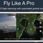
Fly like a pro - Create flight plans quickly that keep the camera focused on your subject with smooth transitions and perfect framing. With autonomous flight plans you can accomplish shots far to difficult to fly manually. Crosshairs display lat/lng targetFollow-me with auto gimbal controlFull ground stationVariable width FPV/map viewGesture camera controlInstructions:http://flightplan.beyondthecube.ca/Demo Videos:https://www.youtube.com/watch?v=FbO_dfTj-PY&list=PLa6UXqRipoPoss6G69VPzQtf89GVg3jnM
-
size 113 MB
Bebop Control US - for Parrot's Bebop Drone
The new remote control app for Parrots breathtaking drone: the Bebop drone. To connect, please turn on the Bebop and connect to the wifi network of the Bebop drone and launch the app. We do not collect or transmit any data.
-
size 32.8 MB
Pix4Dcapture
Pix4Dcapture turns your consumer drone into a professional mapping tool. A free companion of Pix4D software, Pix4Dcapture is the perfect tool to automatically capture image data for optimal 3D models and 2D maps. Discover our cloud and desktop 3D mapping and modeling solutions on our website.
-
size 137 MB
More Information About alternatives
Watch Me Bebop
With this app you can pilot your Parrot bebop or bebop2 like never beforeMain Feature:-Exponential analog stick for precise manual piloting-Configurable 4 positions rate selector on piloting screen (turns your bebop from a precise flying machine to a rocket ship in one touch)-Watch Me Mode (read more down below)-Watch IT Mode (POI) (read more down below)-Exclusive Headless Mode-Piloting mode 1, 2, 3, 4 -Skycontroller compatibility-MFI controller compatibility-Return home-Banked Turn-Flight Limits-Media Management-On screen information: -speed -altitude -distance -wifi signal strength -bebop battery level -device battery level -skycontroller battery level -bebop gps fix (with satellite number) -device gps fix (color coded on the precision level) -skycontroller gps fix -dinamic viewfinder-Video streaming from the bebop -Map view-Flat Trim-Save last know Bebop Position-Super handy shortcut to system wi-fi options-Siri voice feedbackLocalization: - english - italian - spanishin app purchase (1)-Follow Me Mode (position,speed, and altitude tracking)-Track Me Mode (follow me from any angle)-Dynamic Track (the bebop orbit around you while follow you)-Orbitin app purchase (2)-VR Mode (read more down below)the new parrot skycontroller2 is still not supported Watch Me Mode In this modality the camera of the bebop always point at you You can still the control of the bebop move it around and take unmatched selfie video, no limit to your imagination Or you can move around, the bebop will stay stationary hovering but always looking what you doing self rotating on the z axis and tilting the camera for keep you in frame Follow Me Mode (in app purchase)As you expect in this mode the bebop will follow you Just choose the distance and the elevation from which you what to be followed and enjoy the best follow algorithm out there The movement of the bebop are precisely calculated considering speed,acceleration,direction,distance both of you and the bebop it self. Track / Dynamic Track Me Mode (in app purchase)Not only follow you from behind, with the mode the bebop follow you from any angle, you can change angle altitude and distance on the fly and more the angle can change dynamically so the bebop orbit around you Watch IT Mode (POI) Choose a point on the map and the bebop will always look at your Point Of Interest You can move the bebop around while it look at the place you choose The best solution for shot your favorite monument, castle,lakeyour target will be always in frame, with automatic yaw angular speed calculated base on the tangential speed of the bebop with you POI-VR mode (Split view for VR headset - goggles) (in app purchase)include options forheadtracking for move the camera (optional)exclusive unstabilizzated video effect (optional)on-screen arrow that indicate your position adjustable FOVworks with skycontroller and bluetooth MFI controllerThis app is built with original parrot SDK 3.9-This app works with both Bebop1 and Bebop2 but the update GPS module of the Bebop2 will guarantee better performance and precision in all position related operation-Many of special function of the app require a GPS equipped device-Altitude Tracking require a barometer equipped device
-
size 36.7 MB
-
version 1.3
FPV Bebop
With this app you can pilot your Parrot bebop or bebop2 like never beforeMain Feature:-VR Mode (read more down below)-Exponential analog stick for precise manual piloting-Configurable 4 positions rate selector on piloting screen (turns your bebop from a precise flying machine to a rocket ship in one touch)-Exclusive Headless Mode-Piloting mode 1, 2, 3, 4 -Skycontroller compatibility-MFI controller compatibility-Return home-Banked Turn-Flight Limits-Media Management-On screen information: -speed -altitude -distance -wifi signal strength -bebop battery level -device battery level -skycontroller battery level -bebop gps fix (with satellite number) -device gps fix (color coded on the precision level) -skycontroller gps fix -dinamic viewfinder-Video streaming from the bebop -Map view-Flat Trim-Save last know Bebop Position-Super handy shortcut to system wi-fi options-Siri voice feedbackLocalization: - english - italian - spanishthe new parrot skycontroller2 is still not supported-VR mode (Split view for VR headset - goggles)include options forheadtracking for move the camera (optional)exclusive unstabilizzated video effect (optional)on-screen arrow that indicate your position adjustable FOVworks with skycontroller and bluetooth MFI controllerThis is just the begin More onscreen display style and more option for VR Mode will come soon Compatible with both Bebop1 and Bebop2This app is built with original parrot SDK 3.9
-
size 24.8 MB
-
version 1.1
Bebop 360
With this app you can create stunning aerial 360 panorama with your Parrot bebop or bebop2 Main Feature:-360 Panorama-Exponential analog stick for precise manual piloting-Piloting mode 1, 2, 3, 4 -work with: Skycontroller Skycontroller2 MFI bluetooth controller FLYPAD bluetooth controller WIFI extender-Return home-Banked Turn-Flight Limits-Media Management-Integration with Bebop Pro app-On screen information: -speed -altitude -distance -wifi signal strength -bebop battery level -device battery level -skycontroller battery level -bebop gps fix (with satellite number) -device gps fix (color coded on the precision level) -skycontroller gps fix -dinamic viewfinder -flight timer-Video streaming from the bebop -Map view-Flat Trim-Save last know Bebop Position-Super handy shortcut to system wi-fi options-Siri voice feedbackLocalization: - english - italian - spanish 360 Panorama take stunning 360 aerial panorama with this app just pilot the drone to your favorite spot and start the process the app will automatically take all the necessary pics, then use the panorama manager inside the app for stitch them together to create an immersive 360 pics to share with your friends This app is built with parrot SDK 3.10-This app works with both Bebop1 and Bebop2
-
size 45.3 MB
-
version 1.4
FlyToDiscover - Bebop
Fly to Discover allow you to control your Parrot Bebop, Bebop 2, FTD300X and Super300 thanks to fabulous functions such as:Main features:- Now with SKY CONTROLLER 2 support - PANORAMA create fabulous 360 picture with your Bebop- MULTIMEDIA for managing your bebop memory- VOICE CONTROL to control your bebop with your voice- Translated in English, Italian, Portuguese, French, Spanish, German and Romanian- Integrated 2D simulator to fly even when the weather does not allow it. You can familiarize yourself with all the functions of FTD without reading boring manual and without having to connect your Bebop.- Exclusive compatibility with Apple Watch Control your Bebop with your wrist - Control via analog sticks for precise driving experience at all times- Simple and intuitive graphics, cockpit customizable pull-down menus and draggable items- Compatible with Parrot SkyController and SkyController 2- Magnetometer calibration tool for Bebop and SkyController- Detailed picture settings menu for optimum results- Dynamic charts in real time: battery, altitude, speed and distance- Photo mode (DNG, JPEG 4: 3, 16: 9, Fisheye), Video mode, Time Lapse, Photo Panoramic 360- Map mode with FPV box- Localization Bebop compared to the pilot (Radar)- Follow Me Mode (Bebop follow you at a distance and height adjustable) with block angle (Bebop follow you at the same angle)- Orbit Me (Bebop will make a circle around you at a distance and adjustable speed)- Flight time and time of video recording- Return to home in case of radio signal loss or pressing appropriate button- Selection of piloting modes: Mode 1, Mode 2, Mode 3, Mode 4- Selection of flight parameters: maximum inclination, tilt speed, maximum vertical speed, maximum rotation speed- Selection of banked turn- Warning messages with vibration (optional)- Selection of flight limits: max altitude and max distance- Pause time before RTH- RTH location: takeoff or pilot- Network settings: change your Bebop name, changing country, auto or manual band (2.4GHz-5GHz), wi-fi channel with free channels and setting wi-fi password to make sure your Bebop- Function VR with deactivation video stabilization of Pitch and Roll for a VR experience even more real- Band, channel and name selection of SkyController- Compatible with iOS MFi Bluetooth Controller: Nimbus, Mad Catz, Moga rebel and others- Move the framing of Bebop dragging two fingers on the screen- Automatic recording of all flights, and section to review all the details- Function Find my drone, in case you lost your drone you can easily find it again with this function- Successfully Tested with wi-fi extender
-
size 79.3 MB
-
version 1.5.0
Altimeter Pro - Altitude, GPS, Compass, Speed
Altimeter - Altitude, GPS, Compass, Speed Mobile ApplicationPro Edition Features : - You will be able to follow your speed.- Press and hold on the map to get the altitude information of a point -> BEST Feature Standard Features : - You can instantly see the coordinates and Altitude of your position- You can determine your direction with a compass feature- You can automatically track your location on the map with tracking mode- You can share location and altitude information. Note: Altitude and position information is calculated from the GPS sensor of the device; Therefore, it may vary depending on the quality of GPS signals
-
size 30.7 MB
-
version 1.0
RangeFinder PRO
High Distance Range Finder IT REALLY WORKS Measure distances from your iPhone to any choosen Target as far as you can see. No limits It has the ability to get Targets position on map with a lot of other informations like coordinates, altitude, bearing, elevation angle, distance from user, etc. - High Definition graphics.
-
size 4.3 MB
-
version 3.1
Best Bike Computer
The Best Bike Computer is a biking performance tracking application developed by a biker. It tracks various metrics from your bike ride and saves them for review in Best Bike or export in a CSV file. Data Recorded During Your Ride- Current speed- Total distance during ride (saved in Health app)- Total time of ride- Current position (displayed in coordinates and on map)- Where you have been (on map display)- Compass heading- Average speed- Whether your current speed is above or below your average speed (indicated by + or after current speed)- Maximum speed- Altitude- Delta altitude (difference between minimum and maximum altitude during ride)- Calories burned - Cumulative elevation gain (or altitude gain)
-
size 0.9 MB
-
version 2.2.9
Altimeter - Altitude, GPS, Compass
Altimeter - Altitude, GPS, Compass Mobile Application- You can instantly see the coordinates and Altitude of your position- You can determine your direction with a compass feature- You can automatically track your location on the map with tracking mode- You can share location and altitude information. Note: Altitude and position information is calculated from the GPS sensor of the device; Therefore, it may vary depending on the quality of GPS signals.
-
size 31.5 MB
-
version 1.1.2
MobileLogger
Record location, heading, speed, altitude, accelerometer, sound level, trip duration and distance to storage on the device. Each log can be viewed on a map and individual samples inspected. Licensed under GPL/MIT.
-
size 5.1 MB
-
version 1.2.4
GPS Stone GPX Trip Recorder
GPS Stone trip tracker is a GPX file generator. Display current GPS information, speed (max and average), position, distance, elevation, and shows on the map but also record all the trip information to review it in Google Earth. GPS Stone Trip Recorder can: Record and date your trip Show live path on the map Auto-restart recording after a phone call Check your instant, max, and average speed View the distance, altitude, GPS accuracy GPS coordonnates Compass to see your current direction Delete and rename any trip Units: mph or km/h Fine tuning of log details and file size Send GPX by mail This application use background mode, continued use of GPS can dramatically decrease battery life.
-
rating 2.75
-
size 3.3 MB
-
version 4.5
