Soldier's Field Card!
-
Category Reference
-
Size 197 MB
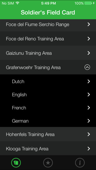
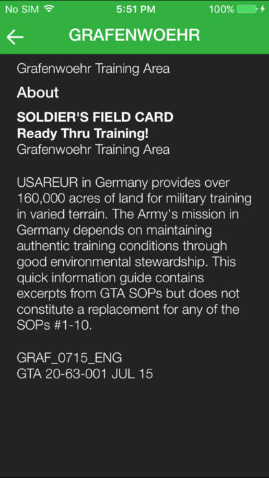
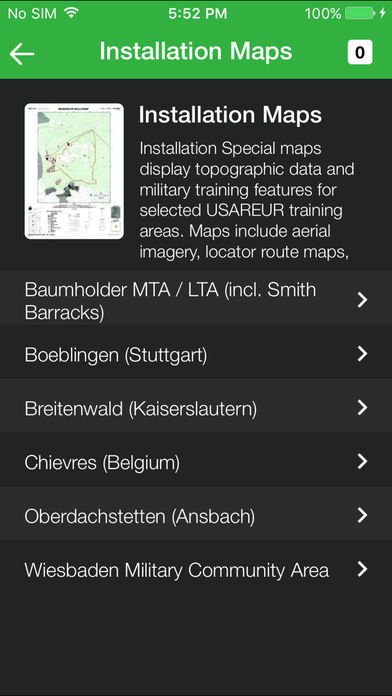
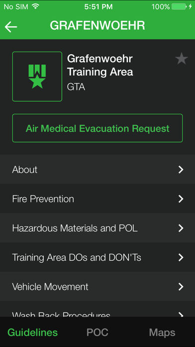
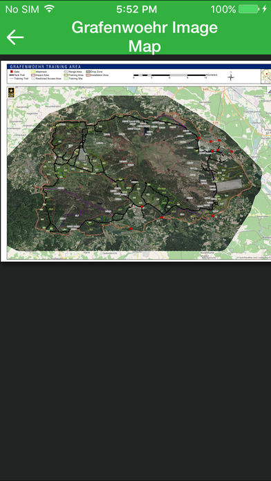
Success of the Armys mission depends on sustaining realistic training conditions through good environmental stewardship. The Integrated Training Area Management (ITAM) program - a core component of the U.S. Army Europes Sustainable Range Program (USAREUR SRP) - contributes to this goal, in part by establishing the guidelines contained in the Soldiers Field Card app. Sections of the app are training area and language-specific and cover topics such as: - Medical Evacuation Requests, Emergency Numbers and Frequencies - Spill Prevention / Response (including HAZMAT / POL) - Vehicle Movement, Washrack Procedures, Policing Training Areas - Training Area DOs and DONTs - Wildlife, Fire Prevention - IED / UXO Reporting - Camouflage - Safety Risk Assessment Models - Orientation and Training Area Maps The app has Cards for the following Training Areas: - Adazi- Ansbach TSC- Asiago- Babadag - Bakony Combat Training Center- Baumholder- Boeblingen- Breitenwald LTA / Range- Cao Malnisio Range - Cellina Meduna / Juliet DZ / Frida DZ / Dandolo MOUT - Chievres- Chinchilla- Divaca Drop Zone- Drawsko Pomorskie- Foce del Fiume Serchio Range- Foce del Reno- Gaiziunu- Grafenwoehr - Hohenfels - Klooga- Monte Carpegna - Monte Romano - Novo Selo - Nowa Deba- Pabrade- Persano LTA & Indoor Range- Pocek- Rivoli Bianchi di Venzone- San Giorgio Urban Assault Course - Slunj - T-Series- Tapa- Valle Ugione and Lustrissimi- Wedrzyn- Wiesbaden TSC- Yavoriv- Zagan