Fires - 3D Fire Map!
-
Category Weather
-
Size 15.9 MB
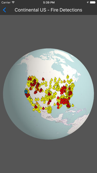
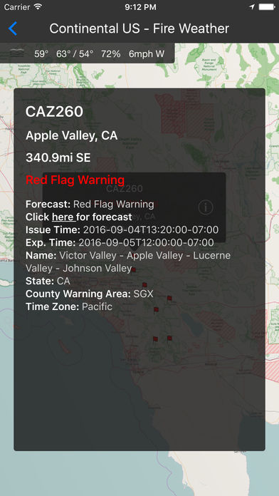
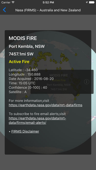
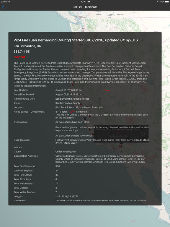
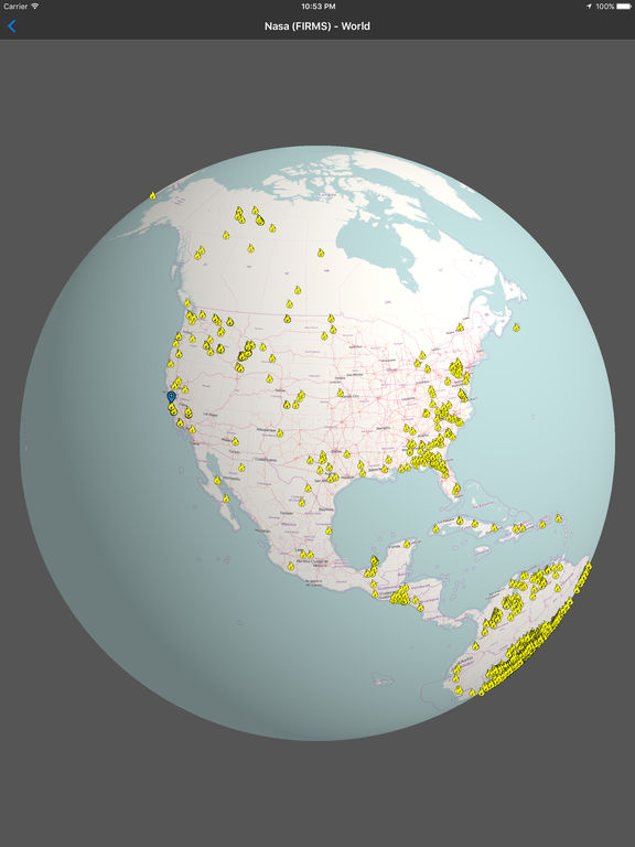
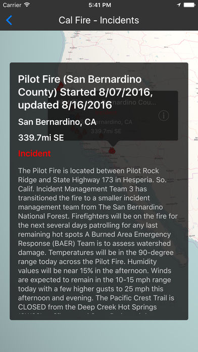
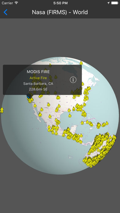
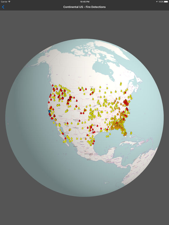
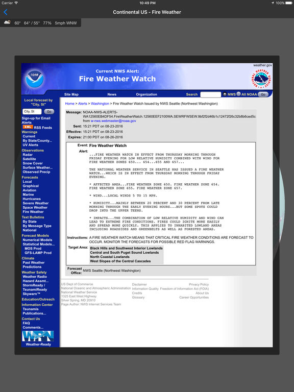
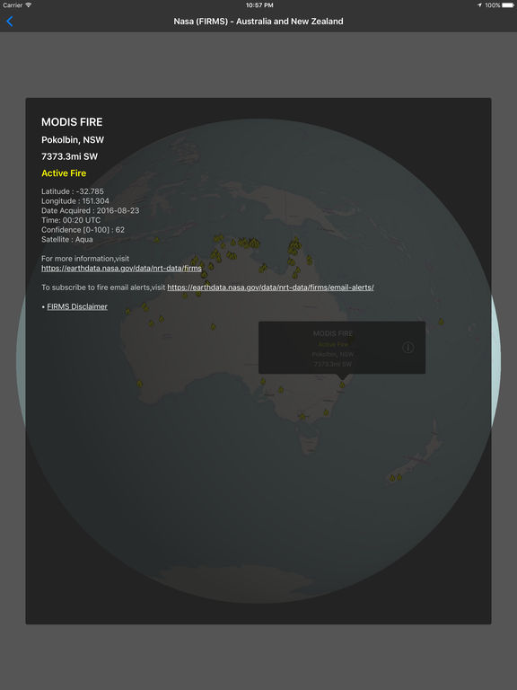
Fires presents 3D visualizations of worldwide fire data from multiple sources including the USDA, NASA, and Cal Fire on an interactive virtual globe. Whether youre monitoring a nearby wildfire and want the most up to date information on fire detections, checking your current weather and fire weather conditions, or youre just curious about the amount of fires in a certain area (anywhere), this app is for you. Globe Layers:USDA Forest Service - Continental United States- Fire Detections (MODIS)- Fire Radiative Power (MODIS)- Large Incidents- Fire WeatherUSDA Forest Service - Alaska- Fire Detections (MODIS)- Fire Radiative Power (MODIS)- Large Incidents- Fire WeatherUSDA Forest Service - Hawaii- Fire Detections (MODIS)- Fire Radiative Power (MODIS)- Large Incidents- Fire WeatherUSDA Forest Service - Canada- Fire Detections (MODIS)- Fire Radiative Power (MODIS)- Large IncidentsNASA Fire Information for Resource Management System (FIRMS) - Last 24 Hours- Alaska- Australia and New Zealand- Canada- Central America- Europe- North and Central Africa- Russia and Asia- South America- South Asia- South East Asia- Southern Africa- USA (Conterminous) and Hawaii - WorldCal Fire - Incidents