-
Category Weather
-
Size 4.6 MB
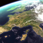
WxSat (short for Weather Satellite) displays and animates full-resolution, real-time weather satellite data. WxSat leverages SSEC Data Center holdings and RealEarth to provide global coverage for visible, infrared, and water vapor channels.
WxSat alternatives
My Weather
World Rain radar, Satellite Image and World Earthquake present on Google Map with weather info provided by OpenWeatherMap. 260 radar & satellite images, countries supported: Argentina, Australia, Belgium, Brazil, Hong Kong, Japan, Korea, Macau, Malaysia, Singapore, Taiwan, United Kingdom, United States, more coming soon. Features:- Rain Alert (Server side), currently only support 2 countries: United States and Malaysia.- Weather info like temperature (Max/Min),Wind,humidity,pressure and cloud coverage.- Weather forecast (Daily / every 3 hours)- Animation radar map and satellite image- Weather broadcast- bookmark landmarks/locations- Current location*more coming soon.
-
size 30.2 MB
NEXLAB Models for iPhone
NEXLAB Models brings the College of DuPages NEXLAB Numerical Forecast Model Products to you in app form. We have designed the app from the ground up with the idea that nothing should be in the way of you interacting with the products the way you want to use them. To start with your favorite product from a particular model, press the settings icon in the lower right hand corner and set your default product, sector and parcel settings (where available.)
-
size 4.6 MB
GlobalCast
Find the local weather forecast for any town in the world. GlobalCast provides the current weather, the forecast at 3-hourly and daily intervals, and near real-time local and animated wide-area satellite views for each location. Satellite images are courtesy of NOAA and NASA.
-
size 20.1 MB
Cloud Map
Quickly check any of the 120 NOAA weather station satellite images for visible cloud cover. If you travel, you can use the GPS feature to find the nearest weather station image. Upgrade to Pro version and get 12 more satellite views and no ads.
-
size 27.7 MB
SatWeather
SatWeather is a new type of weather application that allows you to see REAL TIME IMAGES received from the satellite in order to understand the evolution of disturbances and the position of clouds over you. With this tool you can have a clear and precise idea on the REAL weather conditions by analyzing the movement of clouds. It may rarely happen, for reasons not attributable to developers, that a snapshot of a particular time could not be available.
-
size 28.5 MB


