-
Category Navigation
-
Size 353 MB
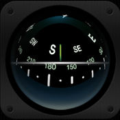
This is a working detailed 3D-Simulation of a U-Boat compass used on German Type VII U-Boats during World War 2.This App uses artwork from the upcoming mobile submarine simulation WOTA: Wolves of the Atlantic and was developed in cooperation with the Technical Museum U 995 of the German Naval Association. In addition, the app comes with a short animated tour detailing the compass installations aboard Type VII submarines. Please dont use this app for critical applications like real world navigation
WOTA: U-Boat Compass alternatives
OpenSeaMap
OpenSeaMap is a worldwide Opensource-project for creating a free nautical chart. Founded in 2009 the project gained a lot of attention lately adding more and more nautical information for free. LICENSE: This app uses icons from the library http://icons8.com/ we thank for providing these under Creative Commons Attribution-NoDerivs 3.0 Unported License.
-
size 4.4 MB
3D Sailing Compass
The 3D compass (or half-sphere compass/nautical compass) is just like what you find on a beautiful yacht or airplane. Unlike other compasses you can view it in any orientation, not just when it lays flat. Keywords: compass , boat compass , ball compass , dome compass, half-sphere compass, airplane compass
-
size 3.6 MB
Barometric Altimeter
Barometric Altimeter is based on the new barometer in iPhone 6, iPhone 6 Plus and iPad Air 2. On other devices the app shows your GPS altitude. For manual calibration use the following options:- enter your current altitude- use altitude-information from your GPS device- enter current sea-level air-pressure- use local weather data from the internet for your current positionYou can choose between meter and feet for altitude display.
-
rating 3.42857
-
size 1.7 MB
Pro Compass
Pro Compass replicates the look and feel of classic pocket compass hardware in use since the 1800s, adding modern features and technologies. The app uses advanced OpenGL graphics (normally reserved for games) to render 3D floating compass hardware for realistic operation. Be aware that we are not able to respond to iTunes reviews, so please do not leave a review if you need tech support or assistance, or are confused about accuracy or operation of the app.
-
rating 3.72727
-
size 2.3 MB
Streets App
CONVENIENTDrop a pin, search for a city or address or find a person from your contacts to view a nearby 360 street panorama. Switch the map to satellite or terrain mode and use the app in portrait or landscape as you prefer. FEATURES- Supports iPad Pro, Split View and Slide Over- Supports keyboard navigation (with Bluetooth or Smart Keyboard)- Mark panoramas as favorites that are automatically synced between all your iOS devices- Rename favorites and organize them in folders- Share Panoramas via email, message, or social networks- Spotlight search also finds Streets panoramas- Handoff lets you easily transfer the currently viewed panorama from iPhone to iPad or vice versa- Siri can create reminders with a link to the currently displayed panorama- Create workflows to grab and process panoramas for specified contacts or other locationsWHAT OTHERS SAYI highly recommend Streets 3.- John Voorhees, MacStoriesits hard to imagine Cupertino doing it better than Streets 34.5/5 mice- J.R. Bookwalter, MacworldIf you havent migrated to Google Maps on iOS because youre OK with Apple Maps but you miss Google Street View, heres a pretty easy solution.- Mel Martin, EngadgetThankfully, with Streets, you can continue using Maps and still be able to quickly pull up Street View without ever feeling like youve left the app.- Jordan Khan, 9to5MacTwitter & FacebookCheck us out on Twitter: @futuretapand Facebook: http://facebook.com/streetviewapp
-
rating 4.825
-
size 30.1 MB


