-
Category Weather
-
Size 16.5 MB
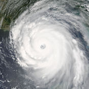
Hurricane & Typhoon Track gives you the most up to the minute and reliable hurricane & Typhoon path,Tracking Map,coordinates data,Satellite Images, Computer Models,Warning Information and high resolution Satellite maps with data provided by 22,000+ trusted or official weather stations all over the world. This app also contains a hurricane survival guide, detailing how to prepare for before, during and after the storm.and The emergency shelter locator provides you with a effective way of getting help if you find yourself in a really bad situation. Get the most recent maps and forecast details about active storms.
Hurricane Track & Outllok Pro alternatives
Earthquake+ | Alert,Map & Info
Custom Alerts and Custom Filter are now available FREE of charge More than 50,000 active monthly users Over 5,000,000 push notifications each month 750,000 downloads. Thanks a lot # THE BEST Earthquake App in the App Store # Reached TOP 10 in Weather Category in More Than 80 countries # FREE push notifications for multiple locations Why is our app better than other apps?# We keep improving Earthquake+ all the time, so you get more and more features. If you want to look at the strongest or the closest earthquakes for the past week - you can easily do it # You can look at seismic activity history by changing Period End Date in Custom Filter section. Download Earthquake+ now
-
size 88.8 MB
NOAA Now
NOAA Now provides the latest information from the National Oceanic and Atmospheric Administration including: hurricanes and tropical storms in the Atlantic, Pacific and Indian oceans; mainland storms, including the latest tornado and severe thunderstorm alerts; worldwide animated satellite views; the latest marine conditions from the National Data Buoy Center; the ultraviolet index. All data is courtesy of NOAA, NASA and other sources where indicated. Continued use of GPS running in the background can dramatically decrease battery life.
-
size 21.3 MB
MyWorldWeather
MyWorldWeather is a mobile version of the WWIS developed for iOS platform. It is equipped with location-based technology to detect the location where the user is located and to provide users with official city weather forecast automatically. By March 2017, WWIS provided official weather information for 2123 cities in which 1997 cities are available with forecast from 135 members while 1961 cities are available with climatological information from 169 members.
-
size 24.8 MB
My Hurricane Tracker - Tornado & Hurricane Warning
My Hurricane Tracker gives you the most comprehensive tools for tracking tornados, cyclones, tropical storms and weather warnings available. In a beautiful interface, you wont be overwhelmed with cluttered screens like you might with other apps. It is similar to apps such as Hurricane Tracker, Hurricane Pro and Storm by Weather Underground.
-
rating 4.69638
-
size 35.2 MB


