-
Category Travel
-
Size 211 MB
GyPSy Guide GPS driving tour of the famous Going to the Sun Road is an excellent way to enjoy a sightseeing trip in Glacier National Park. There are 100+ audio points that play automatically, featuring what to see, stories, tips and advice. None of our apps include paid advertising or placements for benefit.
Going to the Sun Road GyPSy alternatives
Canadian Mountain Parks Companion
Welcome to the Canadian Rockies. Allow us to present to you the mountains, lakes, and points of interest that surround you while youre in Canadas Rocky Mountain National Parks. Dave is also the author of two books on the Canadian Rockies and www.peakfinder.com.
-
size 63.6 MB
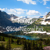
Hiking Glacier National Park
For those who love the great outdoors and want to explore the amazing Glacier National Park, this application is for you. It provides easy-to-use day hike information for more than 70 hikes in the park. This is not a GPS app.
-
size 45.2 MB
Olympic by Chimani
Chimani helps you plan, navigate, discover and socialize on your next national park adventure. * collect points and earn badges for visiting parks and points of interest* expert-written details on more than 260 unique points of interest (POIs)* auto touring guide* GPS-enabled map that works without a cell/wifi connection and downloadable for offline use* calendar of Ranger-led events * sunrise/sunsets times and top viewing locations* photo gallery stocked with high-quality park images* descriptions of more than 30 hiking trails* information on restrooms, picnicking, bicycling, and other in-park activities* Where Am I? Requires an initial Internet connection to download photos and offline map (either Wifi or cellular).
-
size 109 MB
Glacier by Chimani
Chimani helps you plan, navigate, discover and socialize on your next national park adventure. * collect points and earn badges for visiting parks and points of interest* expert-written details on more than 200 unique points of interest (POIs)* GPS-enabled map that works without a cell/wifi connection and downloadable for offline use* calendar of Ranger-led events * sunrise/sunsets times and top viewing locations* photo gallery stocked with high-quality park images* descriptions of more than 30 hiking trails* information on in-park transportation, restrooms, picnicking, bicycling, and other activities* Where Am I? Requires an initial Internet connection to download photos and offline map (either Wifi or cellular).
-
size 109 MB
Grand Teton by Chimani
Chimani helps you plan, navigate, discover and socialize on your next national park adventure. * Works without a cell/wifi connection (because there usually isnt one in the park )* Collect points and earn badges for visiting parks and points of interest* Expert-written details on more than 220 unique points of interest (POIs)* Auto touring guide* GPS-enabled map that works without a cell/wifi connection and downloadable for offline use* Calendar of Ranger-led events * Sunrise/sunsets times and top viewing locations* Photo gallery stocked with high-quality park images* Descriptions of more than 30 hiking trails* Information on museums, restrooms, picnicking, in-park transportation, bicycling, and other in-park activities* Where Am I? Requires an initial Internet connection to download photos and offline map (either Wifi or cellular).
-
size 109 MB


