-
Category Weather
-
Size 57.1 MB
Get your family and home ready for a flood. The American Red Cross Flood app is the complete solution you need to understand and prepare for flooding and all that comes with it. Let others know where you are with the Toolkits strobe light, flashlight and audible alert functions
Flood:American Red Cross alternatives
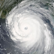
My Hurricane Tracker - Tornado & Hurricane Warning
My Hurricane Tracker gives you the most comprehensive tools for tracking tornados, cyclones, tropical storms and weather warnings available. In a beautiful interface, you wont be overwhelmed with cluttered screens like you might with other apps. It is similar to apps such as Hurricane Tracker, Hurricane Pro and Storm by Weather Underground.
-
rating 4.69638
-
size 35.2 MB
FloodWatch
FloodWatch allows users to monitor rivers and streams throughout the United States. Add USGS gages to your favorites for quick monitoring of current gauge height, precipitation, and flood stage. If your home or other interests have been flooded in the past or could be flooded in the future, FloodWatch allows you to easily keep an eye on any potential flooding issues.
-
size 32.3 MB
Forecast Now
Want to keep up with the latest local weather forecast? Forecast Now provides the latest detailed local weather forecast, animated radar and satellite views, weather warnings, air quality, and uv index for any town in the US, direct from the National Weather Service, NOAA, and the EPA. Continued use of GPS running in the background can dramatically decrease battery life.
-
rating 4.53629
-
size 21.1 MB
Earthquake Lite - Realtime Tracking App
As written in the NY Times. The free version of Computerworlds Favorite smartphone apps Track and follow earthquakes now around the world in real time * Live earthquake data delivered quickly to your phone * International data (USGS, EMSC, GeoNet, Natural Resources Canada, British Geological Survey, GFZ, INGV, KNMI, MNSS, OVSICORI, and GeoScience Australia)* Tsunami information* Sort list by Magnitude, Location, or Time* Full Google Map integration with detailed map view* Color & size coded pins to see at a glance relevant earthquakes* Integration within the map to the reporting agencies website* Report if you felt an earthquake directly on the USGS website* Email detailed screenshots of maps and vital details anytime to anyone* Real time Twitter and Facebook integration See Tweets related to the earthquake plus Tweet out your own news. [email protected]) Please check out our other apps, Dog Whistler & Dog Whistler Pro (consistently ranked in top 10), Mobile Caddy (previously chosen as a Staff Favorite), Hurricane Monitor, Air Quality, Thumper, Date Util, Polar Opposite, Earthquake (full version), and Free Metal Detector.
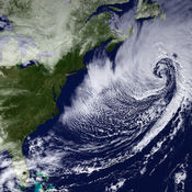
NOAA Now
NOAA Now provides the latest information from the National Oceanic and Atmospheric Administration including: hurricanes and tropical storms in the Atlantic, Pacific and Indian oceans; mainland storms, including the latest tornado and severe thunderstorm alerts; worldwide animated satellite views; the latest marine conditions from the National Data Buoy Center; the ultraviolet index. All data is courtesy of NOAA, NASA and other sources where indicated. Continued use of GPS running in the background can dramatically decrease battery life.
-
size 21.3 MB


