iPilot by AIR Avionics!
-
Category Navigation
-
Size 29.1 MB
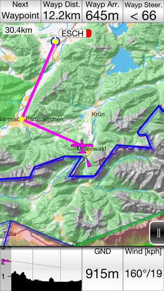
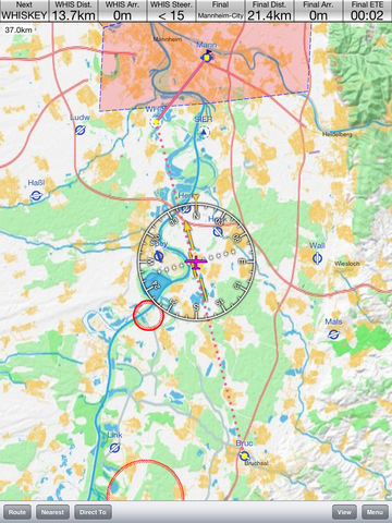
iPilot - the simple moving map softwareFeatures:- easy to understand and supereasy to use- detailed 3D-Terrain-Map- fast Direct-to navigation- easy in-flight route manipulation with dynamic waypoints, comprehensive route planning- reporting points with automatic insertion of selected reporting points into planned routes- sideview showing airspaces and terrain on track, airspace overview with vertical infos- traffic display and warning if Flarm device is connected- flight recording (IGC / XML / KML file format)- livetracking on different servers (e.g. livetrack24.com)- live METAR data (internet connection required)- DropBox integration for synchronisation of logfiles and user data- email logfiles- export the planned route as pdf file for printing- integration of AIP approach plates (currently Germany only)- many custom configuration settings possibleIMPORTANT: iPilot requires iOS 6 or newer. OLDER DEVICES ARE NOT SUPPORTED For more information on iPilot visit www.butterfly.aero/iPilotiPilot hardware is available at our store: www.butterfly.aero/store