iMariner Offshore!
-
Category Navigation
-
Size 310 MB
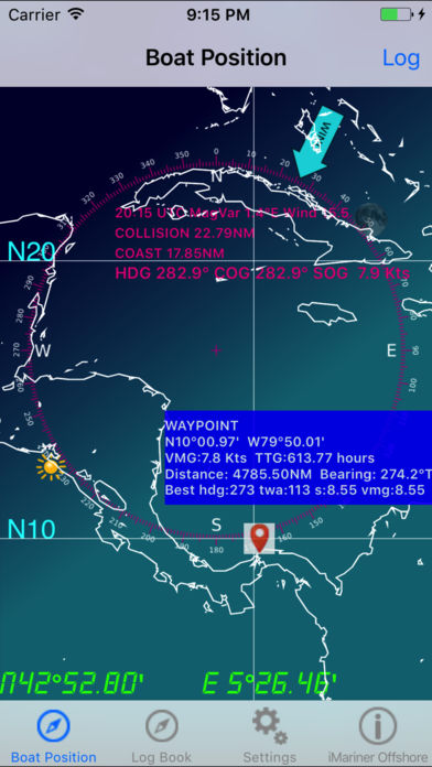
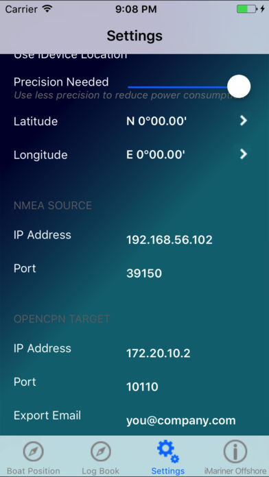
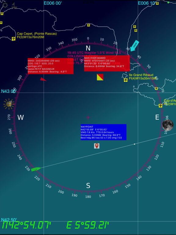
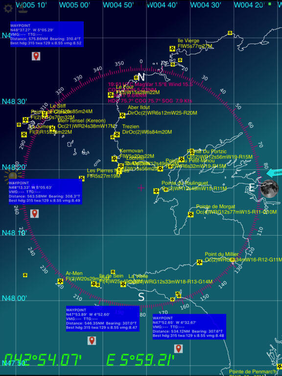
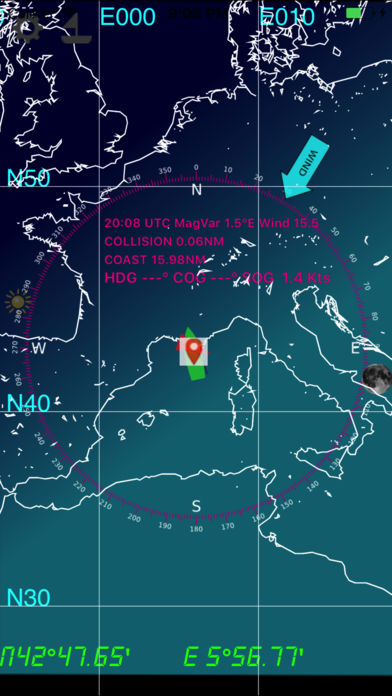
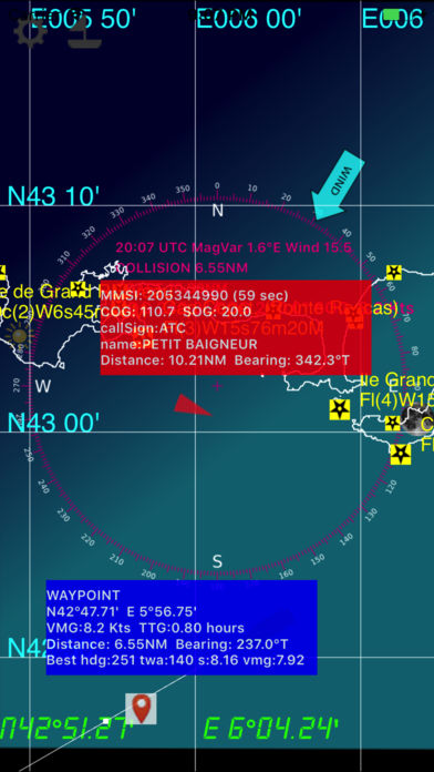
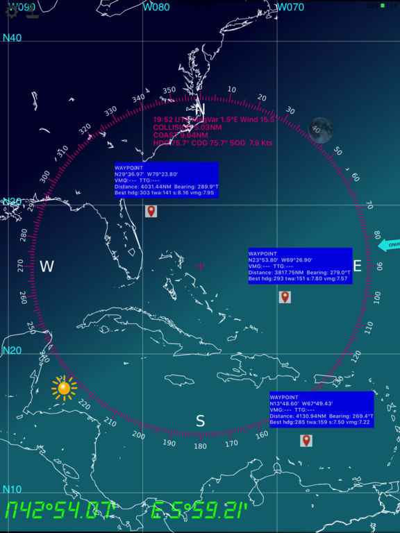
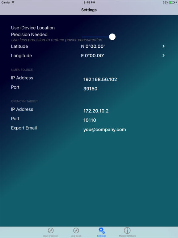
Prepare your navigation and your landings : includes GSHHS shore lines, major lighthouses, GPS, AIS, magnetic variation, position of Sun and Moon, logbook. Note : AIS display requires an AIS/Wifi gatewayAIS : AtoN, MOB, shipsWayPointsAlso embedded are the USCG database and NGA database of all marine lights around the world, that have a nominal range of 10 or more Nautical Miles. This application will be updated in a regular basis.All major ligthhouses (landing) that have a distance at least 15 NM for the following countries :Full world coverage. based on the NOAAs GSHHS Shoreline Database Version 2.2.0- world coverage from 75S to 75N (poles excluded)- zoom in and zoom out : automatically selects between the 5 GSHHS databases : full, high, intermediate, low, crude- mercator projection- Precise positioning of your boat and other vessels (NMEA GPS and AIS frames)- you need a NMEA Wifi connection (TCP or UDP) with a NMEA repeater like Digital Yachts iAIS- log book (date,time,latitude,longitude,COG,SOG,Heading,Log,Water Depth, TWA,TWS,Leeway,Stream Set, Stream Drift and your comments- log book organized in passages- log book export via email (csv format)- NMEA protocol debug window- magnetic variation computed with the algorithms from the NOAAs World Magnetic Model- distance to coast- distance to others vessels- goto boat function- double tap for full screen display- integrated solar compass : the rose displays the sun and moon positions in real time