Topography!
-
Category Navigation
-
Size 17.2 MB
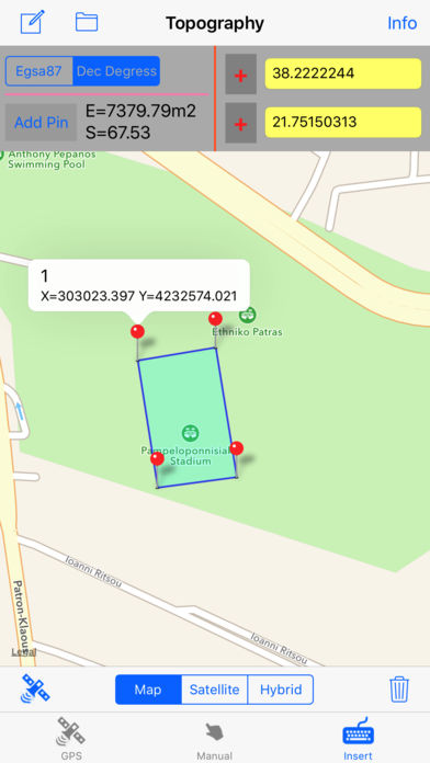
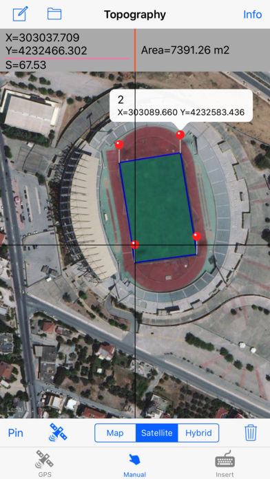
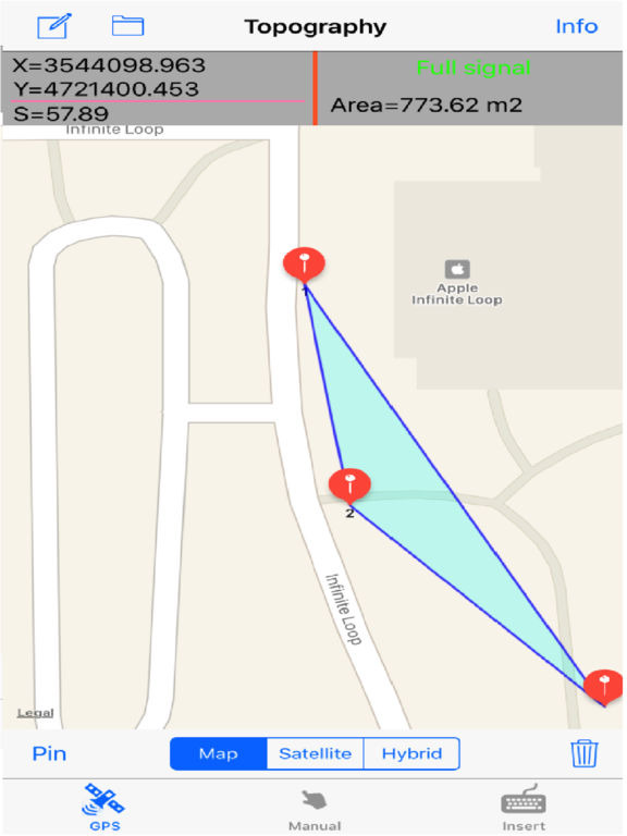
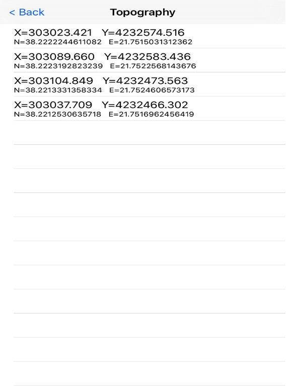
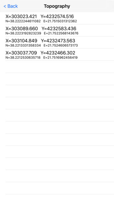
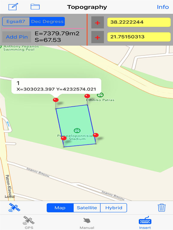
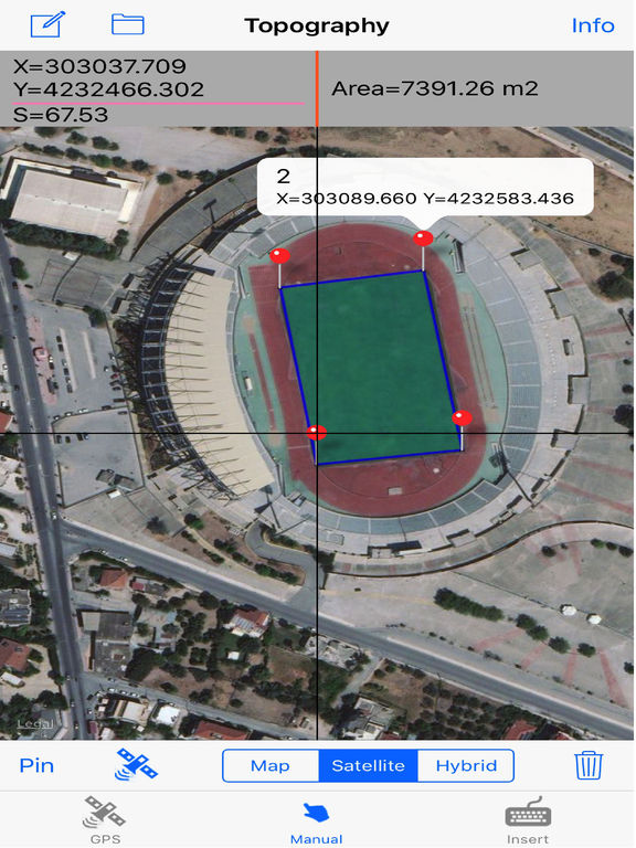
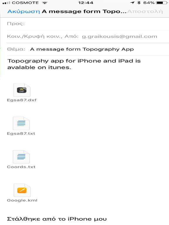
The application is very useful to Civil Engineers, Architects, Surveyors, and those interested in measuring a surface area or converting its coordinates to UTM EGSA87. This tool enables users to:1. Users may also have their final measurements by entering the coordinates either in EGSA87 Datum or Latitude and Longitude in decimal degrees.