Sky-Map!
-
Category Navigation
-
Size 74.4 MB
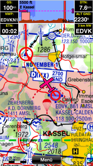
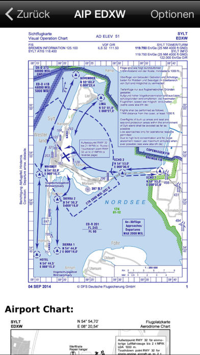
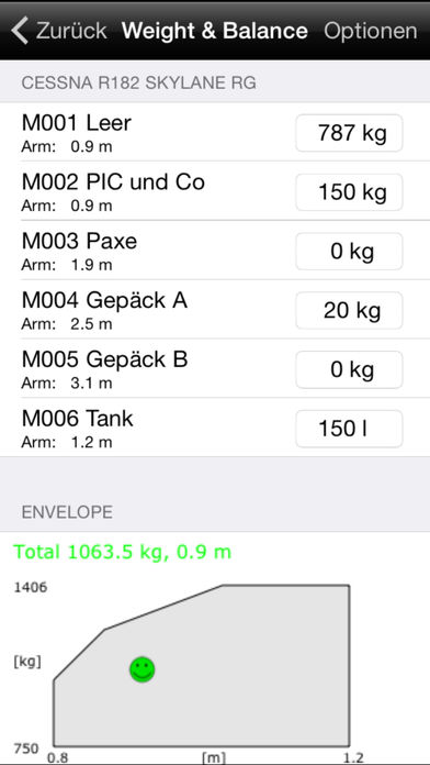
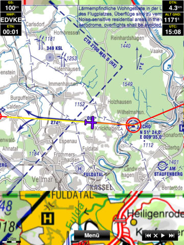
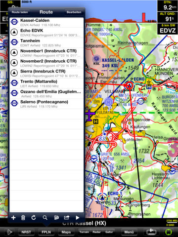
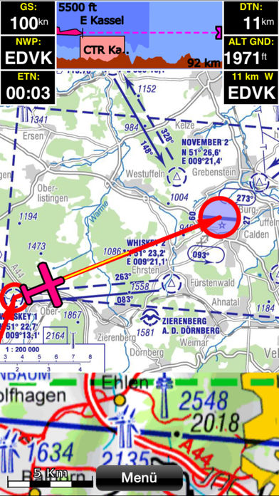
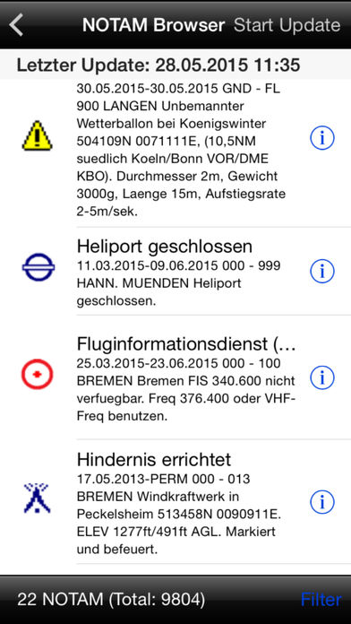
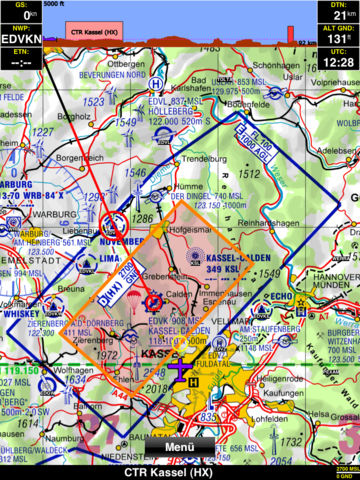
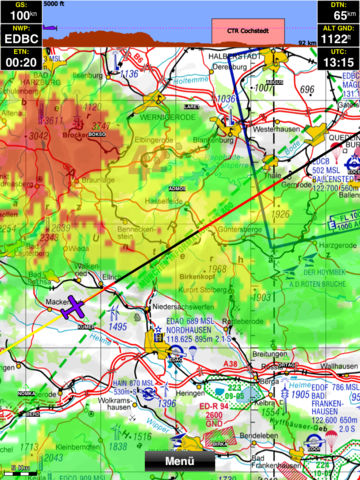
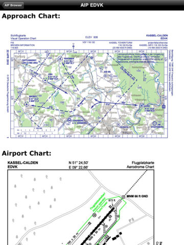
Sky-Map is a Moving Map navigation and flight planning system. Like the Sky-Map Versions for other platforms it contains the following functionality:- Moving Map: Displays the actual position on digital aviation charts, like ICAO chart from DFS (Maps not included)- Fast move and zoom of the map- Flightplanning: Flights can be planned direct on the map or using the waypoint database.- Routes can be saved, loaded or modified- Calculation of distances, flighttimes, wind influence, fuelconsumption - Automatic display of approach/airport charts (if AIP is installed)- Airspace warnings- Terrain overlay and altitude warning- Direct to function- Nearest Airports function- AIP Browser: displays of approach/airport charts as well as text information (if AIP is installed)- PCMet Browser: Quick access to weather information (additional costs for pc_met access apply)- Displays precipitation radar and GAFOR directly on the map (additional costs for pc_met access apply)- Logbook function: automatic logging of Starttime/Position, Landingtime/Position und Flighttime- Checklist function- Infopanels (configurable) for Speed, Altitude, Distance, Time aso- Logbook and track recording in Background when in motion Please note: Continued use of GPS running in the background can dramatically decrease battery lifeThe software contains an worldwide basemap (not for navigation), additional charts from the Flight Planner/Sky-Map selection have to be installed.