Photographer's Ephemeris 3D!
-
Category Photo & Video
-
Rating 4.22222
-
Size 74.9 MB
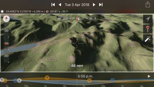
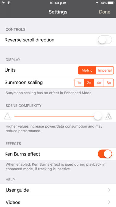
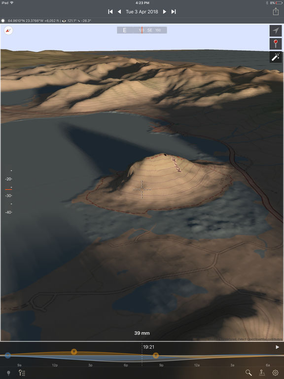
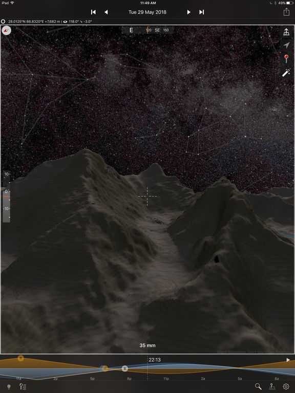
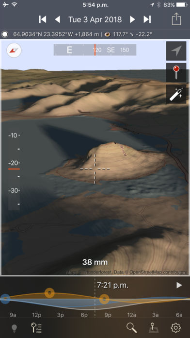
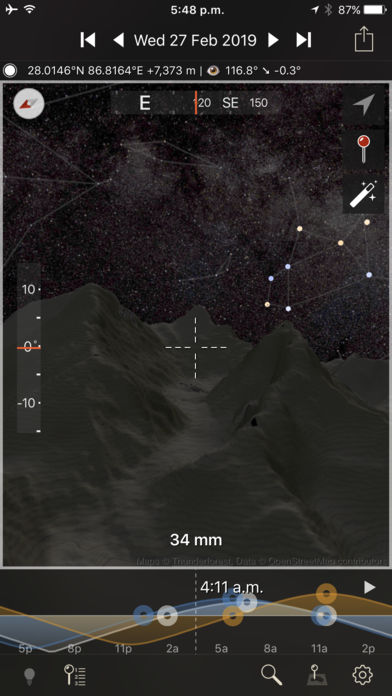
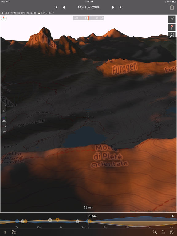
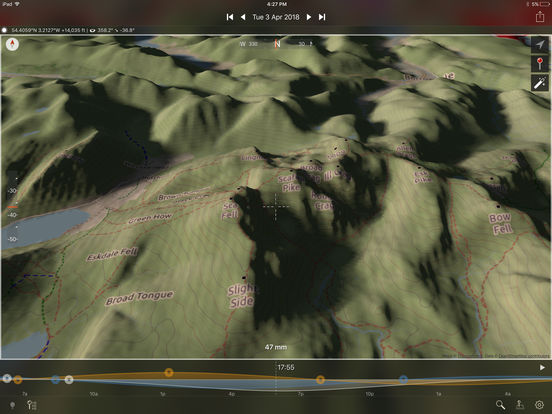
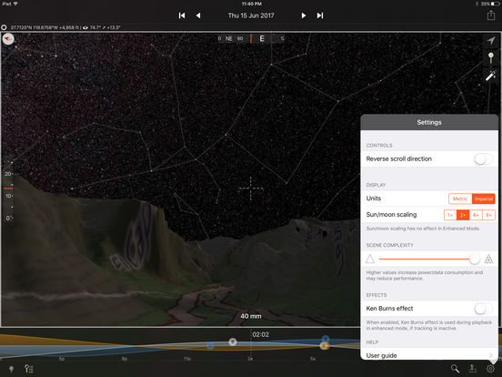
3D Sun, Moon and Night Photography Planning For Outdoor Photographers. The Photographers Ephemeris 3D (TPE 3D) is a unique natural light visualization tool for outdoor and landscape photographers shooting in varied terrain. Key features includes:- 3D topographic maps with simple navigation options- Sun, moon and galactic centre continuous timeline showing key rise, set and transit events- Full search capability to find your location (or enter decimal or DMS coordinates directly)- Automated playback to watch a realtime or faster-than-realtime simulation of the light- Flying mode for quick movement around a scene- Enhanced mode for maximum topography and shadow detail- Symbolic represetation of the Milky Way in Flying mode- High resolution Milky Way and stars in Enhanced mode- Direct elevation control for the 3D model camera- Camera pitch and bearing indicators- Moon phases are rendered accurately in the 3D scene- Zoom in/out to equivalent 35mm focal length in enhanced mode- Daily and annual events lists- Shared location database with TPE- Navigation and Artificial Highlights lighting modes- Support for multiple map pins- User settings for controlling scene complexityIf you like to plan your natural light photography to capture the photo opportunities others miss, TPE 3D is a must-have tool Note:- This app is CPU and graphics intensive: modern device models provide the best user experience and highest resolution data- Not recommended for users who only shoot in flat terrain- Satellite maps are not included- Building are not shown in 3D- Max elevation data resolution is 1 arcsecond (approximately 30m/33yards)- Requires an internet connection- Does not currently provide simulation of lighting during solar and lunar eclipses- Topographic data is available only between 83N and 83S: data may contain artifacts and errors- Availability of map types is subject to change, due to 3rd party map service availability, terms or conditions