Photo Planning Tools!
-
Category Photo & Video
-
Size 133 MB
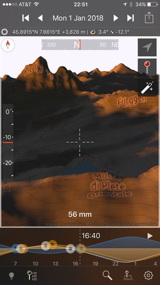
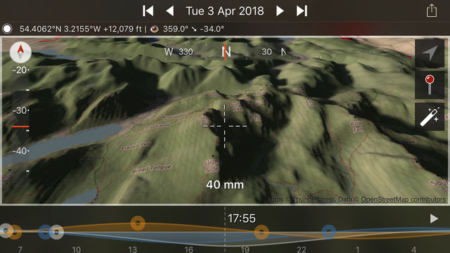
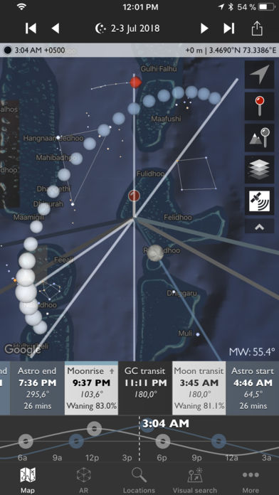
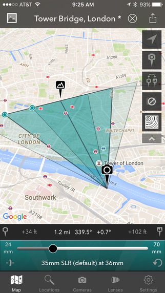
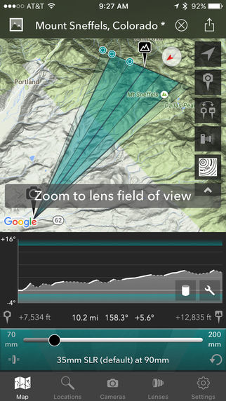
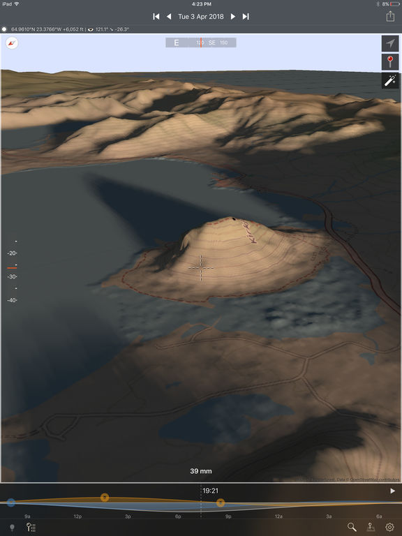
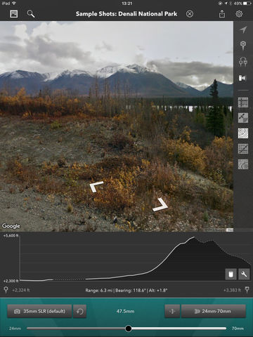
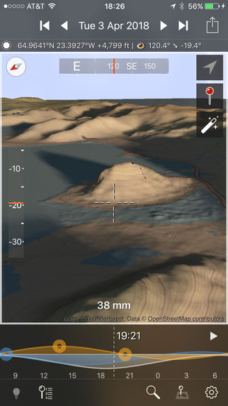
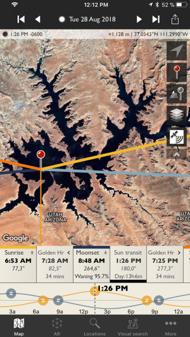
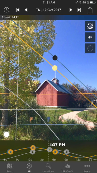
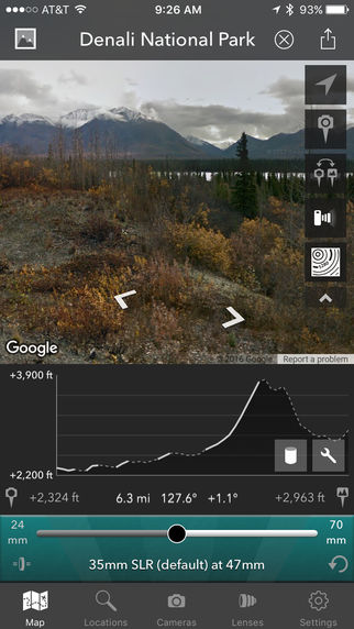
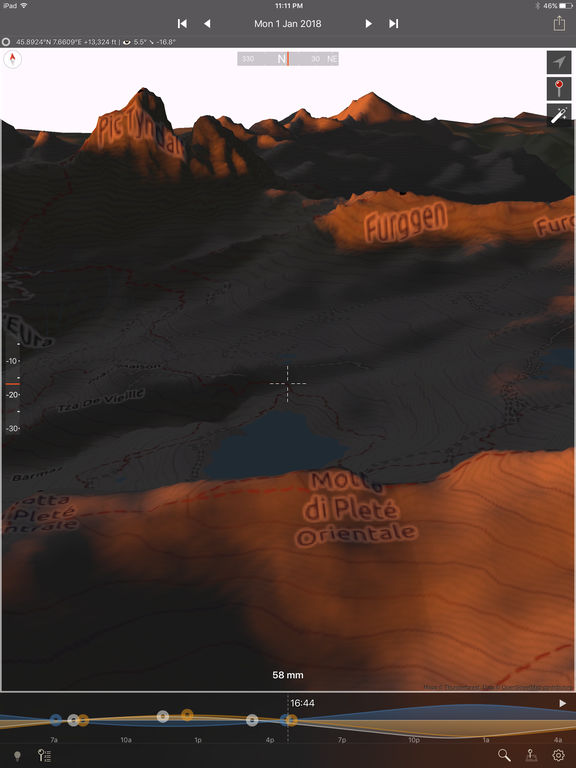
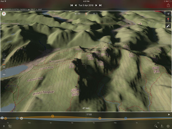
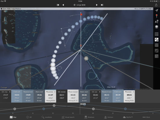
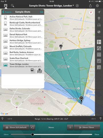
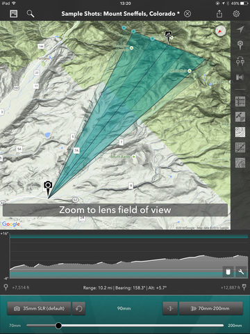
Three outstanding planning tools for outdoor and landscape photographers: The Photographers Ephemeris 3D, The Photographers Ephemeris and The Photographers Transit. See how the light will fall on the land with TPE 3D and TPE: plan your sun, moon and star shots in locations around the world. Available map types for both TPE and TPT include: - Standard, Satellite Hybrid and Terrain - OpenStreetMap and OpenCycleMap Topographic (available offline)TPE 3D uses Open Cycle Map topographic mapsNote: - Please see individual app description for notes on TPE 3D- Photo Transit app is designed for photographers using interchangeable lens cameras (e.g. SLR, Micro 4/3rds, Medium/Large format film)- Maps and elevation-based calculations require a data connection unless an offline data source is used- Topographic map data is available only between 60N and 47S- In TPT Elevation data is subject to daily usage limits per IP address- Availability of specific map types is dependent on 3rd party service availability, terms and conditions, and is subject to change
* Support http://photoephemeris.com/support/
* Tutorials http://photoephemeris.com/tutorials/
* Download http://photoephemeris.com/buy-download
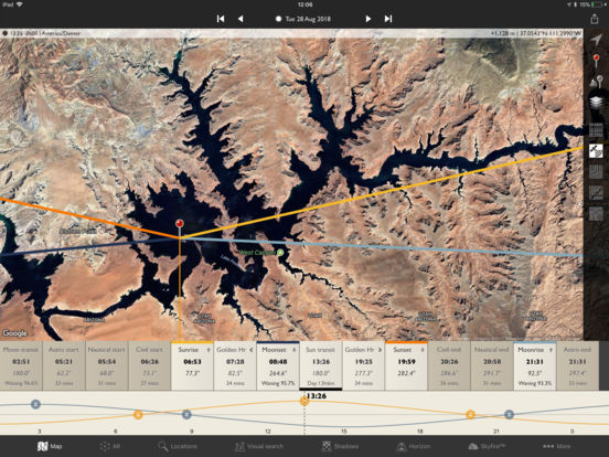
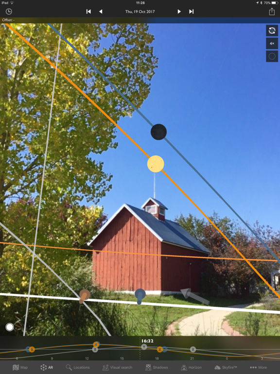
* Welcome! The Photographer's Ephemeris® (TPE is a tool to help you plan outdoor photography in natural light, especially landscape and urban scenes. It is a map-centric sun and moon calculator: see how the light will fall on the land, day or night, for any location on earth.