OkMap Mobile, an off road GPS navigator for your sport activities!
-
Category Navigation
-
Size 96.4 MB
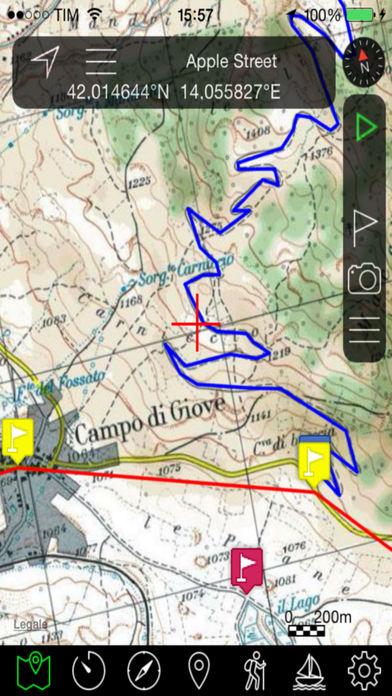
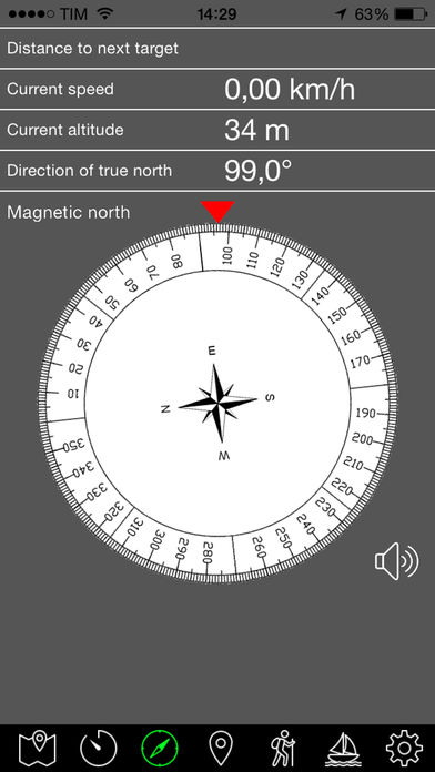
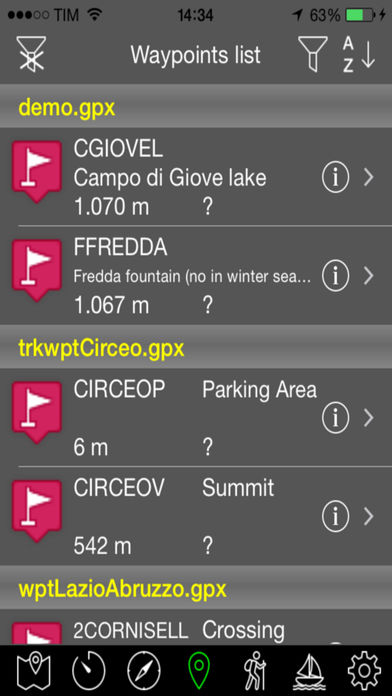
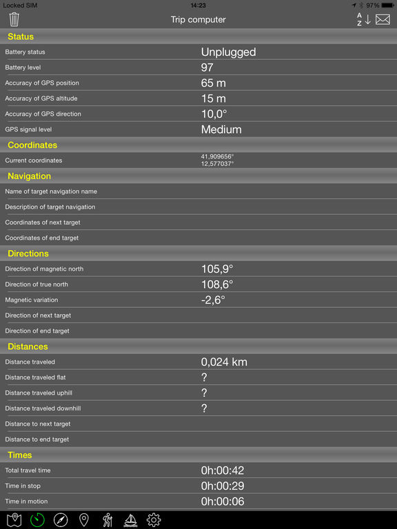
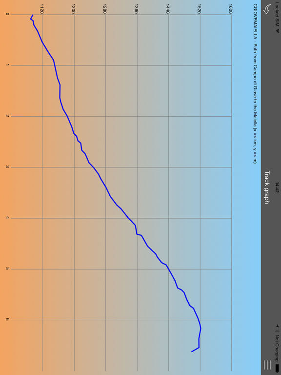
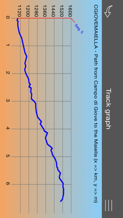
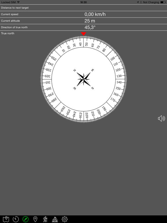
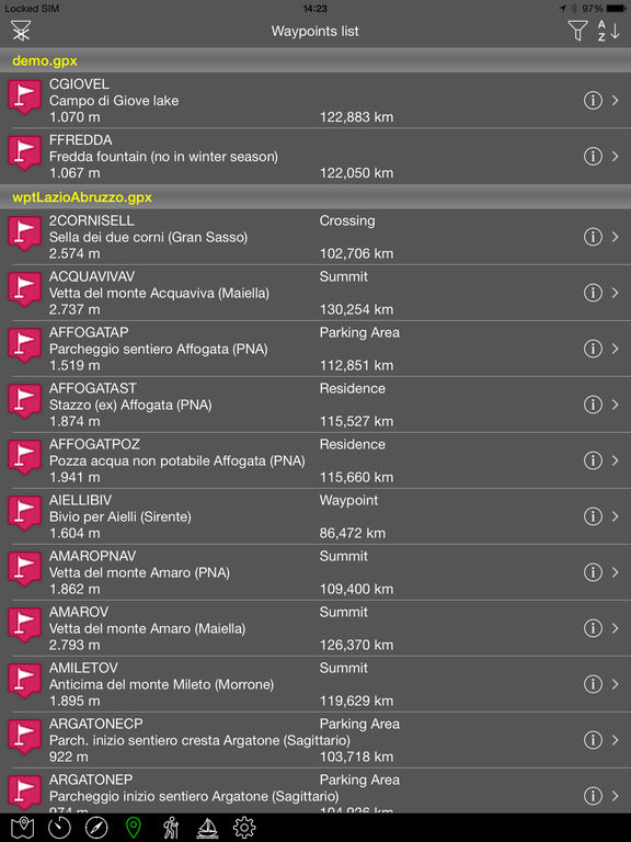
OkMap Mobile is easy to use and its capabilities are similar to those of the best known handhelds GPS.Draw your path on the map OkMap will calculate for you the altitude differences and travel times producing also statistics and graphs. A compass will show you the direction to follow along the path. FEATURES Maps- Offline custom map in KMZ format- Online map from various TMS and WMS web servers (Apple, OpenStreetMap, Nokia, ESRI, ecc)- Adding new web services- Tiles caching- From 0 to 4 customizable navigation and status indicators (among about 60)- Coordinates in different datum and in UTM, GeoRef, USNG, BNG, IG format- Mode: 3D map, follow user, distance computing- Find: waypoint, track, route, address, coordinates, geocaches- Zoom on: GPX data, copied coordinates- Reverse geocoding- Create tracks with autorouting- Create and modify waypoints, tracks and routes on the map- Download and manage altrimetric data (DEM) from SRTM project Navigation- Start, pause and stop recording of current track- Save waypoint in current position (with photo also) - Go to a waypoint and navigation along a track or route- Trip computer with about 60 navigation and status indicators- Reset and send values via email- Proximity waypoint feature- Anchor alarm- Send position to OkMap remote server Compass- 4 customizable navigation and status indicators (among about 60)- Graphic compass with north and target direction- True or magnetic compass- Vocal syntethizer when you are pointing your deviceAugmented reality- Augmented reality to show your waypoints - Manual aligment of waypoints dragging on the screen - Set the view ray (minimum and maximum)- Take high resolution pictures with superimposed information - Waypoints search featureWaypoints- List of waypoints- Modify and delete functions- Sort and filters features- Waypoint detailsTracks- List of tracks and track points - Modify and delete functions- Sort and filters features- Track details- Track graphs- Track statistics- Invert track- Estimate travel time featureRoutes- List of routes and route waypoints- Modify and delete functions- Sort and filters features- Route details- Invert routeUtilities- List GPX files- Send GPX files by email- List custom maps files (KMZ)- Download and upload your GPX and KMZ file from/to iCloud drive- Archive current GPX file- Send my position via email- Customizable preferences- Delete cache and restore factory settings- Information and links