NavLink US!
-
Category Navigation
-
Size 40.1 MB
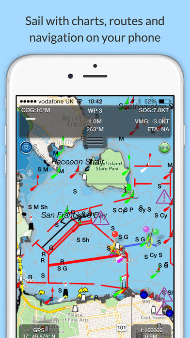
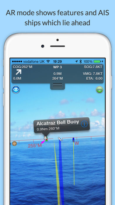
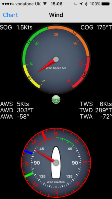
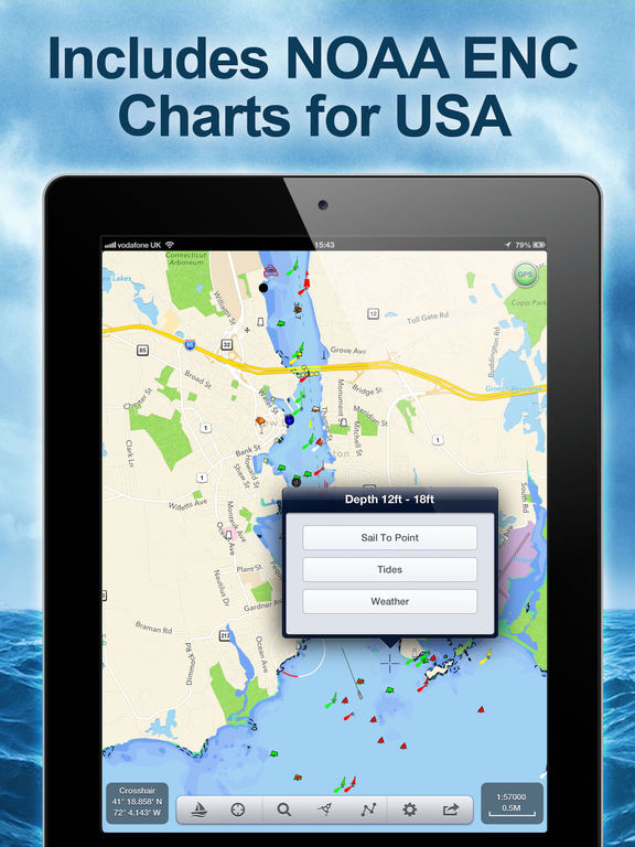
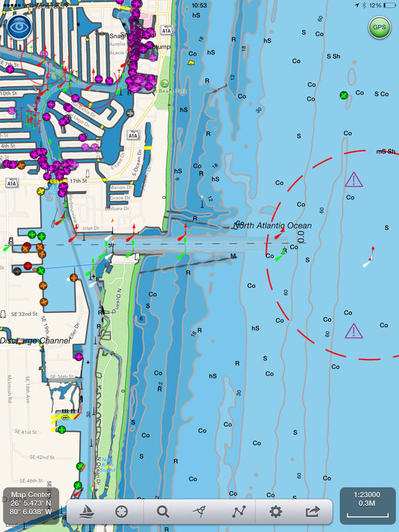
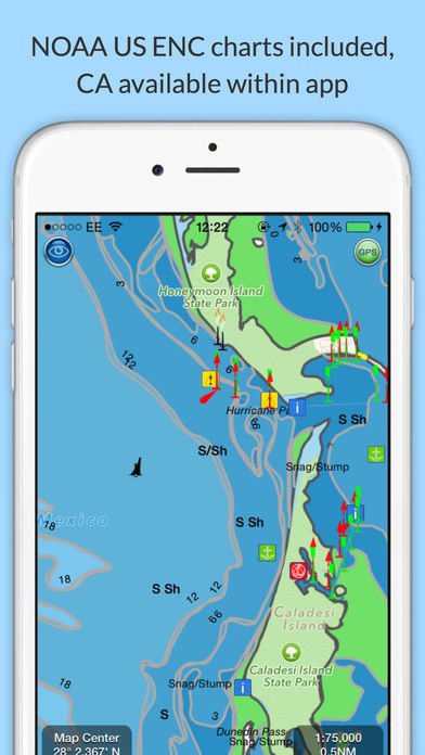
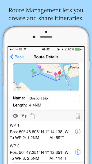
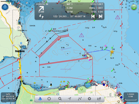
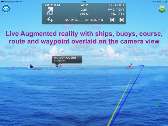
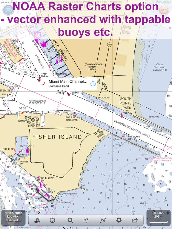
Marine Navigation App that turns your Apple Device in to a full function chart plotter. Features include: Realtime GPS position plotted on Marine charts derived from NOAA data (Vector (ENC) and Raster (RNC)) AIS overlay when connected to compatible wireless AIS system Waypoints and routes with full route editing and planning function Position, COG, SOG, VMG, bearing, distance and ETA displays Configurable chart layers HorizonView overlays navaid and targets onto iPad/Phone camera display Automatic free chart updates included for 1 year Weather buoy data A-B chart ruler for quick and easy bearing and distance measurement All NOAA US charts are included in the price Optional in-app purchase of CA chartsAIS FunctionalityWhen connected to an AIS system via a wireless NMEA link, NavLink will provide a real time overlay of AIS targets and CPA and TCPA alarms. Third Party Licenses and NoticesNOTICE: US Marine Charts are derived from official NOAA Electronic Navigational Charts.