NavLink UK!
-
Category Navigation
-
Size 40.2 MB
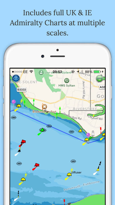
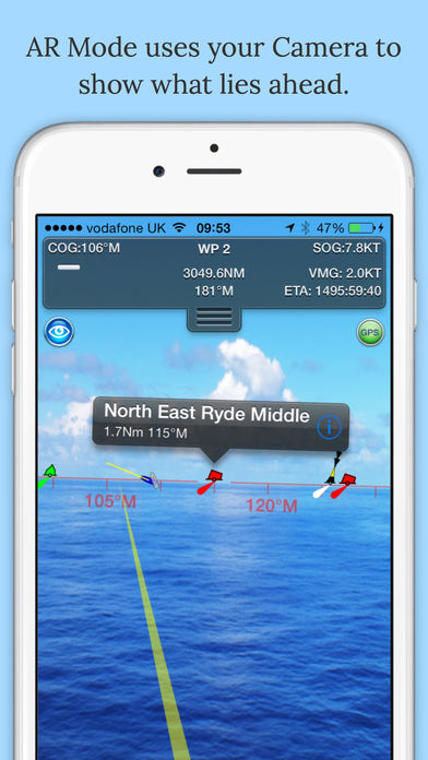
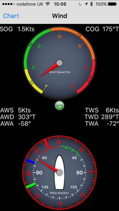
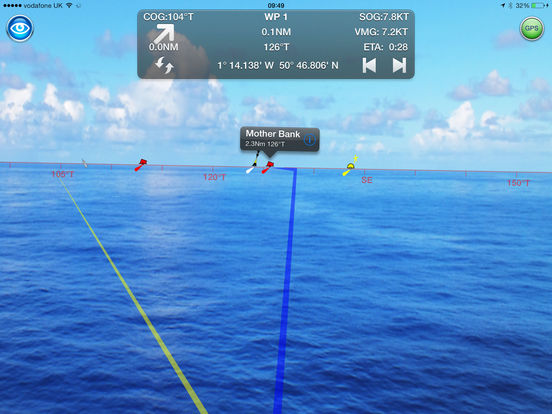
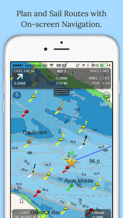
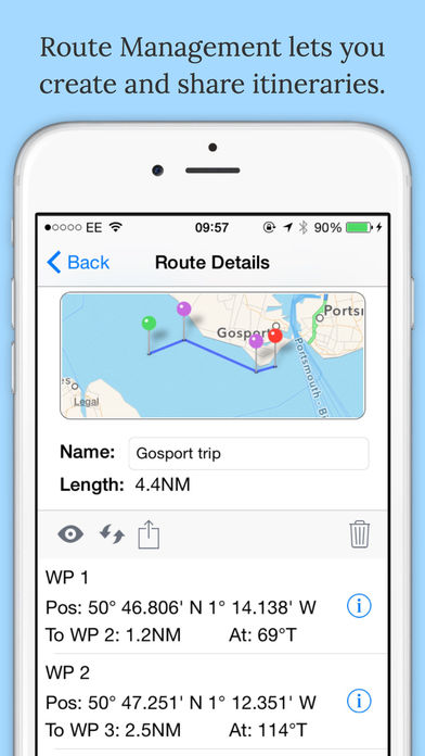
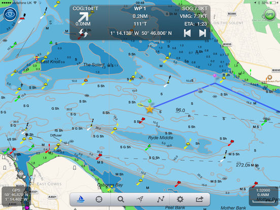
Marine Navigation App that turns your Apple Device in to a full function chart plotter. Features include; Realtime GPS position plotted on Marine charts derived from UKHO data AIS overlay when connected to compatible wireless AIS system Waypoints and routes with full route editing and planning function Position, COG, SOG, VMG, bearing, distance and ETA displays Configurable chart layers HorizonView overlays navaid and targets onto iPad/Phone camera display Automatic free chart updates included for 1 year Weather buoy data A-B chart ruler for quick and easy bearing and distance measurement All UK & Ireland charts are included in the price Optional in-app purchase of French, Benelux and German chartsAIS FunctionalityWhen connected to an AIS system via a wireless NMEA link, NavLink will provide a real time overlay of AIS targets and CPA and TCPA alarmsHorizonViewOverlay chart and AIS objects on the iPhone or iPad camera image to create an augmented HorizonView display, that makes Nav-Aid and vessel identification simple and reliablePlan and sail routesInstant route and waypoint creation by tapping on screen. Our Privacy Policy may be accessed via http://seanav.net/digitalyacht/privacy.php