Michigan Lakes Fishing Charts!
-
Category Navigation
-
Size 24.7 MB
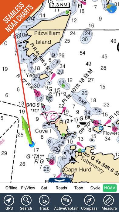
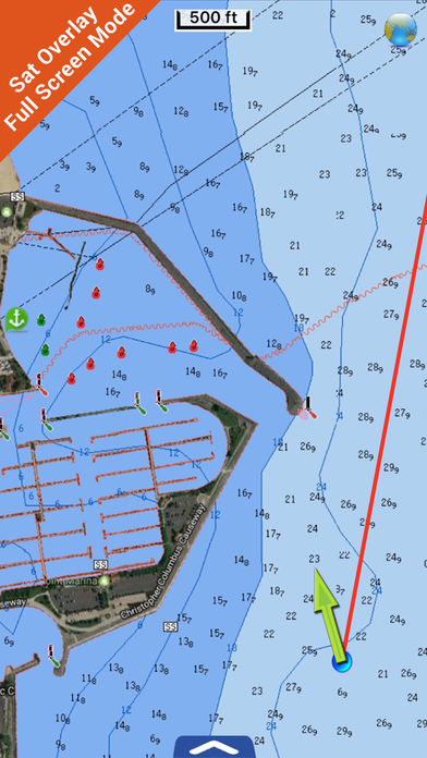
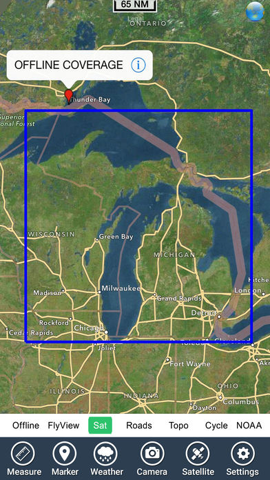
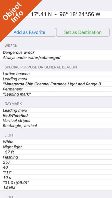
Flytomap is a valid and interesting alternative, Benetti YachtsTop Ten since 2008Featured in : On the Deck Michigan Lakes - The whole coverage resident in the app. It works WITHOUT mobile coverage Worldwide Marine,Lakes and Outdoor Maps available, thanks to viewer.flytomap.com Worldwide Satellite images overlay on charts Worldwide Terrain features overlay on charts, thanks to Open Street Map, Open Cycle Map, Bing,Earth,Topo Chart and GMap Local Weather forecastNow with NOAA,USGS,DRG,Topo raster charts seamless with continuous updates from the official Government serverNow with ActiveCaptain - Worldwide boaters and fishermen community, with * 200.000 + Captains Use to Explore: Latitudes and Longitudes to go to your favorite places Search your Favorite points directly Zoom, Rotate and Pan fast just by a finger touch Quick Object information just tapping, thanks to vector technology GPS Heading Vector Towards the direction movement Distance Measurement Tool to easily calculate the distance from one location to another Route planning, Waypoints - Insert the target/destination and see in real time your Speed, Distance, COG, Bearing and ETA. Thank you for the feedback Continued use of GPS running in the background can dramatically decrease battery life.