Map Plus OE!
-
Category Utilities
-
Size 56.5 MB
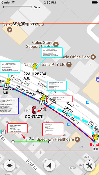
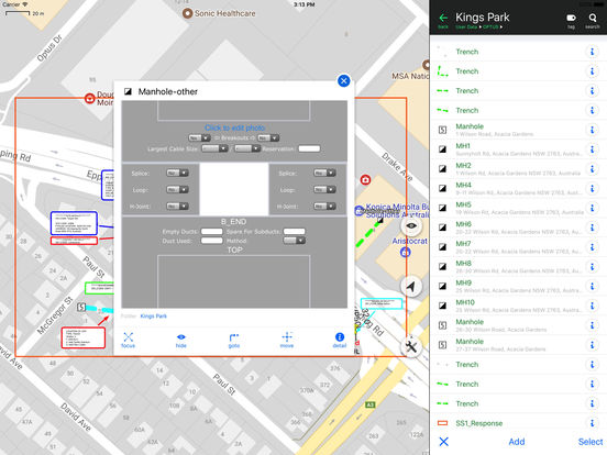
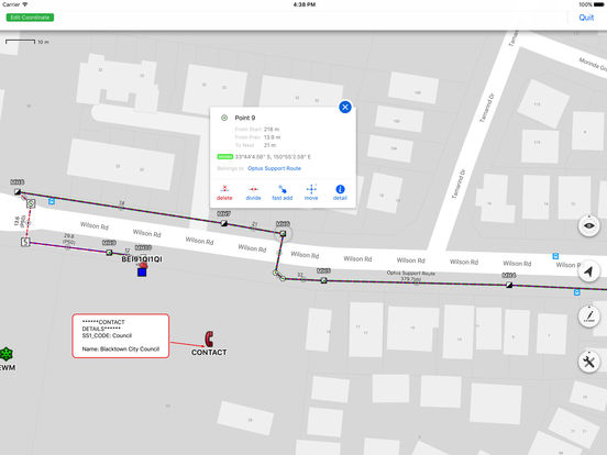
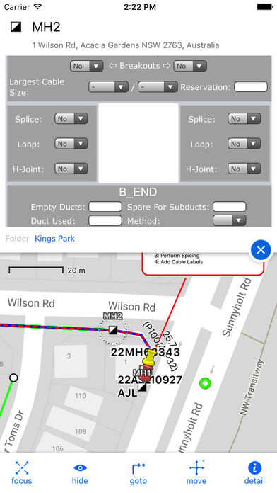
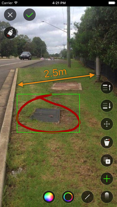
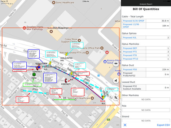
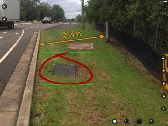
Map Plus OE is the Optus Customized Edition of the public map app of Map Plus, with extra enhancements and functions designed for Optuss special network business, aims to provide a iOS solution for their GIS data viewing, creating, editing, managing for Optus and users working with them. Those enhancements would be partly listed bellow, and more details about the base functions inherited from the Map Plus app, please refer to http://www.duweis.com/en/mapplus.html.Enhancements in OMPAuto Link helps user to fast create lines between special business points, for example create cables between splices, trenches between manholes, etc.Smart Divide helps to fast break a line into two parts with a point feature inserted at the break point of specified feature class. There are many other enhancements and customizations which is required by Optus but not been listed here.Please be aware:While doing GPS track recording or enabled Arrival Notification feature, GPS hardware would continue running in the background until you manually stop those features, and the continued use of GPS in background would dramatically decrease battery life.