METAR new!
-
Category Travel
-
Size 0.3 MB
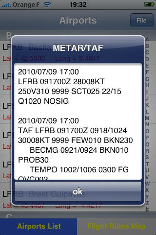
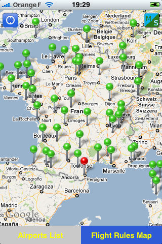
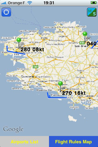
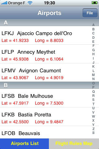
Metar application gives METAR and TAF information of more than 2000 airports all over the earth, it also computes the Flight rules near the airports. Airports information can be downloaded from the nelix-dev site :- http://www.nelix-dev.com/airport/xx.txt, xx stand for the country tag : alaska.txt = the US Alaska state as.txt = Austria and Swizerland au.txt = Australia bnl.txt = Benelux (Belgium, Netherlands, Luxemburg) cae.txt = the east of Canada caw.txt = the west of Canada es.txt = Spain fr.txt = France gd.txt = Germany, Denmark uk.txt = United Kingdom and Ireland use.txt = the east coast of USA usce.txt = the center east of USA uscw.txt = the center west of USA usw.txt = the west of USAThis application uses the available METAR information to compute the Flight rules :- VFR : Visual Flight Rules if ceiling is above 3000 feet and visibility better than 8 kilometers.- mVFR : marginal VFR- IFR : Instruments Flight Rules- I IFR : Intensive IFR- VI IFR : Very Intensive IFR- no Flight : very bad flight conditions- no Status : when METAR information is not available. The application keeps last METAR and TAF information on the internal memory.