FSAV - Flight Situational Awareness Viewer!
-
Category Weather
-
Size 9.5 MB
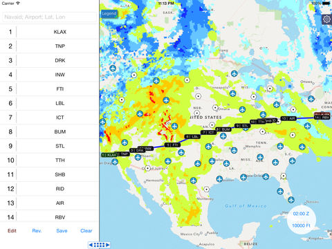
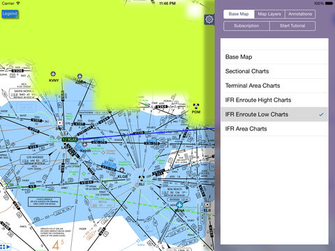
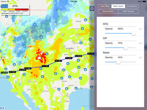
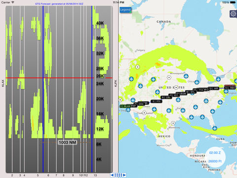
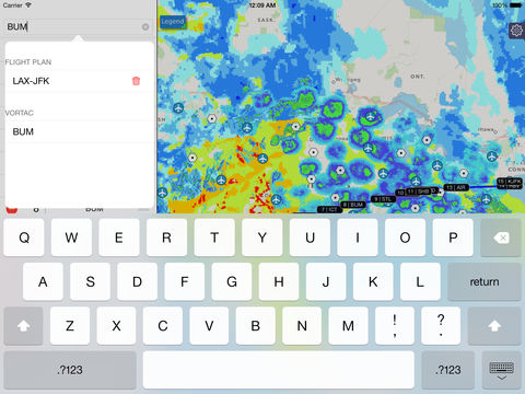
FSAV provides better situational awareness for flight planning by providing weather products such as turbulence, icing, and radar reflectivity along with aeronautical charts and navaids. Features:- Flight path planning tool Plot flight path via map and/or text input Manipulation of the flight path for adaptability Save and load favorite flight path- Viewable aeronautical charts: Sectional charts Terminal area charts IFR enroute high and low charts IFR area charts- Selectable navigational aid: airports, VOR, VOR-DME, VORTAC- Unique vertical cross section views depicting a weather product along a plotted flight path - Traditional top down view of weather products- Weather products * Includes Graphical Turbulence Guidance (GTG) forecast Includes Current Icing Product - severity (CIP) / Forecast Icing Product - severity (FIP) Includes NEXRAD base reflectivity Up to 8 hrs of forecast with 1 hr increments With 2 hrs of historical data Altitude slices of 1000 ft increments from 1,000 ft and up to 44,000 ft in elevation * Coverage is only available for the Continental United States only Only available for current time Availability depends on subscription Optional Non-Renewing In-App Subscriptions - 1 month of GTG and CIP/FIP forecast/nowcast data - 1 year of GTG and CIP/FIP forecast/nowcast data Subscriptions are managed through the in app settings panel. You use all the information at your own risk.