EarthObserver!
-
Category Education
-
Size 6.9 MB
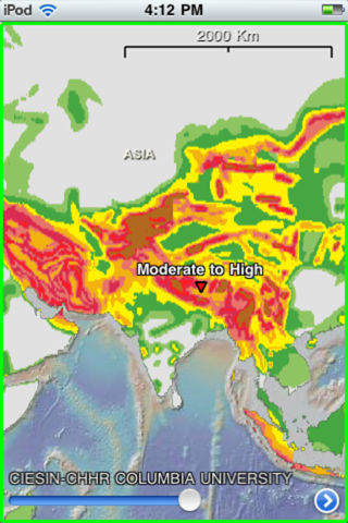
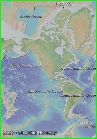
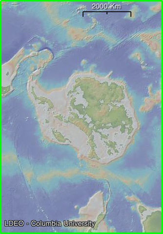
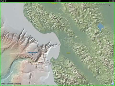
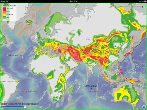
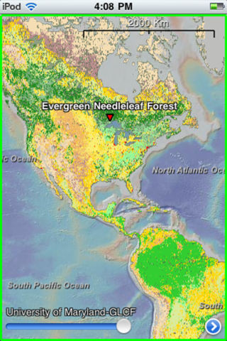
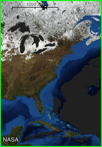
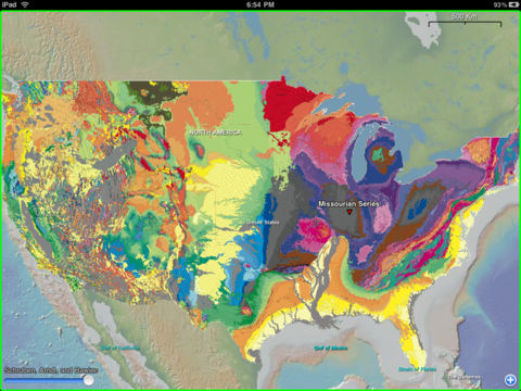
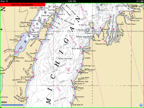
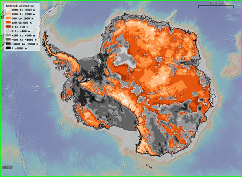
Explore your planet as never before with the mobility of EarthObserver. Use your fingertips to travel through terrestrial landscapes and across the ocean floor. Features:- World, North Polar, and South Polar views- Zoomable interface from global scale to street and harbor scale- Maps draped over topography with adjustable transparency- Tap any map for its digital or text values- The elevation anywhere - right at your finger tip- Geographic names for land and ocean features- Further educational content including data sources and suggested readings- Data streamed to your device via Wi-Fi or 3G network- Content cached locally after delivery so you can view it offline- Instructions and Frequently Asked QuestionsContent:- Basemap (computer-generated color-shaded relief of land and ocean floor)- US Coastal Bathymetry (with color palette appropriate to provide details of bays, sounds, estuaries, harbors and rivers)- US Nautical Charts (paper raster and digital electronic at all scales for Atlantic, Pacific, Gulf of Mexico, Bering Sea, Arctic and Great Lakes)- US Topographic Sheets (entire USGS collection for US mainland, Alaska, Hawaii and Puerto Rico)- Geologic Maps (entire world, by continent, by country and by US state showing formation ages, names and rock types)- Geophysical Maps (global earthquakes, tectonic plates and boundaries, gravity anomalies, geoid height, magnetic anomalies and the configuration of world stress)- Land Surface (temperatures day and night, primary productivity, vegetation index, land cover classifications and diversity, forest cover types and fragmentation)- NASA Visible Earth (global earth scenes for each month)- Ocean Floor (crustal age, sediment types, sediment thickness, seabed heatflow, seafloor true color, seafloor spreading rates, manganese nodules)- Ocean Surface (temperature, salinity, primary productivity, temperature during prior ice age)- Human Impact (area per person, human footprint index, population density (2010), infant mortality rate, underweight children)- Hydrology (river drainage basin outlines, drainage networks, river flow accumulation)- Natural Hazards (cyclones, drought, earthquakes, floods, landslides, tornadoes, volcanic eruptions)- Atmosphere and Clouds (aerosols, carbon monoxide, cloud fraction, cloud optical thickness, cloud particle radius, cloud reflectance, cloud water content, radiation, solar insolation)- Snow, Ice and Water (ice cover, permafrost cover, snow cover, snow-water equivalent, water leaving radiance, water vapor)- Shorelines and Political Boundaries (countries, provinces, states, maritime)Developed by Lamont-Doherty Earth Observatory (Columbia University)Columbia University continually seeks to advance the frontiers of knowledge and address the complex global issues of our time.