-
Category Navigation
-
Rating 4.18421
-
Size 119 MB
* View over 70,000 USGS and Canadian topographical maps on your iPhone or iPod touch. * Ideal for hiking and other backcountry activities. The website also has more screenshots and other information.
Topo Maps alternatives
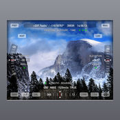
Theodolite
40%-OFF SALE Theodolite is on sale for 40%-off to celebrate its seven year anniversary As seen in Apples Special Event Keynote, Theodolite is a multi-function viewfinder for iPhone and iPod touch that combines a compass, two-axis inclinometer, rangefinder, GPS, map, nav calculator, tracker, and geo-tag photo/movie camera into one indispensable app. Uses are endless, and the app is great for hiking, boating, hunting, golf, outdoor sports, sightseeing, navigation, and finding your way around. iPod touch devices do not have GPS or compass hardware.
-
rating 4.58993
-
size 6.6 MB
Gaia GPS Classic
Gaia GPSGaia GPS\Your Verse\OutsideTrailRunnerTappedInGaia GPS2009Gaia GPSGaia [email protected] (guy-yuh) www.gaiagps.com/map Gaia (USGS, USFS, NRCan) www.gaiagps.comGaia FacebookTwitter NEXRAD Gaia POI iTunesSafari DropBoxGPX/KML Gaia GaiaProGaiaPro www.gaiagps.com MapBoxOpenStreetMap Wunderground GaiaCloud http://support.apple.com/kb/ht4098 2424iTunes iTunes http://www.gaiagps.com/gaiacloud-terms/ http://www.gaiagps.com/terms_of_use IPOD TOUCH WIFI ONLY IPADSGPSGPS
Earthmate
Get all the features of a handheld GPS at a fraction of the cost with everything you need to plan a trip, navigate and share your outdoor adventures. Hunting map data is now available through Earthmate Hunt Edition. Dont forget to stop tracking.
-
size 43.9 MB
Topo Maps US
Download and view topographic maps covering the United States. Topographic maps are useful for recreational activities such as hiking, canoeing, camping, fishing, mountain biking, geocaching, and exploring. Note: Continued use of GPS running in the background can dramatically decrease battery life.
-
rating 5.0
-
size 17.2 MB
Topo Maps+
Topo Maps+ TUAWApple GPSUSGSMapBoxNRCAN/GEOBCThunderforestiPhoneGPS GPS APPLE WATCHiPhone USGSMapBoxNRCAN/GEOBCThunderforest * USGS 7.5USGS * USGS 7.5USGS * NRCAN/GEOBC* Thunderforest * MapBox* MapBox * MapBox * MapBox* LINZ * * * * iOS * MapBox * * * * * * * KMLGPX* KMLGPX* * KMLGPXTopo Maps+ * iOS * iOSGPS
