-
Category Navigation
-
Rating 2.53333
-
Size 34.3 MB
- TIME Magazines 15 Fantastic Gadgets Perfect for hiking or mountain biking. - TUAW.com The GPS Kit app has a number of excellent outdoor uses, especially [for] hiking, biking or geocaching. Pace- Moving Time, Stopped Time, Direction- 3 Equally customizable dashboard cells on mapLoaded with Related Utilities- Elevation and speed graphs - On-map ruler with multi-touch area measurementsContinued use of GPS running in the background can dramatically decrease battery life.
GPS Kit HD alternatives
Pro Altimeter - Barometric Altimeter with Manual/GPS/METAR Calibration
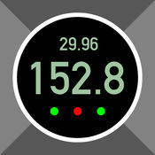
Pro Altimeter is the newest app from Hunter Research, developer of the popular outdoors apps Theodolite, Pro Compass, and Nav Camera. Pro Altimeter uses the high-fidelity barometric pressure sensor in new iOS devices to measure and compute altitude. On older devices without a barometric pressure sensor, only GPS altitude and accuracy will be displayed.
-
rating 3.92857
-
size 0.4 MB
GPS & Map Toolbox
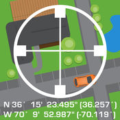
This is the ultimate GPS location database tool designed to save, organize, share, display, import, export, and analyze location records and their properties. Extensive customization options make this app useful for everyone from salesmen, hikers, farmers, hunters, scientists, land/site surveyors, search & rescue, police, and military. This includes map view, elevation, geocoding, business/place search, and street view.
-
size 28.1 MB
DIY Map GPS (App for World Travelers)
iOS 10 Support TUAW Review - DIY Map GPS is a good app if you are a hiker, or someone who is going to an area where mapping data may be sparse.Do you need an offline map? DIY Map GPS offers you Unique features. Homepage: http://www.builtsoft.com
-
size 78.5 MB
Offline Topo Maps
WARNING - DOWNLOAD THE NEW APP INSTEADInstead of buying this app, please download the new Gaia GPS app. You can find it by searching for Gaia GPS - then scroll down and download the app with the gold border called Gaia GPS: Topo Maps and Hiking Trails.Were maintaining Offline Topo Maps for existing users, but our work is focused on the new app. Get in touch with the six+ hikers that develop OTM at [email protected]* download maps of the entire world - USGS topo maps and aerial imagery - OpenStreetMap-based topo and road maps of the world - USGS topos for Alaska and NRCan topos for Canada - highest resolution USGS topos on the App Store * fast, functional, stable, and easy-to-use for even novice hikers* mark waypoints and get guidance to and from places* use metric, imperial, or nautical units* display coordinates in Decimal, UTM, MGRS, DMS, or Decimal Minutes* fully auto-rotatable for widescreen maps and other viewsWarning: Continued use of GPS running in the background can dramatically decrease battery life.
-
size 49.5 MB
Maps n Trax - Offline Maps, GPS Tracks & Waypoints
MAPS n TRAX is a VERSATILE and HIGHLY CUSTOMIZABLE offline map viewer, GPS track recording and WAYPOINT detail recorder. * IMPORT AND VIEW YOUR OWN MAPS and GPS tracks on your device, and record tracks and detailed WAYPOINT notes. Continued use of the GPS running in the background can dramatically reduce battery life on the iPhone or iPad.
-
size 38.8 MB
