Yachting Weather is the cost-free and user friendly weather App for iPod Touch, iPhone and iPad to receive precise sea weather predictions for the next 3 days (2 days on iPad) - or with an upgrade to Yachting Weather EXPERIENCE- for the next five days. You receive all marine weather predictions according to your current GEO location or any other sea area worldwide determined by GPS, a single click on the map tool or by manual input. Available forecast data: Storm risk Wind speed Wind direction Gusts Wave heights Wave directions Wave frequency Air Pressure Common weather condition Temperature Air humidity Precipitation risk Amount of precipitationAdditional Features: iCloud sync of all your locations Forecast Graph and Wind Radar Compact Forecast Today Widget Apple Watch App + Complications Support for iPad Splitview Optimized for VoiceOverYou always can decide whether you want to configure your GEO position by GPS GEO tracking Fingertipping on the map tool Or manual inputIndividual configuration of your adjustments for:Speeds, distances, air pressure, amount of precipitation and temperature
Yachting Weather alternatives
WINDY - waves & wind forecast
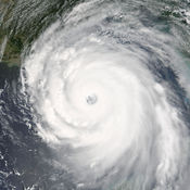
WINDY - wind, wave, tide forecast and local communities for wind sports and outdoor activities. If you are a kiter, surfer, sailor, fisherman, windsurfer, paraglider, skydiver or any other wind lover/ hater - this app is for you WINDY is also a beautiful hurricane tracker. Help us to make the best wind sport app
-
rating 4.65574
-
size 74.7 MB
Windy: wind and waves forecast
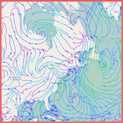
Windy (also known as Windyty or Windytv) is the most accurate weather forecast app trusted by governments, professional pilots, surfers, boaters, fishermen, kiters, storm chasers and weather geeks. Based on ECMWF, GFS, NEMS, NAM and other forecast models offers better services than a Ventusky, Windguru and Windfinder.MAP LABELSWindy lets you display observed wind and temperature, forecasted weather, airports around the World, 1500+ paragliding spots, kiting spots or nearby webcams right on the map. FOLLOW US ON SOCIAL MEDIA Facebook: https://www.facebook.com/windyforecast Twitter: https://twitter.com/windyforecast
-
rating 4.14286
-
size 18.7 MB
NOAA Now
NOAA Now provides the latest information from the National Oceanic and Atmospheric Administration including: hurricanes and tropical storms in the Atlantic, Pacific and Indian oceans; mainland storms, including the latest tornado and severe thunderstorm alerts; worldwide animated satellite views; the latest marine conditions from the National Data Buoy Center; the ultraviolet index. All data is courtesy of NOAA, NASA and other sources where indicated. Continued use of GPS running in the background can dramatically decrease battery life.
-
size 21.3 MB
More Information About alternatives
iSailing
WeatherOnline applications for iPhone and iPod touch are available on the iPhone App Store. WeatherOnlines iSailing Maps forecast includes regional wind maps and local forcast tablesMaps Wind* Surface pressure* Precipitation* Wave heights* Loop, 3 Day Forecasts in 6 hrs intervals* View pictures step by stepTable* 1-12 days:Tmax; Tmin; Weather -a.m.; -p.m.; -evening; Rain risk; Precipitation; Wind direction and mean wind-force -a.m.; -p.m.; -evening; UV index; Sunshine hours; Sunrise; Sunset; Moonrise; Moonset;*24 hrs Forecast in 3 hrs intervals:*Temperature; Wind direction; mean wind-force; Relative humidity; Weather; Sunshine hours; Peak gusts;*Choose units (C/F, km/miles)* Up to 10 locations at a timeUpdate periods* 1-12 Day Forecast every 6 hrs, 24 hrs Forecast every 3 hrs, maps every 6hrs. Send your questions and feedback to [email protected]
-
rating 1
-
size 5.1 MB
-
version 1.4
WeatherOnline
WeatherOnline offers worldwide city forecasts aswell as weather mapsCities: 1-12 Days: Tmax; Tmin, Weather -am; -pm; -evening; Rain Risk; Precipitation; Wind Direction and Mean Wind Force -am; -pm; -evening; Sunshine hrs; UV index; Sunrise; Sunset; Moonrise; Moonset; 24 hrs Forecast in 3 hrs intervals: Temperature; Wind Direction; Mean Wind Force; Relative Humidity; Weather; Sunshine hrs; Max. Gusts; Current Weather: Temperature; Weather; Precipitation; Visibility; Wind -Speed; - Gust; -Bearing; Relative Humidity; Cloud Cover; Cloud Base; SL Pressure; -Trend; Snow Depth; Locate your current position Choose units (C/F, km/miles) Up to 10 locations at a timeMaps: Weather Overview Tmax Tmin SL Pressure Precipitation 3 Day ForecastsRadar: Loop over the last hours View pictures step by step Level: Continent; Country; Region (Radar only available for UK, Ireland, France, Netherlands, Belgium, Germany, Spain, the Continental US and Australia). Send your questions and feedback to [email protected]
-
rating 2
-
size 5.0 MB
-
version 1.4
Croatia Weather
Croatia Weather is the most detailed weather forecast application for Croatia country. It is Your personal mobile weather station. Second type of forecast allows you to preview maps with mean wind, wind gusts, cloudiness and precipitation for Adriatic sea for next 72 hours.11) UV index - maps for Croatia and Europe with UV index level.
-
size 8.8 MB
-
version 1.7.0
Weather Map with wind,wave height and air pressure
Stay connected to the latest, real-time, marine weather conditions with this app.- Quickly view current marine weather conditions.- World coverage- Interactive map, pinch to zoom and use pan gesture to move mapThe Following information is available:- Wind direction map- Air Pressure map- Temperature map- Precipitation map- Wave Height map
-
size 22.5 MB
-
version 1.0
Windy - the wind compass and forecast
Powerful application about wind You can easy to find where the wind blows Also tracking wind speed, wind gusts, direction, temperature and hourly forecast for 3 days with visual charts of speed. Features:More than 6,000 weather stations around the world Automatic or manual selection of locations Displays speed in knots, miles/h, m/s, km/h Hourly weather forecast for 3 daysSupports over 20 languages Must have for all who needs to know all about wind at this moment and next hours or days
-
size 1.3 MB
-
version 1.6
Windria - Greece (High-res marine forecasts)
Looking for the most accurate Wind/Marine Forecast for Greece and the Aegean Sea?Windria shows you high-resolution SKIRON Wind forecast, wave forecasts and currents Features:> Leading wind forecast model (SKIRON) for Greece.> High-resolution interactive map with 5km forecast resolution for 72hrs. ( localized & more precise than windguru, windfinder or predictwind )> Award-winning User Experience > Must-have app for anyone sailing, kiteboarding, windsurfing, fishing or yachting.> Forecast data is updated 4x daily.> Radar & satellite view to keep track of bad weather.> WaveWatch3 wave predictions (25km resolution) & NEMO Ocean Currents (8km resolution)Coming Soon:> Offline Mode> Model Switcher to compare different forecast models> Government issued weather alerts
-
size 9.4 MB
-
version 1.0.1
NOAA Marine Weather Forecast
The #1 NOAA Marine Weather app Features Include:* Real-time marine weather buoy data* 6-hour historical wave height and energy trend reports* 7-day hourly NOAA WaveWatch III forecast model* 7-day hourly harmonic tide forecast* 5-day National Weather Service marine weather forecast* Detailed NWS Forecast Discussion Reports* Automatically saves your favorite buoy for quick viewingReal-time Data Includes: - Primary and secondary swell height, period, direction - Spectral wave energy density (wave energy vs period) - Significant wave height - Wind speed, gust and direction - Air temperature - Water temperature - Pressure - Current NWS Alerts6-hour History Data Includes: - Primary and secondary wave height, period, direction - Wave energy, period, direction7-day NOAA WaveWatch III Forecast Model Includes: - Hourly swell component predictions (1-6 swells) - Accurate wave height, period, direction predictions7-day Hourly Harmonic Tide Forecast Includes: - Interactive tide graphs - Hourly tide predictions - Current tide5-day NWS Marine Forecast Includes: - Text summary forecast - Weather, sky, wind, waves - Click any point on the map Available for iPad and iPhone with single purchase No Ads IMPORTANT: Please remember that this app can only show data the buoy collects. Not all buoys collect weather data. Enjoy.
-
rating 4.42568
-
size 11.4 MB
-
version 1.3.4
SwellMap Boat
SwellMap Boat is based on our popular website SwellMap.co.nz providing you with the latest marine weather predictions for hundreds of boating and fishing locations across New Zealand. Forecasts are generated using the latest atmospheric and oceanographic numerical models providing updated information four times daily. - Forecast maps of rain/pressure, temperature, wind, wave height, wave period and sea temperature.- Save your favourite spot forecasts.
-
size 29.6 MB
-
version 2.0.4
SwellMap Surf
SwellMap Surf is based on our popular website SwellMap.co.nz providing you with the latest surf and marine weather predictions for hundreds of spots across New Zealand. Forecasts are generated using the latest atmospheric and oceanographic numerical models providing updated information four times daily. - Forecast maps of rain/pressure, temperature, wind, wave height, wave period and sea temperature.- Save your favourite spot forecasts.
-
size 29.2 MB
-
version 2.0.4
G3M Open Weather Map
Open Weather Map Glob3 is a demo application developed by glob3 mobile API and fed by Open Weather Map API. The application runs like Weather channel, Accuweather, etc but focused in 3d maps visualization. -Different global weather layers (precipitation, snow, wind, pressure and clouds) -8 Next Days forecast -GPS or searched location.http://owmgapp.glob3mobile.com
-
size 1.4 MB
-
version 1
