-
Category Navigation
-
Size 9.0 MB
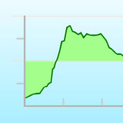
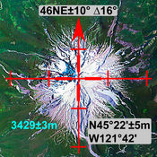
Topo Profiler is an elevation graph viewer. Topo Profiler can create a elevation chart(profile) to show elevation values and a topographic profile along an arbitrary drawn path on a map. Therefore, please DONT use this app for making important decisions.
Topo Profiler - elevation graph viewer alternatives
Altitude (elevation, height above sea level)
Altitude is an application that can display altitude (m and ft) on the map. You can display the altitude of one place in the center on the map and you can display the altitude of five places on the straight line near the center [FUNCTION]- Display the altitude of one place in the center on the map- Display 5 altitudes on a straight line on the map- Search- Current locationIt is an intuitive application that is easy to use.
-
size 15.7 MB
Elevation Chart - Draw Profile View by Touchs
Elevation Chart is a tool used to get the elevation of any place on the surface of the Earth. Youre able to place a pin anywhere on the map to view its elevation in feet or meters along with its longitude, latitude, and address. #1 in Mexico and other 5 countries, #2 in United States, and top 10 in 12 countries (iPad Navigation) Features Show the elevations between two points in profile view, more visualization One tap to show the elevation of your current location Get elevation of any place on earth by: 1) touching the location on the map; 2) search by address/name Show Walking Distance between two points if available Show Ellipsoidal Distance (according to Vincentys formula) as label of x-axis Show elevation in feet or meters Work on iPad, iPhone, and iPod Touch Known Issues - In some situations, the Walking Distance which get from maps.googleapis.com is obviously wrong, compare to the Ellipsoidal Distance.- Limitations of elevation query: 2,500 requests per day; 50 requests per second. Requirements Internet connection. Video Tutorial Pick one of the following: https://appbead.com/app-elevation-chart.html http://youtu.be/o1T9-prX9Dg
-
size 2.4 MB
Ella - GPS Elevation Tracker
Record your elevation in real-time with Ella. Perfect for hiking, climbing, or road trips. Please Note: Continued use of GPS running in the background can dramatically decrease battery life.
-
size 19.3 MB
Topo Reader
Download high resolution USGS topographic maps for GPS* use while offline and with no need for cellular service. Topo Reader is designed for road trips, camping, hiking, exploration and geographical history. After a subscription period expires, advertisement may resume from usage of the import features.
-
size 40.5 MB
MapTool - GPS, Compass, Altitude, Speedometer, UTM, MGRS and Magnetic Declination
A must have toolkit for every outdoor enthusiast: climber, hiker, off-road driver. All the essential tools for navigation are integrated seamlessly in one app. MAP GridHigh precision grid combined with predefined scale values for both metric and feet/miles (click Scale button)BATTERY FriendlyTurns off GPS in compass only and browsing modes to improve battery savings
-
size 17.7 MB


