-
Category Navigation
-
Size 88.4 MB
Tactical Navigator (TacNav) is a mobile application tool for communications, operations, and outdoor planningperfect for any military or outdoor enthusiast Whether you want to save a training location or your best fishing spot, this app is for you. Tactical Navigator comes with the following features:Basic App Features Compass Day of Year & UTC Time always visible Add many locations to the map at the same time Coordinate systems: Degrees, DM.m, DMS, MGRS, and UTM Search by address or any coordinate format Elevation Current weather conditions and temperature Local and Military time Choice of Metric or Imperial measurement valuesEnhanced Map Actions Distance & Direction ETA to a location Calculate a Satellite Look Angle Calculate an offset coordinate given distance & direction Trace a path Routes (great for land navigation) Calculate Area Add a radius around a locationOther Great Features Use MIL-STD-2525C symbology to change your locations icon Save notes to your saved locations Open Turn-by-Turn apps for driving directions with 3rd party apps (Apple Maps, Google Maps, and Waze) Universal application for use on iPhone or iPad iCloud integration to sync across your devices and auto-backup your data Angle of Device (ex. US Army Major Kevin Militello - Owner & DeveloperDisclaimers: Continued use of GPS running in the background can dramatically decrease battery life TacNav is not endorsed by any government agency
Tactical Navigator alternatives
Where Am I At?
FREE again for a limited time only - get it while it lasts Where Am I At? is a Top 25 Free Navigation App on the U.S. app store For the moments when you have to ask yourself, Where am I?, the Where Am I At app is there to help Simply open the app to have your iPhone, iPad, or iPod Touch device instantly zoom in on your position. Key Features:- See your location automatically just by opening the Where Am I At app.- View your exact coordinates, approximate address, county information, and altitude.- Scroll around the map and keep track of your position while moving.- Zoom feature lets you take a closer look or get a birds eye view of your location.- Choose between Map, Satellite, and Hybrid view.- Easily copy your longitude, latitude, and address to the clipboard to paste elsewhere.- Share your location on Twitter, by email, or through text/iMessage without leaving the app. Average 4 out of 5 star rating with nearly a thousand 4 & 5 star reviews f60d9e0298
-
rating 4.72727
-
size 5.6 MB
Spyglass
Spyglass is an essential offline GPS app for outdoors and off-road navigation. Packed with tools it serves as binoculars, heads-up display, hi-tech compass with offline maps, gyrocompass, GPS receiver, waypoint tracker, speedometer, altimeter, Sun, Moon and star finder, gyro horizon, rangefinder, coordinate converter, sextant, inclinometer, angular calculator and camera. DEMO & HELPVideos:http://j.mp/spyglass_vidsManuals:http://j.mp/spyglass_help
-
size 19.9 MB
GPS Kit - Offline GPS Tracker
- TIME Magazines 15 Fantastic GadgetsPerfect for hiking or mountain biking.- TUAW.comThe GPS Kit app has a number of excellent outdoor uses, especially [for] hiking, biking or geocaching.- NBCs The Browser Radio ShowMost beneficial for adventure-type guys.Top-of-the-line GPS system for adventurers and professionals in the great outdoors. Designed for outdoor activities such as:hiking, hunting, camping, skiing, cycling, geocaching, mountain biking, motorcycling, off-roading, fishing, and other romping in or out of the backcountryANYWHERE IN THE WORLD.GPS Kit is a full-featured GPS system for the iPhone that combines all the functionality of expensive handheld units with the power of wireless technology. Pace- Moving Time, Stopped Time, Direction- 3-Axis Inclinometer and Glide Ratio- Customizable cell on mapLoaded with Related Utilities- Elevation and speed graphs - On-map tracking controls and timer- On-map ruler - Multi-touch area measurements* Use of Squawk requires an Internet connection and extended use may adversely impact battery life Continued use of GPS running in the background can dramatically decrease battery life
-
rating 3.5
-
size 19.5 MB
MotionX GPS
#1 About.com Winner: Best Outdoor App#1 iPhone app, Backpacker MagazineTremendous - ComputerWorldThe software you need - NavigadgetMy favorite when I go hiking - Washington PostFavorite, hands down - Mac Observer The #1 multi-sport GPS app for the iPhone Great for hiking, biking, skiing, snowboarding, running, sailing, flying, navigating, geocaching, and more Over 5 million users, top rated around the world Most accurate iPhone GPS Best map selection: choose from 14 different sources including road, terrain, satellite, and marine map types Free map downloads worldwide Including OpenStreetMap, terrain maps, and NOAA marine charts Unlimited map downloading for use offline Save up to 300 GPS tracks & 2500 waypoints Live Position Updates: optionally share your position automatically in real-time with others you choose Optimized for use with the Apple Watch Advanced interactive stopwatch with voice coaching Supports DMS, DM, D, MGRS, UTM, and OSGB grid systems Record GPS tracks and waypoints, follow saved or imported routes, import and export GPX files, and much moreContinued use of any GPS service running in the background can significantly decrease battery life. MotionX is committed to constant improvement. Thank you for the feedback
-
rating 3.66667
-
size 56.5 MB
More Information About alternatives
MGRS/UTM Pro
MGRS/UTM Pro is a tool for converting between lat/lon, MGRS and UTM coordinate values. Its unique - you dont need to mess around with defining the coordinate type or what you want to convert it to. MGRS/UTM Pro accepts:- decimal degrees, decimal minutes and degrees/minutes/seconds latitude and longitude values in any order, with or without N/S- UTM (N/S hemisphere designated values)- MGRS (100km precision level and higher - converted coordinates are centre of grid square)
-
size 2.8 MB
-
version 1.2.0
GPSts
GPSts is an application to convert UTM/MGRS coordinate values here were obtained using GPS for iPhone. We support the actions of the user also equipped with compass and altimeter. The headquarters of the U.S.Army Engineer has devised a UTM/MGRS.UTM/MGRS position indication system is used in such U.S.Army NATO JSDF.I can select the map view from AppleMAPor OSM orOrdnance Survey map (Japan only).
-
size 4.8 MB
-
version 3.2
Coordinate Systems Converter
This app is the first, and for now the only, app that can convert coordinates between 3800+ coordinate systems/datums. Not only the usual conversions between UTM, MGRS and the various WGS84 systems but also eg. Features:- Over 3800 coordinate systems/datums to convert- When applicable, in- and output can be formatted D, DM or DMS- Results visible in OpenStreetMap when an internet connection is available- Export the converted coordinate to WhatsApp, Twitter, Email, Text message or just copy it to any other app
-
size 2.4 MB
-
version 1.1
Coordinates Pro
Directly control the displayed coordinates an the corresponding geolocation without any delays. With this App you do not need to use a complicated map to extract or lookup some coordinate. FEATURES:- Touch any point on the integrated map graphic- See what country/ocean/city you have pointed at- Smoothly manipulate latitude & longitude separately- Bookmark any coordinate in a list of entries- Geolocate yourself to see where you are on the map- Export any coordinate as WGS84, UTM or MGRS to - to directly open in other Apps - clipboard - via e-mail- Choose the three main notations of coordinates
-
size 1.2 MB
-
version 1.1
GPS Map for Pebble SmartWatch - mini Wrist Navigator & Maps & Directions & Speeds
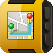
ON SALES 50% OFF, 1.99->0.99$ FOR A LIMITED PERIOD OF TIME Turn your Pebble SmartWatch into a mini Wrist Navigator with information of Maps & Directions. Perfect companion for your outdoor exercise/activity. Features:> Navigator the map> Zoom level controller> Moving Direction> Location search> Live Map transmission to Pebble smart watchContinued use of GPS running in the background can dramatically decrease battery life.
-
rating 1.11111
-
size 12.2 MB
-
version 3.0
Solocator - GPS Field Camera to stamp photos with location, direction, altitude, date, time + optional editable notes
Solocator is a GPS camera for fieldwork. Overlay and stamp photos with GPS location, compass direction, altitude, date & time taken + with Industry Pack (IAP) capture editable notes such as project name and photo description, street address and UTM/MGRS coordinate formats. Email KML file of photo location
-
rating 4.21739
-
size 12.5 MB
-
version 2.3.5
GeoPosition
Convert GPS coordinates to map coordinates in a twinklingNever get lost again With GeoPosition you know always exactly where you are. Within a second you convert GPS coordinates received by your iPhone to popular map projection coordinate systems like UTM/UPS, Mercator, Gauss/Krger, MGRS, GGRS87, LUREF, Swiss Grid CH1903+/LV95, CH1903/LV03-M and vice versa. When the coordinate is received via E-Mail, GeoPosition or Google Maps may be started tapping on the embedded link in the E-Mail
-
size 2.8 MB
-
version 2.0
Coordinate System Converter
Contains more functionality than any other Coordinate Converter out there Manually convert to/from:-UPS/UTM using WGS 84-MGRS using WGS 84-Latitude Longitude Decimal Degrees -Latitude Longitude Degrees Minutes Seconds (DMS)-Latitude Longitude Degrees Minutes (DM)Fully functional map (internet connection required for map content)-Track your current location-Track your current heading-Get coordinates from dragging and dropping pins-Save dropped pins for later viewing-View all saved coordinates-View manually entered coordinatesGet your current location in all supported formatsGet your current headingSave coordinates for later viewingView Coordinates in the Apple Maps app or the Google Maps app. Share/save coordinates via Notes, Messaging, E-mail, Twitter, and other App extensions.
-
size 2.3 MB
-
version 1.4
Map Tools
Map Tools is a utility that let users to fully utilize coordinates. Map Tools converts coordinates among various datums, coordinate systems and map projections. The following coordinate systems are available to choose as the input or output coordinates system:* Geodetic (latitude and longitude)* MGRS* UTM/UPS* USNG* Georef* Map Grid Australia (MGA) for GDA94 Datum* British National Grid for OSGB36 Datum* New Zealand Transverse Mercator 2000 (NZTM2000)* New Zealand Map Grid (NZMG) for NZGD49 Datum* Swiss Grid for CH1903 Datum* Greek Grid for EGSA87 Datum* Singapore TM for SVY21 Datum
-
size 15.3 MB
-
version 5.1
This Way - auto rotating map
This Way is a map app that rotates by itself to match where youre heading, so its easier for those who cant read maps. As you get closer to your destination, the map zooms in automatically, so you can check confirm where you are by comparing it to your surroundings. The app shows:- Direction to the destination*- Distance to the destination- Travel time* based on average speed*The app has below LIMITATIONS.- No turn by turn direction- Cannot calculate time based on traffic condition or routes
-
size 18.7 MB
-
version 1.4
