-
Category Navigation
-
Size 690 MB
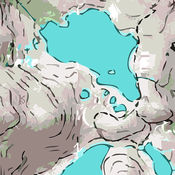
A 3D topo map of State of Alaska, USA. The vector map data is contained within the app and can be used without an internet connection. Caution: Continued use of GPS running in the background can dramatically decrease battery life.
Scenic Map Alaska alternatives
iNavX - Marine Chartplotter
Navigate Confidently, Navigate with iNavX - the worlds #1 Handheld ChartplotterAnd, the ONLY app to provide all your favorite charts from your favorite chart providers including Navionics Editors Choice - Practical SailorThe Standard - Cruising MagazineMust Have List - Cruising WorldTrusted internationally by casual and professional sailors, cruisers, boaters, fishermen, and divers. Downloads iNavX TODAY and automatically receive a complimentary copy of the official and up-to-date high resolution NOAA RNC United States marine raster charts.iNavX is the ONLY APP to give you access all of your favorite charts directly through the app. MORE INFO Website: http://inavx.com/Users Guide: http://inavx.com/help/ Privacy Policy: http://inavx.com/privacy
-
rating 4.5
-
size 87.1 MB
Offline Topo Maps
WARNING - DOWNLOAD THE NEW APP INSTEADInstead of buying this app, please download the new Gaia GPS app. You can find it by searching for Gaia GPS - then scroll down and download the app with the gold border called Gaia GPS: Topo Maps and Hiking Trails.Were maintaining Offline Topo Maps for existing users, but our work is focused on the new app. Get in touch with the six+ hikers that develop OTM at [email protected]* download maps of the entire world - USGS topo maps and aerial imagery - OpenStreetMap-based topo and road maps of the world - USGS topos for Alaska and NRCan topos for Canada - highest resolution USGS topos on the App Store * fast, functional, stable, and easy-to-use for even novice hikers* mark waypoints and get guidance to and from places* use metric, imperial, or nautical units* display coordinates in Decimal, UTM, MGRS, DMS, or Decimal Minutes* fully auto-rotatable for widescreen maps and other viewsWarning: Continued use of GPS running in the background can dramatically decrease battery life.
-
size 49.5 MB
Earthmate
Get all the features of a handheld GPS at a fraction of the cost with everything you need to plan a trip, navigate and share your outdoor adventures. Hunting map data is now available through Earthmate Hunt Edition. Dont forget to stop tracking.
-
size 43.9 MB
i Hike GPS : USA + SE & SW Canada Topo Maps
Your iPhone or WiFi+Cellular iPad can be a high-performance GPS receiver with USGS & US Forest Service topo maps Headed into the wilderness? Buy this app now so you will always know where youve been, where you are, & where youre going. View maps using the iOS device alone Continued use of GPS running in the background can dramatically decrease battery lifeYour dream of hiking adventures reaches new heights with iHikeGPS
-
size 9.5 MB
i Sail GPS : USA NOAA Marine Chart Plotter
Your iPhone or WiFi+Cellular iPad can be a high-performance GPS receiver with USA NOAA Raster Nautical Charts Rated Best Choice Excellent by Practical-Sailor.comOn the water in a bad storm and your chart plotter just failed? Download this app now. View charts using the iOS device alone Continued use of GPS running in the background can dramatically decrease battery lifeWinner of the Practical Sailor Editors Choice AwardSailing becomes safer and more fun with iSailGPS
-
size 10.2 MB
