-
Category Navigation
-
Size 7.9 MB
Free APRS application for radio amateurs, RTL SDR users or curious, all APRS data right in your pocket, fast & simple.- Model and vendor detection- Offline repeaters database (Voice, Fusion, DMR, DSTAR)- Decode weather data- Conditional highlight for C4FM devices or callsigns - Receive last 10mn packets for your location at start- Nightmode- Standard, Satellite or Hybrid map view- Extremely fast packets listing using on device database- Display main informations based on packet context, frequencies when found, temperatures for wx packets- Detect clickable URLs- Lookup for callsigns on local database (works offline/disconnected)- Change location from GPS, from maps, from cities names database or manual input coordinates- Find the closest city with bearing and distanceFirst releases of MyAPRS will focus on an APRS-IS connected read only application but further developments direction is to be used off the grid with a real modem connected to a transceiver with position sending.
MyAPRS alternatives
Locative
PLEASE NOTE: As announced in https://blog.locative.io/bye-everyone-df01871fe949 Ive shut down my.locative.io effectively 14th of May 2017. This app will remain in the App Store for reference reasons but wont ben further supported. Also make sure to check our GitHub in case you need working examples or youd like to contribute to this project: https://github.com/LocativeHQ
-
size 27.7 MB
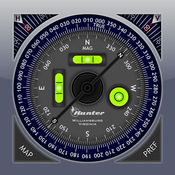
Pro Compass
Pro Compass replicates the look and feel of classic pocket compass hardware in use since the 1800s, adding modern features and technologies. The app uses advanced OpenGL graphics (normally reserved for games) to render 3D floating compass hardware for realistic operation. Be aware that we are not able to respond to iTunes reviews, so please do not leave a review if you need tech support or assistance, or are confused about accuracy or operation of the app.
-
rating 3.72727
-
size 2.3 MB
AirNav FBO
GREAT NEWS: Our advertising-support has reached a point where we can afford to offer the app for free. This app is FREE for ALLAirBoss membership (www.airnav.com/airboss) can still be purchased from the app and renewed from the app. However, the app does not include the web site in its entirety.
-
rating 4.28571
-
size 24.4 MB
Topo Maps US
Download and view topographic maps covering the United States. Topographic maps are useful for recreational activities such as hiking, canoeing, camping, fishing, mountain biking, geocaching, and exploring. Note: Continued use of GPS running in the background can dramatically decrease battery life.
-
rating 5.0
-
size 17.2 MB
Go Map!!
Go Map lets you create and edit information in OpenStreetMap, the free crowd-sourced map of your neighborhood and the world. Add shops and restaurants, streets, cycling and hiking paths, buildings, lakes and rivers. OpenStreetMap.orgFree registration and acceptance of the OpenStreetMap licensing terms is required to upload your changes.
-
rating 4.96552
-
size 11.7 MB
