-
Category Navigation
-
Size 151 MB
Snapshot-Mobile software allows the pilot to operate the TrackAirs Flight Management System (FMS) using their very own mobile device. Snapshot-Mobile is used as a Pilot (client) device which wirelessly connects to the Navigator (server) system such as the NexTrack system. Multiple devices can be run simultaneously for large flight crews.
Mobile snapSHOT alternatives
Direct To Aviation GPS
Thanks everyone for making FlyGo-Aviation apps so successful, with over 100.000 downloads This FlyGo-Aviation product is a real time VFR navigation system for pilots. We keep it simpleOur aviation GPS application is specially designed to make flight navigation easy, quick and safe. Enjoy the app & FLY SAFE The FlyGo-Aviation Team.
-
size 55.2 MB
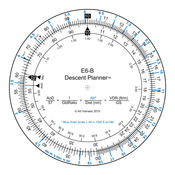
E6B Descent Planner
The E6B Descent Planner provides a fully functional circular slide rule for use in real time descent planning. Using one finger, and with a single turn of the rotating inner disk, pilots can easily perform calculations to determine top of descent distance, angle of descent, vertical descent rate required, glide ratio, maximum glide distance based on altitude, plus many other calculations that are not commonly associated with a mechanical E6B.
-
size 37.8 MB
AeroPointer - Global Aeronautical Data for Pilots
If you are a pilot - AeroPointer is for youAeroPointer provides you with worldwide aeronautical data for over 41,000 airports and 10,900 radio navigation aids (Navaids).From the creator of Nav Trainer and Holding Pattern Trainer.-Offline access to most data even when internet is off.-Other data, such as airport charts and weather is cached for later offline view after you first access to it online.-Weather, airport charts and notams are cached for offline view once they are downloaded. Airport data:-Name, city, state and country-Local and ICAO identifiers.-FAA / NACO airport diagrams and instrument procedure charts.-Coordinates.-Radio frequencies.-Runway info.-Time zone-Current local and zulu (UTC) time.-Sunrise/sunset/civil twilight times.-METAR/ TAF weather reports.-Color-coded weather dashboard for METAR supported airports.-Notices to airmen (NOTAMs).Navaid data:-Type.-Power output.-location.-Identifier (letters and Morse code).-Time zone-Current local and zulu (UTC) time.-Sunrise/sunset/civil twilight times. Enjoy
-
size 65.8 MB
AHRS Utility
AHRS utility is a free application designed to display Levils AHRS data graphically and numerically. This application is only compatible with the Attitude and Heading Reference System from Levil Technology, model AHRS G mini and iLevil series. This application is not meant to be used as a Primary Flight Display or for IFR flight.
-
size 7.8 MB


