-
Category Utilities
-
Size 41.2 MB
Map Pilot Business is the same app as Map Pilot for DJI except it includes all of the In-App Purchase options at a discounted price. Map Pilot Business is offered with volume discounts for large institutional purchases through the Apple Volume Purchase Program. Features:Terrain Awareness Multi-Pass Linear Mission PlanningMulti-Flight CoordinationMulti-Battery ManagementAutomatic, Shutter Priority and Manual Exposure ModesBasemap Caching for Offline OperationsConnectionless Camera TriggeringExternal Map Data and Markers via MapBoxTerrain Aware Image Footprint DisplaySave/Edit MissionsRefly Saved MissionsView 3D logs on-device with Google EarthImport KML via Email or AirDropExport KML, log files, and Flights file via Email or AirDropFlight Log reviewBuilt-in Simulator for testingHealthyDrones upload from Log File ManagerRAW imaging available via In App PurchaseFullest Possible Use of Each BatteryAppropriate Camera TriggeringOverlap ManagementSpeed ManagementAutomatic Takeoff and LandingLive Video Preview (large and small)Signal Quality WarningLine of Sight IndicatorAutomatically Captures Elevation Reference Image (Ground Image)Natural Landing AssistanceLive Map ViewCompatible with iOS 8, iOS 9, and iOS 10.Supported Aircraft:Inspire 2Phantom 4 ProPhantom 4 AdvancedPhantom 4Mavic ProPhantom 3 ProfessionalPhantom 3 AdvancedPhantom 3 StandardInspire 1Inspire 1 ProMatrice M100Matrice M200Matrice M600
Map Pilot for DJI - Business alternatives
AirMap for Drones
AirMap is the leading provider of aeronautical data & services to unmanned aircraft, or drones. AirMap offers these features and more:- View only the airspace rules you need based on the context of your mission with localized rulesets for Germany, Japan, the U.K., the U.S., and the Canada.- Super Fast Vector Maps- Pilot Profile View- Manage UAV Aircraft- Create & Manage Flights (incl. Future Flights)- Submit Digital Flight Notifications to Participating Airports- View Public Flights- Get Real-time Traffic Alerts- Toggle between Four Different Map Styles- Search Map by Place or Location- Confirm that your flight is cleared for takeoff with AirMaps recommended preflight checklist.
-
rating 3.30709
-
size 116 MB
Flight Plan for DJI Drones
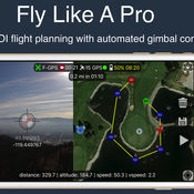
Fly like a pro - Create flight plans quickly that keep the camera focused on your subject with smooth transitions and perfect framing. With autonomous flight plans you can accomplish shots far to difficult to fly manually. Crosshairs display lat/lng targetFollow-me with auto gimbal controlFull ground stationVariable width FPV/map viewGesture camera controlInstructions:http://flightplan.beyondthecube.ca/Demo Videos:https://www.youtube.com/watch?v=FbO_dfTj-PY&list=PLa6UXqRipoPoss6G69VPzQtf89GVg3jnM
-
size 113 MB
Autopilot for DJI Drones
Fly like a professional - capturing smooth, perfectly framed, and visually stunning imagery. With autonomous and semi-autonomous flight modes, Autopilot enables you to execute flight and camera control sequences that were previously too difficult or impossible to perform manually. The aircraft will intersect the imaginary laser created by your device.
-
rating 4.4
-
size 166 MB
Pix4Dcapture
Pix4Dcapture turns your consumer drone into a professional mapping tool. A free companion of Pix4D software, Pix4Dcapture is the perfect tool to automatically capture image data for optimal 3D models and 2D maps. Discover our cloud and desktop 3D mapping and modeling solutions on our website.
-
size 137 MB
HD Sync
Is your drone healthy? Or is it about to surprise you on your next flight? In order to view your flight details - please visit the site directly.
-
size 10.9 MB
More Information About alternatives
Map Pilot for DJI
Map Pilot helps you create and fly the optimal flight path to create great maps using the Maps Made Easy map processing service. Collecting great data to create high resolution aerial maps with your DJI flying camera is just a few clicks away. Features: Terrain Awareness Multi-Pass Linear Mission Planning Multi-Flight Coordination Multi-Battery Management Automatic, Shutter Priority and Manual Exposure Modes Basemap Caching for Offline Operations Connectionless Camera Triggering External Map Data and Markers via MapBox Terrain Aware Image Footprint Display Save/Edit Missions Refly Saved Missions View 3D logs on-device with Google Earth Import KML via Email or AirDrop Export KML, log files, and Flights file via Email or AirDrop Flight Log review Built-in Simulator for testing HealthyDrones upload from Log File Manager RAW imaging available via In App Purchase Fullest Possible Use of Each Battery Appropriate Camera Triggering Overlap Management Speed Management Automatic Takeoff and Landing Live Video Preview (large and small) Signal Quality Warning Line of Sight Indicator Automatically Captures Elevation Reference Image (Ground Image) Natural Landing Assistance Live Map ViewCompatible with iOS 8, iOS 9, and iOS 10.Supported Aircraft: Inspire 2 w/X4S and X5S Phantom 4 Pro Phantom 4 Advanced Phantom 4 Mavic Pro Phantom 3 Professional Phantom 3 Advanced Phantom 3 Standard Inspire 1 Inspire 1 Pro Matrice M100 Matrice M200 Matrice M600
-
size 41.2 MB
-
version 2.6.4
FPV Camera for DJI
Complete new flying and shooting dimension for DJI drones with innovative features. Compatible DJI platform: Mavic Pro, Phantom 3/4, Inspire 1/2, Matrice 100/600 Compatible DJI camera: Zenmuse X3, X5, X5R, Z3, Z30, X4S, X5S Compatible iOS devices: iPad Air/Air 2/Pro, iPad mini 2/3/4, iPhone 5s/6/6+/6s/6s+/7/7+/SE Both app and support are in English onlyCamera Navigation Map consists of accurate Google Map and Pilot Wand Up-to 12 custom telemetry data with either vertical or horizontal layout Unique and creative Touchless UI allows pilots to change camera settings and control the app without touching screen Real-time battery consumption meter - mAh/km or mAh/mi Custom Warning message Screen RecorderMission Planner Mission Planner is an intelligent ground station with unique TERRAIN ELEVATION to program & save autonomous WAYPOINT, ORBIT and PANORAMA flights for superior footage. You can delete, import and export flights logs to CSV file for third-party application (such as DashWare) for further manipulation.
-
rating 4.2
-
size 105 MB
-
version 3.5
FastOut Pilot
FastOut Pilot for iOS facilitates taking pictures for panoramas using a DJI drone at a click of a button. This app is for FastOut users only and requires that you have signed up for an account. FEATURES:- Set waypoints with location and altitude- Take pictures for panoramas with a single button- Take snapshots- Start/Stop recording- Full camera settings- Take-off, Return-to-home and Set-home buttons- FPV or map mode- Full drone status (mode, satellites, RC level, battery level, drone warnings, etc)- CTR areas are marked on the map - Supports DJI Phantom 3 (Professional and Advanced)- Supports DJI Phantom 4 (including Pro and Advanced)- Supports DJI Mavic - Supports DJI Spark
-
size 60.5 MB
-
version 2.0.2
GirlsGang Stamp by PhotoUp - cute girl doodle stamps for decorate photos
Have fun with your gang by take a photo and decorate by GirlsGang Stamp This camera app have much more cute stamps for the girl action like a cartoon bookYou will love it :) GirlsGang Stamp You can also share the photos with your friends via Facebook, Instagram and Twitter. General - support from iOS 5 / iOS 6 /iOS 7 - landscape mode (iPad only) Camera - auto focus & exposure - tap to focus & exposure - pinch to zoom - flash mode selection - 1:1 / 3:4 image ratio selection - shutter timer - dual shutter button (iPad only) - import from photo album Image decoration - image rotation - filter - frame - unlimited sticker category - butterfly gesture for sticker decoration - Text input - Auto Hashtag
-
size 66.6 MB
-
version 1.4.1
Senam Camera by PhotoUp Watercolor Stamps Frame Filter photo decoration app
Senam Camera is cute camera app, beautiful mixed form handmade illustrate sticker and digital camera app. Take a picture, select a filter, decorate your pic by sticker, save or share with friends and social media.easy and free Senam is mean watercolor in Thai, all sticker picture in this app painted and created by @Lingjaidee he is Thai illustrator. Remove all Ads ,Purchase one from any stamp setFind your own way to decorate your photos and be the best cutest creator Feature :General - support from iOS 5 / iOS 6- landscape mode (iPad only)- localizationCamera- auto focus & exposure- tap to focus & exposure- pinch to zoom- flash mode selection- 1:1 / 3:4 image ratio selection- shutter timer- dual shutter button (iPad only)- import from photo albumImage decoration- image rotation- filter- frame- unlimited sticker category- butterfly gesture for sticker decoration- Zoom Indicator- loading position iphone 5- Auto Save- Auto HashtagShare image- camera roll- email- instagram- facebook- twitter (iOS 5 or above)
-
size 94.1 MB
-
version 1.4.1
RibbonCamera by PhotoUp - Cute Stamps Frame Filter photo decoration app
Happy New Year 2015 Ribbon Camera new feature new stamp Bear & Bunny again ,So cute for decorate your special weekend to be a super cute music card :) Ribbon Camera is a Camera application which have many stamps for decorating your photos. Enjoy with Free set of stamps and frames or In-app purchase. Cats lover stamp, Good morning Stamp and Digital masking tape stamp set .More stamps will be added soon Find your own way to decorate your photos and be the best cutest creator Feature : General - support from iOS 5 / iOS 6- landscape mode (iPad only)- localizationCamera- auto focus & exposure- tap to focus & exposure- pinch to zoom- flash mode selection- 1:1 / 3:4 image ratio selection- shutter timer- dual shutter button (iPad only)- import from photo albumImage decoration- image rotation- filter- frame- unlimited sticker category- butterfly gesture for sticker decorationShare image- camera roll- email- instagram- facebook- twitter (iOS 5 or above)
-
rating 4.3
-
size 83.2 MB
-
version 1.4.2
This Stamper by PhotoUp
This stamper include free stamps and frames that you can use any time you want, and other cute stamp sets to decorate your photoLets get fun with little red pants girl and creamy elephant, they love to stay in the kitchen if you have the same passion, dont miss themWith This stamperyou can change your picture into an adorable or funny photo and share with your friend via facebook, instagram or twitter General - support from iOS 5 / iOS 6 - landscape mode (iPad only) - localization Camera - auto focus & exposure - tap to focus & exposure - pinch to zoom - flash mode selection - 1:1 / 3:4 image ratio selection - shutter timer - dual shutter button (iPad only) - import from photo album Image decoration - image rotation - filter - frame - unlimited sticker category - butterfly gesture for sticker decoration
-
rating 4.5
The Photographer's Transit
Visual field-of-view calculator and shot planner for outdoor photographers. The Photographers Transit (Photo Transit) is a map-based shot planning tool for outdoor photographers who use interchangeable lens cameras (such as SLRs). Key features: - Define your own camera and lens kits- 5 available map types, including 2 offline map choices- Adjustable field of view map overlay- Google Street View camera control- Elevation profile from camera to subject location- Apparent altitude profile to visualize the effect of local terrain- Find and save your favorite locations- Shot lists and projects- Integrates with TPE (The Photographers Ephemeris)- Sample project with example shots and reference photosSharing + Export:- Twitter, Facebook, Message- View in Safari- Email Shot- Email Project- Add shot to calendar- Import/export locations- All sharing options include link to website so you can freely share your photo plans with friends and colleaguesAdvanced features: - Teleconverter support- Add custom sensor/film type- Show field of view for multiple prime lenses- Simulate lens zoom directly- Camera-subject distance, bearing, altitude- Camera orientation, pitch and height above ground- Subject height above ground- Map tilt and rotate, autorotate- Magnetic north option- Multiple elevation data sources available (Google, SRTM3, AsterGDEM, GTOPO30)- SRTM3, AsterGDEM and GTOPO30 elevation data is saved for offline use- KML project and shot exportAvailable map types include: - Google Maps Standard, Hybrid, Terrain - OpenCycleMap Topographic (available offline)- OpenStreetMap (available offline)Note: - This app is designed for photographers using interchangeable lens cameras (e.g. SLR, Micro 4/3rds, Medium/Large format film)- Maps and elevation-based calculations require a data connection unless an offline data source is used- Maps and elevation data must be viewed while connected to the internet in order to be saved for later use offline- Not all map types and elevation data sources are available offline- Topographic map data is available only between 60N and 47S - Overlay maps are not always available for the highest zoom levels - Topographic maps courtesy of OpenCycleMap.org - OSM map tiles courtesy of CartoDB- Google Elevation data is subject to daily usage limits per IP address- Availability of specific map types and Google Street View is dependent on 3rd party map service availability, terms and conditions, and is subject to change - Google Maps, Google Street View and Google Earth are trademarks owned by Google Inc.- Future updates may require iOS 9 or higherPlan the perfect vantage point for your photographic subjects and enjoy a better field of view
-
size 47.6 MB
-
version 2.3.2
Where Them?
The main functionsMap viewThe locations and the directions of taken points by the camera at the date taken the latest or designated date are shown on map(fig.1).By a tap of a taken point, the photo or video is previewed in a balloon on the map(fig.2).By a tap of the button on the balloon, its possible to switch favorite or not of the photo or video. Its possible to export the informations of location and direction(GPX, KML, KMZ) or the map image of taken points as a file(fig.3).The taken points to show on the map are possible to be switched all or only of favorite.Photo and video viewBy a tap of the preview of the photo or video in the balloon, it is shown in a view (fig.4). Please be careful.
-
size 24.0 MB
-
version 2.1.1
iGrand Piano FREE for iPad
THE CONCERT QUALITY PIANO APP UPDATED FOR AUDIOBUS AND INTER-APP AUDIO WITH NEW EXPANSION PACK, EQ AND USER VARIATIONSThe ultimate piano instrument provides you with an extraordinary collection of ultra-realistic acoustic pianos along with built-in recording Use the iRig KEYS and KEYS PRO portable keyboards (www.irigkeys.com) or the iRig MIDI 2 interface (www.irigmidi.com) to connect your external keyboard, and youre ready to compose, rehearse, perform and record with the very best instruments for your mobile world. You can now edit your sound even further with the new 3-band EQ and save up to 4 user variations per instrument. Virtual MIDI and MIDI Program Change are also supported along with Audiobus and Inter-App Audio for iOS 8.iGrand Piano features:- World-class, multi-velocity stereo grand and upright piano instruments (upright available by registering) - Upgrade to Full Version with 6 more pianos and full 88-note range instantly available via in-app purchase- Expandable libraries offer 31 additional instruments instantly available via in-app purchase- Intuitive instrument edit controls including ambience, lid, brightness, release, tuning and transpose- Included MIDI Recorder with overdub and punch-in capability- Export performances via E-mail, File Sharing and Audio Copy- Large visual metronome with variable click volume and adjustable tempo- Easy-to-use instrument editor with transpose to adjust ambience, tonality and tuning with 4 user variations per instrument- Audiobus and Inter-App Audio support for iOS 8- Virtual MIDI and MIDI Program Change support- Low-latency for real-time playing- More than 64-voice polyphony on the latest devices- Designed in concert with iRig KEYS and iRig KEYS PRO portable MIDI keyboards and iRig MIDI 2 interface- Full version also availableFor more information:www.ikmultimedia.com/igrandwww.irigkeys.comwww.irigmidi.com
-
rating 3.42857
-
size 677 MB
-
version 1.2.4


