-
Category Utilities
-
Size 39.7 MB
MAVPILOT is a Ground Control Station for iOS. You can monitor the vehicles status and plan and execute fully autonomous missionsMAVPILOT connects using WiFi* to your personal UAV (unmanned aerial vehicle) using the popular MAVLink protocol used by ArduPilot, ArDrone*, 3D Robotics Solo and other autopilots uisng this open source protocol. *NOTE: Requires a WiFi connection to your MAV compatible drone, see http://www.communistech.com/support for helpNOTE: There is a support forum and Q&A section if you need help http://www.communistech.com/forums/ NOTE: if you are stuck please email [email protected] help is available*
MAV Pilot alternatives
Airspace for DJI
Airspace is a free iOS app that allows you to participate in Airspaces created with Autopilot. Airspace allows multiple devices to share telemetry in real-time, including both location and altitude information. There are many possible use cases for Airspace, including but not limited to:- Using the location of an iPhone as the Focus Subject where the iPhone is attached to an athlete- Using the location of an iPhone as the Follow Leader on a wifi-only iPad- Using the barometric altitude of an iPhone as the Altitude Reference on an older iPad without a barometer- Using the location of an aircraft as the Focus Subject for a second aircraft (chase plane)- Using the location of an aircraft as the Follow Leader for a second aircraft (formation flying)
-
size 26.5 MB
Mobile Flight for Cleanflight, Betaflight, INAV
Configure and monitor your Cleanflight/Betaflight/INAV multicopter with your iPhone or iPad Mobile Flight connects to your multicopter with Wi-Fi or Bluetooth 4.0. See below for the list of supported communication modules. * TBS Crossfire TX and TBS Crossfire Diversity RX.Continued use of GPS running in the background can dramatically decrease battery life.
-
rating 5.0
-
size 38.3 MB
Flight Plan for DJI Drones
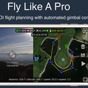
Fly like a pro - Create flight plans quickly that keep the camera focused on your subject with smooth transitions and perfect framing. With autonomous flight plans you can accomplish shots far to difficult to fly manually. Crosshairs display lat/lng targetFollow-me with auto gimbal controlFull ground stationVariable width FPV/map viewGesture camera controlInstructions:http://flightplan.beyondthecube.ca/Demo Videos:https://www.youtube.com/watch?v=FbO_dfTj-PY&list=PLa6UXqRipoPoss6G69VPzQtf89GVg3jnM
-
size 113 MB
Vibration
Vibration is a true vibration spectrum analyzer using the built in accelerometers and gyroscope inside the iPod Touch and the iPhone and starting with version 3.x it can sample the built in microphone and the Digiducer professional quality external USB accelerometer. It acquires and displays time series data, optionally removes DC bias, applies a Hamming window and performs an FFT on each channel to produce frequency spectra. Please use the email links in the program to request new features and report any problems.
-
size 9.6 MB
Drone Complier
Drone Complier the most useful, intuitive and intelligent drone management software available, built by pilots, for pilots. Use this cross-platform solution to instantly check airspace and weather, plan flights, manage aircraft, batteries and pilots, and make sure you are complying with local regulations and documentation requirements. Drone Complier gives your business an immediate competitive advantage:- Instantly view Airspace and weather data from your desktop or mobile device- Advanced Maps integrating real-time airspace restrictions, NOTAMs and TFRs- Contact info for all facilities/towers/hospitals- Total visibility of all your batteries, pilots, aircraft, and payloads- Create, Manage, approve and Assign flights around the world- Aviation-grade Safety Management Processes- Maintain logbooks and checklists in the field.- Cloud storage of all records and data for instant access- Total Auditability for risk management- Business Intelligence to enhance future operations- Real time FAA data sync
-
size 235 MB


