-
Category Education
-
Size 956 MB
What did Earth look like 200 million years ago? Are Volcanoes and Earthquakes Related?Interactive Earth is an interactive tool for tablet that allows you to explore geography, climates and geodynamics. Available maps:Geography: Topography, Oceans and Seas, Rivers and Lakes, Snow and ice(*), Vegetation(*), Deserts, MountainsClimatology: Climates, Continent temperatures(*), Sea surface temperatures(*), Atmosphere(*),Thermohaline circulation (*), surface ocean current Geodynamics: Volcanism, Earthquakes, Faults, Tectonic plates, Continental drift(*)(*): Animated map
Interactive Earth alternatives
Khan Academy
Khan Academy allows you to learn almost anything for free. In our iPhone app:-You can learn anything for free: Over 10,000 videos and explanations at your fingertips in math, science, economics, history, and much, much more- Sharpen your skills: over 40,000 interactive Common Core aligned practice questions are included with instant feedback and step-by-step hints. Head over to www.khanacademy.org to learn more.Khan Academy allows you to learn almost anything for free.
-
rating 4.28571
geotimescale 2
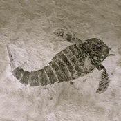
Now a Universal app for iOS 9.Need a quick reference to the geologic time scale of Earths history? Find out, for example, when dinosaurs ruled the world or when reptiles first appeared. Touching each of these icons reveals additional information about which phenomenon occurred at that time such as the extinction of the dinosaurs at 66 Ma.
-
size 8.8 MB
NASA
Come explore with NASA and discover the latest images, videos, mission information, news, feature stories, tweets, NASA TV and featured content with the NASA app. Features: View over 15,000 images (and growing everyday) Watch live NASA TV Read all the latest news & feature stories Watch over 13,000 on demand NASA Videos from around the agency Discover the latest NASA mission information View upcoming sighting opportunities (visible passes for the ISS) and get notifications before they happen Get the latest launch information Display ISS and Earth orbiting satellite trackers Live streaming video from the High Definition Earth Viewing (HDEV) experiment on the ISS Listen to Third Rock internet streaming radio Rate images and also check out which ones make the top rated list Select your own favorite images or missions and get quick access to them Save images to your device and use them as wallpaper for your lock or home screen Explore the featured content section and learn more about the solar system and beyond Earth as Art image collection and interactive map Get the latest tweets from around the agency Easily share everything with your friends on social media
-
size 42.7 MB
EarthViewer
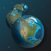
What did Earths continents and oceans look like 250 million years ago, or even 1 billion years ago? What do we know about the climate back when our planet formed? Since teachers play a pivotal role in launching the careers of future scientists and in helping the public understand the beauty and import of science, the BioInteractive team partners with the teaching community to create and distribute media that is engaging and relevant to the science curriculum.
-
size 113 MB
Earth-Now
NASAs Earth Now is an application that visualizes recent global climate data from Earth Science satellites, including surface air temperature, carbon dioxide, carbon monoxide, ozone, and water vapor as well as gravity and sea level variations. Data sets are visually described using false color maps. It was developed by the Earth Science Communications and Visualization Technology Applications and Development Teams at NASAs Jet Propulsion Laboratory, with support from NASA Headquarters.
-
size 198 MB


