-
Category Navigation
-
Size 20.2 MB
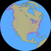
Turn your iOS device into a digital depth finder. Great Depths offers coverage of the entire US coast, the Great Lakes, Lake Champlain and more Know exactly where you are on the water and cruise to your port of call directly and safely. Chart coverage includes the entire coast of the contiguous USA, the Great Lakes, Lake Champlain, the Erie, Oswego and Champlain Canals, Lake Mead, Lake Oswego, Lake Pend Oreille, Lake Okeechobee, Lake Winnebago, Franklin D. Roosevelt Lake, Lake Cayuga, Lake Seneca Lakes, Wake Island and more
Great Depths alternatives
SEAiq Open
SEAiq Open is a full-featured marine navigation app. It is the only marine navigation app that allows you to load your own charts in a variety of standard formats, including: S-57, S-63, iENC, BSB, and KAP. Continued use of GPS running in the background can dramatically decrease battery life.
-
rating 4.33333
-
size 43.0 MB
Aqua Map Americas - Marine GPS
An app to satisfy all your Fishing and Boatings needs, developed with the help of professional fishermen. You will download the best nautical charts and enjoy your new fishing season. The continuous GPS usage, also in background, can drastically reduce the battery life.
-
size 85.6 MB
i-Boating: Nautical / Marine Charts & Fishing Maps
This App offers access to Marine Charts for USA,Canada,UK/Ireland,Germany,Netherlands/Holland &Europe Rivers (Danube,Drava,Rhein etc). Coverage includes NOAA marine vectorcharts,freshwater lake maps,USACE inland river maps (HD/1ft/3ft bathymetryincluded where available),charts derived from UKHO & CHS data. Sample ChartsSUGARLOAF KEY-KEY WESTPORT RICHEY TAMPA BAY - CLEARWATER HBREAST BAY-WEST BAY FLORIDAST JOSEPH,ST ANDREW BAYSINTRACOASTAL WATERWAY MATECUMBE-GRASSY KEYCHESAPEAKE BAY CAPE CHARLES-NORFOLK HARBORANCLOTE KEYS-CRYSTAL RIVERST JOSEPH SOUNDMIAMI HARBORMinnesota lakes - Kabetogama,Minnetonka,Waconia,Leech,Mille LacsLake Keowee,Jocassee,Hartwell,Greenwood,Lake MurrayMark Twain,Ozarks,Table RockLake St. ClairLake KentuckyKEY WEST-THE MISSISSIPPI RIVERSAN PEDRO CHANNELLAKE MICHIGAN STONY LAKE-POINT BETSIEAPALACHICOLA BAY-CAPE SAN BLASEAST CAPE-MORMON KEYCAPE HENLOPEN-INDIAN RIVERCHESAPEAKE BAY CAPE HENRY-THIMBLE SHOAL LIGHTDULUTH-SUPERIORMONHEGAN ISLAND-CAPE ELIZABETHONTARIO - CLAYTON-FALSE DUCKS ISLWinnipesaukeeMIAMI-MARATHON,FLORIDA BAYCAPE MAY-FENWICK ISLANDMISSISSIPPI RIVER-GALVESTONCAPE CANAVERAL-KEY WESTDELAWARE RIVER WILMINGTON-PHILADELPHIAFLORIDA KEYS SOMBRERO KEY-SAND KEYSAN PABLO BAYRAINY LAKE BIG ISLAND MINN-OAKPOINT ISL ONTINTRACOASTAL WATERWAY - BISCAYNE BAYEVERGLADES NTL PARK - SHARK RVR-LOSTMANSHURONTAHOECHESAPEAKE DELAWARE CANALPLEASE NOTE: Continued use of GPS running in the background can dramatically decrease battery life.
-
rating 4.38889
-
size 52.3 MB
Aqua Map Minnesota MN Lakes - GPS Nautical Charts
New exclusive function: mapXpan An app to satisfy all your Fishing and Boatings needs, developed with the help of professional fishermen. CHECK YOUR LAKE HERE BEFORE YOU BUY : http://www.globalaquamaps.com/MNviewer.htmlYou will be able to download the best maps and enjoy your new fishing season. The continuous GPS usage, also in background, can drastically reduce the battery life.
-
size 93.1 MB
SEAiq USA IAP
SEAiq USA IAP is a full-featured marine navigation app. It automatically downloads all charts (both vector and raster) from NOAA and the US Army Corps of Engineers for regions of USA you select. Continued use of GPS running in the background can dramatically decrease battery life.
-
rating 4.68421
-
size 43.3 MB
