-
Category Navigation
-
Rating 1.11111
-
Size 12.2 MB
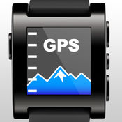
ON SALES 50% OFF, 1.99->0.99$ FOR A LIMITED PERIOD OF TIME Turn your Pebble SmartWatch into a mini Wrist Navigator with information of Maps & Directions. Perfect companion for your outdoor exercise/activity. Features:> Navigator the map> Zoom level controller> Moving Direction> Location search> Live Map transmission to Pebble smart watchContinued use of GPS running in the background can dramatically decrease battery life.
GPS Map for Pebble SmartWatch - mini Wrist Navigator & Maps & Directions & Speeds alternatives
DashCam 2
*Our best DashCam yet*DashCam is a free application that will help you to fight unjust tickets, insurance fraud, and provide data in case of an accident. *DashCam is your own black box that stores video and related information of your driving. *Features include:Video recordingRoute trackingSpeed and Average Speed TrackingDistance TrackingStart time and Date of the recordingStoring the recordings within the applicationLoop recordingVideo resolution settingsMemory size allocationSpeed tracking either in miles or kilometersSupports Landscape and Portrait modePlayback on the device within the applicationSharing to social media sitesAnd more*Not recommended for iPad or iPod
-
size 68.6 MB
Altimeter With Pebble Edition
We would like to introduce you a simple and precise altimeter, working as well on smartwatch pebbles. The program was developed with participation of alpinists; a simple, correct and easy to use altimeter has been tested not in the office rooms, but high in the mountains with professional alpinist during 4 month period.
-
rating 4.63636
-
size 3.4 MB
Sygic North America: GPS Navigation, Offline Maps
The Worlds Most Advanced Navigation app, trusted by 200 million drivers. Sygic: GPS Navigation, Maps, Traffic, Speed CamerasWhether you are travelling, commuting to work, or driving professionally Sygic GPS Navigation & Maps is your one map for everything. FEATURES High quality TomTom* maps stored on your device Voice guided navigation with spoken street names (TTS) Offline navigation without internet connection Free map updates multiple times per year Live Traffic service finds faster route, avoids traffic jams Mobile speed camera / radar warnings Head-up Display (HUD) projects GPS navigation onto your windshield Dynamic Lane Guidance & Junction View for safe lane changes Parking suggestions with info about availability & price Find cheapest gas based on your gas type Safety warnings about sharp turns and railway crossings Speed Limit warnings on map Fixed speed camera warnings Alternative Routes & Multiple waypoints on route Address/GPS coordinates entry by copy & paste Avoid Toll Roads in one country or entire route Pedestrian Navigation & Tourist attractions Millions of points of interest (POI) Car Audio Integration Bluetooth or cable Dashcam that records even while you are navigatingCountries included: Alabama, Alaska, Arizona, Arkansas, California, Colorado, Connecticut, Delaware, Florida, Georgia, Hawaii, Idaho, Illinois, Indiana, Iowa, Kansas, Kentucky, Louisiana, Maine, Maryland, Massachusetts, Michigan, Minnesota, Mississippi, Missouri, Montana, Nebraska, Nevada, New Hampshire, New Jersey, New Mexico, New York, North Carolina, North Dakota, Ohio, Oklahoma, Oregon, Pennsylvania, Puerto Rico, Rhode Island, South Carolina, South Dakota, Tennessee, Texas, Utah, Vermont, Virginia, Washington, West Virginia, Wisconsin, Wyoming, Canada, MexicoPlease note that some features may not be available in all territories. Sharing videos from Dashcam is forbidden by law in following countries: Austria, Belgium, Luxembourg, Switzerland, Slovakia, Spain.
-
rating 3.78571
-
size 86.3 MB
Streets App
CONVENIENTDrop a pin, search for a city or address or find a person from your contacts to view a nearby 360 street panorama. Switch the map to satellite or terrain mode and use the app in portrait or landscape as you prefer. FEATURES- Supports iPad Pro, Split View and Slide Over- Supports keyboard navigation (with Bluetooth or Smart Keyboard)- Mark panoramas as favorites that are automatically synced between all your iOS devices- Rename favorites and organize them in folders- Share Panoramas via email, message, or social networks- Spotlight search also finds Streets panoramas- Handoff lets you easily transfer the currently viewed panorama from iPhone to iPad or vice versa- Siri can create reminders with a link to the currently displayed panorama- Create workflows to grab and process panoramas for specified contacts or other locationsWHAT OTHERS SAYI highly recommend Streets 3.- John Voorhees, MacStoriesits hard to imagine Cupertino doing it better than Streets 34.5/5 mice- J.R. Bookwalter, MacworldIf you havent migrated to Google Maps on iOS because youre OK with Apple Maps but you miss Google Street View, heres a pretty easy solution.- Mel Martin, EngadgetThankfully, with Streets, you can continue using Maps and still be able to quickly pull up Street View without ever feeling like youve left the app.- Jordan Khan, 9to5MacTwitter & FacebookCheck us out on Twitter: @futuretapand Facebook: http://facebook.com/streetviewapp
-
rating 4.825
-
size 30.1 MB
Where To? ~ Find the best places around you
Discover the best locations worldwide: Where To? finds the closest and best rated places to eat, shop, party, and relax. 7.0 continues a remarkable tradition as one of the best ways to find places around town (4.5 of 5 stars)- J.R. Bookwalter, MacLifeHighly recommended- Mel Martin, Engadgetthe excellent location-aware points of interest finder for the iPhone- John Gruber, Daring FireballTwitter & FacebookCheck us out on- Twitter: @futuretap- Facebook: http://fb.com/wheretoapp
-
size 63.1 MB


