-
Category Productivity
-
Size 18.4 MB
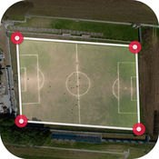
Fields area Measure is a smart tool for measuring areas on the map. There two way to measure any GPS area or distanceFEATURES:- Fast area/distance Mapping.- Smart Marker Mode for super accurate pin placement.- Measurement saving and editing- Measurement Unit Changing Facility.- Map, Satellite, Terrain and Hybrid modes - Area Search Facility. GEO AREA is for:- Land based surveys- Farmers, for farm management- Land record management- Construction surveys- Agronomists- Town planners- Construction surveyor - Health, Education and facilities mapping- Farm fencing- Sports track measurement- Construction sites and building sites area- Asset mapping- Landscape artists- Landscape design
Fields Area Measurement alternatives
Planimeter - Measure Land Area & Distance on a Map
Planimeter measures distances and land areas on maps. Measure your outdoor projects - lawns, fences, paving, or anything else visible on the satellite map. AppAdvice.com, Distance Mapping AppGuidePlanimeter supports imperial and metric units.
-
rating 4.80556
-
size 51.6 MB
AgDNA
AgDNA is a powerful mobile farming platform for the Agriculture industry. AgDNA features include farm planning, record keeping, boundary mapping, worked area mapping, live equipment tracking, scouting observations, communication tools, data sharing and more. Continued use of GPS running in the background can dramatically decrease battery life.
-
size 68.2 MB
MyCal - Myanmar/Burmese Calendar
MyCal - Burmese calendar app for iOS Computer generated calendar This burmese calendar is converted from English calendar date that allow you to view any year in the past or future. Not needed to wait for data update for new years View public holidays Sabbath Day, Yatyaza, Pyathada Lunar status
-
rating 4.85714
-
size 14.0 MB
Farm At Hand
Built by farmers for farmers, Farm At Hand is your complete farm management app. Farm At Hand is a free, cloud-based farm app that allows you to manage your entire farming operation from seed to sale, anytime, anywhere via your computer, tablet or smartphone. Check www.farmathand.com for updates or contact us at [email protected], wed love to hear from you Download now, completely FREE, to take your farm management from the notebook to the cloud
-
size 84.8 MB
Calf Book
Calf Book allows you to track calving data, calf weaning and yearling performance and generate reports by Sire or entire calf crop. Calf Book will allow you to enter breeding information on your cowherd and project calving dates. FEATURES: - Manage Calving Data - Manage Breeding Data - Manage Cow Data - Reports on Calving and Breeding Data - Data syncs to website - Data stored on mobile device so a constant Internet connection is not needed - Semen Tank Plus - Manage Bull Data - Add Calf by breed - Add Calf to Cows List - Import Cows and Bulls - Export Calving Data - Recip Ids for Calving Data - Export reports
-
size 20.3 MB
More Information About alternatives
Gps Area Calculator
Fields area Measure is a smart tool for measuring areas on the map. There two way to measure any GPS area or distanceFEATURES:- Fast area/distance Mapping.- Smart Marker Mode for super accurate pin placement.- Measurement saving and editing- Measurement Unit Changing Facility.- Map, Satellite, Terrain and Hybrid modes - Area Search Facility. GEO AREA is used for:- Land based surveys- Farmers, for farm management- Land record management- Construction surveys- Agronomists- Town planners- Construction surveyor - Health, Education and facilities mapping- Farm fencing- Sports track measurement- Construction sites and building sites area- Asset mapping- Landscape artists- Landscape design
-
size 18.7 MB
-
version 1.0
GPS Area Calculator - Geo Map Distance Measurement
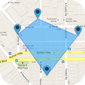
- GPS Area Calculator & Map Distance Measurement is a distance calculator that allows you to know the distance of any route drawn on the map. Features: Fast area/distance Mapping.- Smart Marker Mode for super accurate pin placement.- Measurement saving and editing- Measurement Unit Changing Facility.- Provide Different Map type Like as Normal, Satellite and Hybrid modes.- Add markers on MAP for the area which you want to measure. - Delete marker place by mistake.- Drag and Drop marker to place a marker at the perfect place.- Instant measurement / instant calculation.- Save calculated distances list and you can see My Distance.- Save calculated Area list and you can see My Area.
-
size 38.7 MB
-
version 1.2
GPS Fields Area Measure
GPS Field Area Measure useful as map measurement tool for outdoor activities, sports, range finder applications, bike tour planning, or run tour planning, explore golf area, land survey, golf distance meter, field pasture area measure, garden and farm work and planning, area records, construction, agricultural fencing, solar panel installation - roof area estimation, trip planning. Farmers who have farms and grow wheat, corn, rape, maize, sugar beet and need to do year after year field measuring job to check planted area, this is to best fits all needs. Continued use of GPS running in the background can dramatically decrease battery life.
-
rating 4.5
-
size 23.3 MB
-
version 0.1.12
Planimeter - Field Area Measure on Map & GPS Track
Planimeter is a tool to measure land distances and areas on a map, to check bearing and geo-coordinates of a location. This measurement app is useful for outdoor activities and can be used as land surveyor by amateurs and professionals in various industries like sport, farming, landscaping, paving and construction, road building and repairing, real estate business, hiking and travel, fencing, lot building and planning, solar panel installation (roof area estimation), object mapping, lawn design, and many other where land area and distance / length calculations, land survey or maps are involved. Feel free to contact [email protected] with any questions, comments or bug reports.
-
rating 4.16667
-
size 12.8 MB
-
version 1.0.20
Planimeter PRO - Distance and area measuring tool
DESCRIPTIONPlanimeter is a powerful tool to measure and calculate distance between multiple points on the map, and land area, all expressed in the measuring units you choose. This app uses Apple Maps, GPS and Network location services, ideal companion wherever you go. FEATURES+ Calculate total distance and distance between adjacent flags+ Calculate area, despite its shape+ Precisely drop and move flags with help of magnifier which shows the map under your finger+ Remove one by one or all the flags at once, the shape is automatically recreated, and values are updated+ Determine your GPS location+ Distance units: m, km, yd, ft, mile, nautic mile+ Area units: m2, km2, ft2, ac, yd2, mi2, nmi2+ Search regions on the map by address, city, counties, rivers, mountains, islands, countries+ Save screenshot to Photos or share it on E-mail, Facebook or Twitter+ Standard, Satellite or Hybrid type of the mapUSE+ Road repairing, paving, concrete, seal coating, + Roofing, building fences, underground utilities,+ Outdoor activities, + Land survey, + Sports, + Range finder applications, + Bike or run tour planning, + Exploring golf area, + Golf distance meter, + Running, walking, biking, jog tracking, + Field pasture area measure, + Garden and farm work and crop planning, + Area records, + Construction, fencing, agricultural fencing, + Solar panel installation - roof area estimation, + Trip planning, + Topography tasks
-
size 50.5 MB
-
version 1.5
Map Calculator - Map Measure Distance and Map Area
No In-App purchases, no hidden costs One price, all features, free regular updates, for life. Whether you need to measure distance from point A to point B, compose complex distance paths or simply measure an area of a soccer field, Map Calculator will help you do that and much more with just a few simple taps. Perfect for:- distance measurement for golf- flight distances for pilots- measuring distances on the water (boating)- land surveying- must have for any travel enthusiasts- finding co-ordinates of a point on the mapColours:- Red- Blue- Green- Black- WhiteThe following measurement units are available:- Meters & Kilometers (Metric)- Feet & Miles (imperial)- Yards- Fathoms, Cables & Nautical Miles- Links, Rods, Chains- Acres for area measurementSeveral map types to choose from:- standard- terrain (shows elevation)- hybrid- satelliteAll units will also be used in area measurement, if that mode is selected.
-
rating 3.42857
-
size 17.9 MB
-
version 1.1.1
ONUMA BIM
The free ONUMA BIM mobile app enables ONUMA System users to load and access Building Information Models (BIM) from the ONUMA BIM Server. Building Informed Environments is easy with ONUMA BIM. Key FeaturesView, share and comment on BIM Log in with an ONUMA System ID to view, edit and share BIM Share BIM data with the cloud based ONUMA System View shared models from other ONUMA System users View and comment on floor plans of buildings View and comment on room plans with furniture Lightweight BIM for rapid access to data Connect to many other applications through the ONUMA System Add data as comments directly into the BIM Navigate through sites, buildings, floors and plans with intuitive iPad gestures Work offline and upload attachments once Internet connection becomes availableView BIM and GIS Combine BIM and GIS in the same view Select map, satellite or hybrid view View buildings on maps in the correct geospatial location View location on site plan (contingent on GPS availablity)Manage building data View data for Facility Management Get information like room list, room size, furniture list Create color coded floor plans based on project defined attributes dynamically Collect field data and enter directly into BIM Upload comments to the ONUMA System for stakeholders to view Send an email with attachments directly within the application to other team members Emails recipients are pointed back to the live project Select information to bring up reports of selected items Calculate floor area by selecting single or multiple rooms Take and attach photos Type comments related to selected objects
-
size 29.7 MB
-
version 1.3.83
