-
Category Navigation
-
Size 9.1 MB
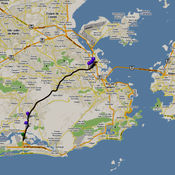
New iPad Release Campaign 50% OFF NOW Geo Elevation is a powerful tool to build a cross-sectional elevation chart from any paths/points on the map with a few clicks. Simply create a path and click on Get Elevation you will see a nice chart. Is there anything to improve?
Geo Elevation: Map Elevation Chart Creator alternatives
Speed Tracker. Pro
Speed Tracker is the most elegant and unique combination of GPS speedometer and Trip computer in just one application. Speed Tracker is YOUR answer to the eternal questions: What is my speed? To enable - Settings> General> Location Services Video: http://youtu.be/lYS1oHbOca0
-
size 63.7 MB
Runtastic Altimeter GPS PRO
Turn your iPhone into an altimeter with this outdoor app and enjoy additional features like compass, weather information, exact position and sunrise & sunset times Ideal for trekking & hiking fans. The app calculates your altitude via GPS while providing a compass feature to make orientating yourself easy when hiking in the mountains. Runtastic Terms of Service: https://www.runtastic.com/in-app/iphone/appstore/termsRuntastic Privacy Policy: http://www.runtastic.com/in-app/iphone/appstore/privacy-policy
-
size 77.6 MB
Map-o-meter
Map-o-meter is an easy to use app that allows you to mark an arbitrary path/route on the map and measure its distance. With closed paths the area is displayed. Features:- Imperial and metric units are supported- Map can be zoomed to your current location- Paths can be loaded/saved to a file- Undo- Search a location (by address or name)- Compute route given a start and finish points and optional waypoints- Portrait and landscape support
-
size 0.9 MB
Altimeter+
Now 50% discount. Get the popular Altimeter+ app for half price. Features:- Apple Watch support - Barometer altitude measurement (iPhone 6 and later)- Altimeter with GPS or ASTER measurement- GPS/ASTER average calculation - Unit of measurement - imperial or metric- Integral map with Apple maps and peak indicator, compass and distance grid- Also functions without active GPSPeak data from peakhunter.com
-
rating 4.0
-
size 49.3 MB
Spyglass
Spyglass is an essential offline GPS app for outdoors and off-road navigation. Packed with tools it serves as binoculars, heads-up display, hi-tech compass with offline maps, gyrocompass, GPS receiver, waypoint tracker, speedometer, altimeter, Sun, Moon and star finder, gyro horizon, rangefinder, coordinate converter, sextant, inclinometer, angular calculator and camera. DEMO & HELPVideos:http://j.mp/spyglass_vidsManuals:http://j.mp/spyglass_help
-
size 19.9 MB


