-
Category Navigation
-
Rating 4.27273
-
Size 13.9 MB
Voted 2nd Best distance mapping app for iPhone and iPad by apppicker.com http://www.apppicker.com/applists/2655/The-best-distance-mapping-apps-for-iPhone-and-iPadEver ask How far do you think that is? Well, with DistanceMap, you can find the exact distance to anything on the map DistanceMap is a fast, easy to use range finder app for your iPhone, iPad, or iPod Touch Get Altitude, Latitude, and Longitude for anywhere in the world, NOT just your current location Simply move the map to your target and tap the toolbar button to add a pin. Get the distances for all landmarks around you so you know the range when the moment of truth arrives For Boating:Get distances to the dock or to your favorite fishing spot
DistanceMap alternatives
Map Points - GPS Location Storage for Hunting, Fishing and Camping with Map Area Measurement
Want to store custom locations? mapPoints will store all of your favorite locations in one spot. You can display your heading and altitude on the main page as an option.
-
size 4.9 MB
Range Finder - ultimate distance and angle measurement tool with augmented reality and compass
Range Finder is an ultimate distance, height and angle measurement tool with augmented reality, compass and inclinometer. Range Finder turns your device into a powerful measurement multi-tool RANGE FINDER TOOL. Your support would greatly help us make the application even better
-
rating 3.50943
-
size 12.7 MB
GPS & Map Toolbox
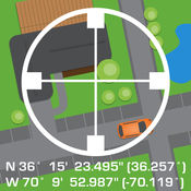
This is the ultimate GPS location database tool designed to save, organize, share, display, import, export, and analyze location records and their properties. Extensive customization options make this app useful for everyone from salesmen, hikers, farmers, hunters, scientists, land/site surveyors, search & rescue, police, and military. This includes map view, elevation, geocoding, business/place search, and street view.
-
size 28.1 MB
Elevation Chart - Draw Profile View by Touchs
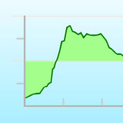
Elevation Chart is a tool used to get the elevation of any place on the surface of the Earth. Youre able to place a pin anywhere on the map to view its elevation in feet or meters along with its longitude, latitude, and address. #1 in Mexico and other 5 countries, #2 in United States, and top 10 in 12 countries (iPad Navigation) Features Show the elevations between two points in profile view, more visualization One tap to show the elevation of your current location Get elevation of any place on earth by: 1) touching the location on the map; 2) search by address/name Show Walking Distance between two points if available Show Ellipsoidal Distance (according to Vincentys formula) as label of x-axis Show elevation in feet or meters Work on iPad, iPhone, and iPod Touch Known Issues - In some situations, the Walking Distance which get from maps.googleapis.com is obviously wrong, compare to the Ellipsoidal Distance.- Limitations of elevation query: 2,500 requests per day; 50 requests per second. Requirements Internet connection. Video Tutorial Pick one of the following: https://appbead.com/app-elevation-chart.html http://youtu.be/o1T9-prX9Dg
-
size 2.4 MB
Pro Compass
Pro Compass replicates the look and feel of classic pocket compass hardware in use since the 1800s, adding modern features and technologies. The app uses advanced OpenGL graphics (normally reserved for games) to render 3D floating compass hardware for realistic operation. Be aware that we are not able to respond to iTunes reviews, so please do not leave a review if you need tech support or assistance, or are confused about accuracy or operation of the app.
-
rating 3.72727
-
size 2.3 MB
